Old Maps of Natal, Virginia
Explore 13 old maps of Natal, spanning from 1921 to today. These high-resolution historic maps reveal how streets, neighborhoods, landmarks, and natural features evolved over time — perfect for genealogy, metal detecting, research, and local history exploration.
What you can do with these maps:
- See how Natal changed over time: Compare historical maps to modern-day views to trace roads, homesites, rail lines & more.
- View detailed metadata: Each map includes creators, publishers, year, scale, and archive source.
- Overlay maps with satellite & LiDAR: Visualize the past alongside modern tools to explore terrain & human change.
- Trusted historical sources: Maps sourced from the USGS, Library of Congress, and other archives.
- Access maps your way: View online, download high-res files, or order prints for personal or research use.
Start exploring old maps of Natal to uncover forgotten places, hidden landmarks, and the deep history beneath your feet.
Natal, VA maps
(13)- 1921 Map of Chatham
 1921 Chatham1921 Print · USGSPittsylvania County's rural heartland is captured here in the early twenties, anchored by the railway and the ridge of White Oak Mountain. Genealogists and historians can locate dozens of country landmarks like Tight Squeeze, Whittles Depot, and Mountain Spring Church.
 - 1923 Map of Chatham
 1923 Chatham1923 Print · USGSPittsylvania County's rural heartland is captured here in the early twenties, centered on the strategic rail hub of Chatham. Researchers can trace the heritage of local industry and community life through sites like Bennett Mine, Tight Squeeze, and the County Poor Farm.3 unique versions available
 - 1953 Map of Greensboro, 1981 Print
 1953 Greensboro1981 Print · USGSThe Piedmont borderlands of North Carolina and Virginia show a landscape defined by new reservoirs and old rail lines. Trace family roots and the changing river geography through Elon College, the John H Kerr Reservoir, and South Boston.
 - 1954 Map of Greensboro
 1954 Greensboro1954 Print · USGSThe Piedmont borderlands of North Carolina and Virginia come alive in this mid-fifties study of a region defined by its rivers and rails. Researchers can trace the growing Buggs Island Lake or follow the paths of the Southern Ry and Seaboard Air Line RR through towns like Oxford and Reidsville.
 - 1962 Map of Greensboro
 1962 Greensboro1962 Print · USGSThe Piedmont region along the Virginia and North Carolina border comes alive in the early 1960s, showing a landscape defined by industry and new reservoirs. Trace the path of the Virginian RR or explore the early development of Greensboro and Durham.
 - 1965 Map of Gretna, 1966 Print
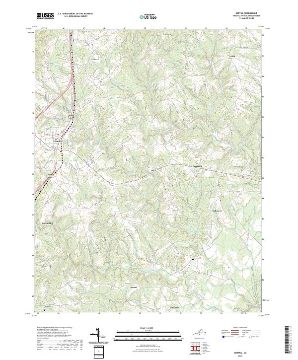
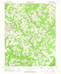 1965 Gretna1966 Print · USGSGretna and its surrounding Pittsylvania County crossroads are documented here in the mid-1960s, showing a landscape defined by the SOUTHERN rail line and quiet creek valleys. Local historians can trace established community sites like Chalk Level, Vadens Mill, and Coles Hill.3 unique versions available
 - 1966 Map of Greensboro
 1966 Greensboro1966 Print · USGSThe North Carolina and Virginia Piedmont thrives during the mid-sixties, showcasing a landscape of textile hubs and expanding river reservoirs. Researchers can trace the rail corridors of the Southern Railway, find local landmarks like Elon College, or locate the extensive Camp Butner Military Reservation.
 - 1984 Map of Danville
 1984 Danville1984 Print · USGSThe Virginia and North Carolina borderlands in the mid-1980s reveal a landscape of industrial river towns and rural Piedmont crossroads. Genealogists and historians can trace family sites near Highland Burial Park, find local landmarks like the Patrick Henry Monument, and locate old settlements like Callands or Milton.
 - 2011 Map of Gretna, 2011 Print
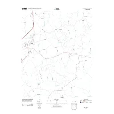
 2011 Gretna2011 Print · USGSCovers Natal, including Gretna, Chalk Level, and other nearby areas
 - 2013 Map of Gretna, 2013 Print
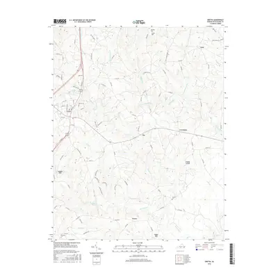
 2013 Gretna2013 Print · USGSCovers Natal, including Gretna, Chalk Level, and other nearby areas
 - 2016 Map of Gretna, 2016 Print
 2016 Gretna2016 Print · USGSCovers Natal, including Gretna, Chalk Level, and other nearby areas
 - 2019 Map of Gretna, 2019 Print
 2019 Gretna2019 Print · USGSCovers Natal, including Gretna, Chalk Level, and other nearby areas
 - 2022 Map of Gretna, 2022 Print
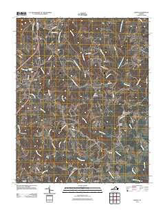
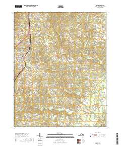
 2022 Gretna2022 Print · USGSIn the early twenty-twenties, this portion of Pittsylvania County remains a landscape of rolling Piedmont ridges and historic rural crossroads. Genealogists and local historians can trace family locations near Chalk Level, Vadens Mill, or the community of Coles Hill.
End of results
Showing maps 1-13 of 13
Top cities near Natal
- Altavista historical maps
- Chatham historical maps
- Gretna historical maps
- Hurt historical maps
- Motley historical maps
Frequently asked questions
- What are the different types of historical maps available for Natal?
- What is the oldest map of Natal?
- Where can I purchase historical maps of Natal for my home or office?
- Where can I download high-res historical maps of Natal?
- Are there historical topographic maps available for Natal?
- Is there historical aerial imagery available for Natal?
- Where are historical maps of Natal sourced from?