1960s Maps of Saranac, Gainesville
Explore 3 historic maps of Saranac from the 1960s. These maps offer a rare glimpse into what life looked like during the 1960s — showing old roads, neighborhoods, homes, and landmarks that have changed or disappeared over time.
Whether you're researching your family's past, planning a metal detecting trip, or studying how Saranac's landscape evolved across the 1960s, these high-resolution maps are a powerful tool for exploring the history of this region.
- Focus on a specific era: All maps on this page are from the 1960s, giving you a focused view of this time period.
- See what’s changed: Compare century-old streets, trails, and buildings to today's modern landscape using overlays and satellite layers.
- Research with precision: Use these maps for genealogy, historical research, land use analysis, or educational projects.
- View, download, or print: Maps are fully viewable online in high resolution, and can be downloaded or printed for your own records.
Start exploring Saranac's history through authentic maps from the 1960s. This is your window into the past.
Saranac, Gainesville maps
(3)- 1961 Map of Washington
 1961 Washington1961 Print · USGSThe mid-Atlantic region in the late fifties is presented in remarkable detail, from the Blue Ridge foothills to the Chesapeake Eastern Shore. Researchers can trace historic river landings and military sites like Mount Vernon, Fort Belvoir, and Point Lookout.2 unique versions available
 - 1966 Map of Thoroughfare Gap, 1969 Print
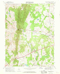 1966 Thoroughfare Gap1969 Print · USGSPrince William and Fauquier counties are captured here in the mid-1960s as the railroad and highways thread through the Bull Run Mountains. Researchers can locate several rural landmarks including Beverley Mill, the Antioch-McCrae Sch, and the Vint Hill Farms Station Military Reservation.3 unique versions available
 - 1968 Map of Gainesville, 1970 Print
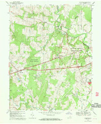 1968 Gainesville1970 Print · USGSGainesville and the surrounding Prince William County countryside are captured here in the late sixties, just as modern infrastructure began to meet the area's deep Civil War legacy. Local historians can locate the Stone Bridge and Dogan House on the battlefield, or trace family landmarks like Mt Calvary Ch and Sudley Springs.6 unique versions available
End of results
Showing maps 1-3 of 3
Frequently asked questions
- What are the different types of historical maps available for Saranac?
- What is the oldest map of Saranac?
- Where can I purchase historical maps of Saranac for my home or office?
- Where can I download high-res historical maps of Saranac?
- Are there historical topographic maps available for Saranac?
- Is there historical aerial imagery available for Saranac?
- Where are historical maps of Saranac sourced from?