Old Maps of Harbor of Newport, Prince William County for Hiking & Exploration
Hike through history with 21 historic maps of Harbor of Newport. Explore old trails, ghost towns, and forgotten backroads — perfect for outdoor adventurers and local explorers.
- Rediscover forgotten places: Map out old mining camps, roads, and footpaths that no longer exist on modern maps.
- Layer with modern tools: Combine with LiDAR or satellite views to plan hikes through historical terrain.
- Made for exploration: Popular among hikers, overlanders, and local history lovers.
Use these maps to find adventure and explore the hidden past of Harbor of Newport.
Harbor of Newport, Prince William County maps
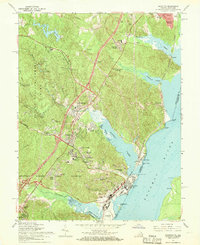
(21)- 1890 Map of Mt. Vernon
 1890 Mt. Vernon1890 Print · USGSCovers Harbor of Newport, including Washington, Arlington, and other nearby areas
 - 1891 Map of Mt. Vernon
 1891 Mt. Vernon1891 Print · USGSCovers Harbor of Newport, including Washington, Arlington, and other nearby areas
 - 1894 Map of Mt. Vernon, 1904 Print
 1894 Mt. Vernon1904 Print · USGSCovers Harbor of Newport, including Washington, Arlington, and other nearby areas6 unique versions available
 - 1897 Map of Mt. Vernon
 1897 Mt. Vernon1897 Print · USGSCovers Harbor of Newport, including Washington, Arlington, and other nearby areas2 unique versions available
 - 1927 Map of Quantico
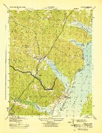
 1927 Quantico1927 Print · USGSCovers Harbor of Newport, including Dale City, Lake Ridge, and other nearby areas
 - 1940 Map of Quantico
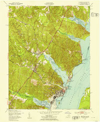
 1940 Quantico1940 Print · USGSCovers Harbor of Newport, including Dale City, Lake Ridge, and other nearby areas2 unique versions available
 - 1943 Map of Quantico
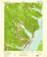
 1943 Quantico1943 Print · USGSCovers Harbor of Newport, including Dale City, Lake Ridge, and other nearby areas
 - 1944 Map of Quantico
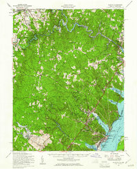
 1944 Quantico1944 Print · USGSCovers Harbor of Newport, including Dale City, Lake Ridge, and other nearby areas
 - 1944 Map of Quantico
 1944 Quantico1944 Print · USGSCovers Harbor of Newport, including Cherry Hill, Montclair, and other nearby areas
 - 1948 Map of Washington
 1948 Washington1948 Print · USGSCovers Harbor of Newport, including Washington, Arlington, and other nearby areas2 unique versions available
 - 1952 Map of Quantico, 1953 Print
 1952 Quantico1953 Print · USGSCovers Harbor of Newport, including Cherry Hill, Montclair, and other nearby areas
 - 1956 Map of Quantico, 1959 Print
 1956 Quantico1959 Print · USGSCovers Harbor of Newport, including Cherry Hill, Montclair, and other nearby areas
 - 1957 Map of Quantico, 1961 Print
 1957 Quantico1961 Print · USGSCovers Harbor of Newport, including Dale City, Lake Ridge, and other nearby areas2 unique versions available
 - 1957 Map of Washington, 1966 Print
 1957 Washington1966 Print · USGSCovers Harbor of Newport, including Washington, Arlington, and other nearby areas5 unique versions available
 - 1961 Map of Washington
 1961 Washington1961 Print · USGSCovers Harbor of Newport, including Washington, Arlington, and other nearby areas2 unique versions available
 - 1966 Map of Quantico, 1968 Print
 1966 Quantico1968 Print · USGSCovers Harbor of Newport, including Cherry Hill, Montclair, and other nearby areas6 unique versions available
 - 1977 Map of Quantico, 1982 Print
 1977 Quantico1982 Print · USGSCovers Harbor of Newport, including Cherry Hill, Montclair, and other nearby areas
 - 1982 Map of Washington West, 1983 Print
 1982 Washington West1983 Print · USGSCovers Harbor of Newport, including Washington, Arlington, and other nearby areas
 - 1986 Map of Washington West
 1986 Washington West1986 Print · USGSCovers Harbor of Newport, including Washington, Arlington, and other nearby areas2 unique versions available
 - 1989 Map of Washington
 1989 Washington1989 Print · USGSCovers Harbor of Newport, including Washington, Arlington, and other nearby areas
 - 1994 Map of Quantico, 1998 Print
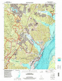 1994 Quantico1998 Print · USGSCovers Harbor of Newport, including Cherry Hill, Montclair, and other nearby areas
End of results
Showing maps 1-21 of 21
Frequently asked questions
- What are the different types of historical maps available for Harbor of Newport?
- What is the oldest map of Harbor of Newport?
- Where can I purchase historical maps of Harbor of Newport for my home or office?
- Where can I download high-res historical maps of Harbor of Newport?
- Are there historical topographic maps available for Harbor of Newport?
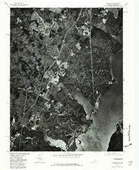
- Is there historical aerial imagery available for Harbor of Newport?
- Where are historical maps of Harbor of Newport sourced from?