Old Maps of Montclair, Virginia
Explore 25 old maps of Montclair, spanning from 1890 to today. These high-resolution historic maps reveal how streets, neighborhoods, landmarks, and natural features evolved over time — perfect for genealogy, metal detecting, research, and local history exploration.
What you can do with these maps:
- See how Montclair changed over time: Compare historical maps to modern-day views to trace roads, homesites, rail lines & more.
- View detailed metadata: Each map includes creators, publishers, year, scale, and archive source.
- Overlay maps with satellite & LiDAR: Visualize the past alongside modern tools to explore terrain & human change.
- Trusted historical sources: Maps sourced from the USGS, Library of Congress, and other archives.
- Access maps your way: View online, download high-res files, or order prints for personal or research use.
Start exploring old maps of Montclair to uncover forgotten places, hidden landmarks, and the deep history beneath your feet.
Montclair, VA maps
(25)- 1890 Map of Mt. Vernon
 1890 Mt. Vernon1890 Print · USGSNorthern Virginia and the capital region appear here in the decade before the turn of the century, showing a landscape of river estates and rail-connected villages. Researchers can trace early property sites and historic river landings from Mt. Vernon to Occoquan and Falls Church.
 - 1891 Map of Mt. Vernon
 1891 Mt. Vernon1891 Print · USGSNorthern Virginia and the D.C. area appear here in the late nineteenth century, as the rail-and-river economy connected rural counties to the capital. Researchers can trace ancestral roots through dozens of local landmarks, including Arlington National Cemetery, the Fox Ferry, and historic towns like Occoquan and Vienna.
 - 1894 Map of Mt. Vernon, 1904 Print
 1894 Mt. Vernon1904 Print · USGSThe Potomac River valley south of the capital was still largely a landscape of crossroads and rail depots in the late nineteenth century. Genealogists can trace the rural reaches of Fairfax through landmarks like Arlington National Cemetery, Mt. Vernon, and Tyson Cross Roads.6 unique versions available
 - 1897 Map of Mt. Vernon
 1897 Mt. Vernon1897 Print · USGSNorthern Virginia and the Potomac River appear in the late nineteenth century as a landscape of rural crossroads and strategic fortifications. Trace the early footprints of Vienna, Herndon, and Manassas along the path of the Southern R. R.2 unique versions available
 - 1927 Map of Quantico
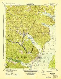
 1927 Quantico1927 Print · USGSPrince William County and the Potomac riverfront appear here in the late twenties, captured just as military and transit corridors began to reshape the rural landscape. Researchers can trace the early foundations of the Marine Corps Reservation and locate vanished local landmarks like Minnieville Store and the Sinclairs Mill.
 - 1940 Map of Quantico
 1940 Quantico1940 Print · USGSCoastal Virginia and Maryland are captured here during the late pre-war era, showing the growing military footprint around the Potomac. Genealogists can trace family names and landmarks like Sinclairs Mill, Bacon Race School, and the historic Dumfries settlement.2 unique versions available
 - 1943 Map of Quantico
 1943 Quantico1943 Print · USGSCoastal Northern Virginia in the mid-1940s reveals a region transitioning from a rural riverfront to a strategic military hub. Researchers can trace the early layout of the Marine Corps Reservation or locate family sites like Shacklet PO and Old Chopawamsic Ch.
 - 1944 Map of Quantico
 1944 Quantico1944 Print · USGSCoastal Prince William County is captured here at the height of the second World War, showing the expansion of military and transit infrastructure. Genealogists and historians can trace old landmarks like Little Union Ch, the Midway Island Housing Project, and the busy Quantico waterfront.2 unique versions available
 - 1948 Map of Washington
 1948 Washington1948 Print · USGSThe Potomac and Chesapeake regions in the late 1940s reveal a landscape of expanding military reach and deep-rooted Tidewater settlements. Trace old rail corridors like the Richmond Fredericksburg & Potomac RR or locate landmarks like the Wakefield Washington Monument and St. Marys College.2 unique versions available
 - 1952 Map of Quantico, 1953 Print
 1952 Quantico1953 Print · USGSThe Potomac riverfront near Dumfries is shown here in the early fifties, just as the military presence was reshaping the Virginia shoreline. Genealogists and historians can locate community landmarks like First Mt Zion Ch, Boswell Store, and the Washington Reid Sch.
 - 1956 Map of Quantico, 1959 Print
 1956 Quantico1959 Print · USGSPrince William County is shown in the mid-fifties as military expansion and suburban growth begin to reshape the Potomac shoreline. Genealogists and historians can trace family landmarks like Hardens Hill Cem, Boswells Store, and Star of Bethlehem Ch.
 - 1957 Map of Quantico, 1961 Print
 1957 Quantico1961 Print · USGSPrince William County in the late fifties shows the expansion of military and park lands along the Potomac. Trace the footprint of Quantico Marine Base and Prince William Forest Park, or locate landmarks like Lebeau Airport and Woodbine Ch.2 unique versions available
 - 1957 Map of Washington, 1966 Print
 1957 Washington1966 Print · USGSThe mid-Atlantic region during the mid-fifties and early sixties reveals a landscape of growing suburbs and vital military outposts. Researchers can trace historic river towns and shorelines from Alexandria to the Hooper Islands and St Clements Island.5 unique versions available
 - 1961 Map of Washington
 1961 Washington1961 Print · USGSThe mid-Atlantic region in the late fifties is presented in remarkable detail, from the Blue Ridge foothills to the Chesapeake Eastern Shore. Researchers can trace historic river landings and military sites like Mount Vernon, Fort Belvoir, and Point Lookout.2 unique versions available
 - 1966 Map of Quantico, 1968 Print
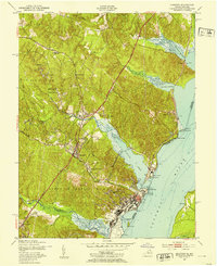
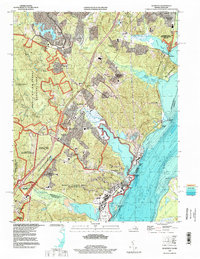
 1966 Quantico1968 Print · USGSCoastal Prince William County is seen here during the mid-sixties, where major military installations meet growing residential villages and thick forest. Researchers can trace the layout of the Quantico Marine Corps Schools or locate local landmarks like Boswells Store and Cockpit Point.6 unique versions available
 - 1977 Map of Quantico, 1982 Print
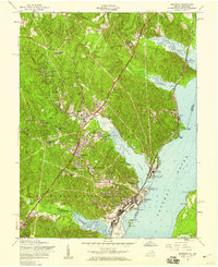
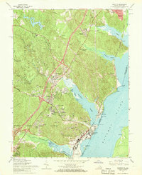
 1977 Quantico1982 Print · USGSThe Potomac shoreline in Northern Virginia appears in sharp aerial detail during the late seventies, showing the transition from historic river towns to modern suburban centers. Genealogists and historians can study the precise layouts of Dumfries and Quantico alongside the tidal reaches of Quantico Creek.
 - 1982 Map of Washington West, 1983 Print
 1982 Washington West1983 Print · USGSThe Virginia and Maryland suburbs were undergoing intense development in the early eighties as the capital region expanded outward. Researchers can trace the footprint of Cold War-era defense sites like Fort Belvoir and Vint Hill Farms Station alongside growing academic centers like George Mason University.
 - 1986 Map of Washington West
 1986 Washington West1986 Print · USGSNorthern Virginia and the D.C. metro area are captured here in the mid-eighties as suburban growth began to meet rural Fauquier County. Trace the development of the corridor from Alexandria out to Dulles and the preserved lands of Prince William Forest Park.2 unique versions available
 - 1989 Map of Washington
 1989 Washington1989 Print · USGSThe Potomac River valley and Chesapeake Bay are shown in comprehensive detail during the late 1980s. Genealogists and historians can trace the transition from urban Alexandria to the rural Northern Neck, locating landmarks like Mount Vernon and Stratford Hall.
 - 1994 Map of Quantico, 1998 Print
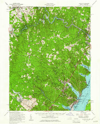
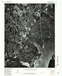
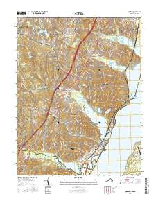
 1994 Quantico1998 Print · USGSCoastal Prince William County in the mid-1990s shows a landscape of military installations and expansive nature preserves. Researchers can trace the boundaries of Marine Corps Base (Quantico) and locate historical landmarks like Dumfries and Possum Point.
 - 2011 Map of Quantico, 2011 Print
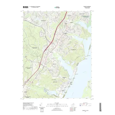
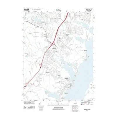 2011 Quantico2011 Print · USGSCovers Montclair, including Cherry Hill, Leesylvania, and other nearby areas
 - 2013 Map of Quantico, 2013 Print
 2013 Quantico2013 Print · USGSCovers Montclair, including Cherry Hill, Leesylvania, and other nearby areas
 - 2016 Map of Quantico, 2016 Print
 2016 Quantico2016 Print · USGSCovers Montclair, including Cherry Hill, Leesylvania, and other nearby areas
 - 2019 Map of Quantico, 2019 Print
 2019 Quantico2019 Print · USGSCovers Montclair, including Cherry Hill, Leesylvania, and other nearby areas
 - 2022 Map of Quantico, 2022 Print
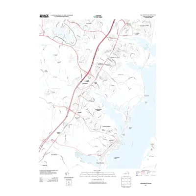
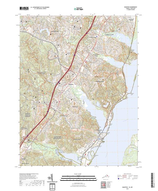 2022 Quantico2022 Print · USGSThe Potomac shoreline in northern Virginia is a blend of strategic military grounds and colonial-era legacies. Researchers can trace family history through numerous burial sites like Henderson Cem or explore the grounds of Marine Corps Base Quantico.
End of results
Showing maps 1-25 of 25
Top cities near Montclair
- Stafford historical maps
- Dale City historical maps
- Lake Ridge historical maps
- Woodbridge historical maps
- Manassas historical maps
- Linton Hall historical maps
See more
Frequently asked questions
- What are the different types of historical maps available for Montclair?
- What is the oldest map of Montclair?
- Where can I purchase historical maps of Montclair for my home or office?
- Where can I download high-res historical maps of Montclair?
- Are there historical topographic maps available for Montclair?
- Is there historical aerial imagery available for Montclair?
- Where are historical maps of Montclair sourced from?