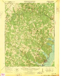
1927 Map of Quantico
USGS Topo · Published 1927About this map
Marine Corps Reservation land dominates the southern landscape of this 1920s tactical survey, illustrating a critical period of military expansion along the Potomac River. The riverfront is a hive of activity where the Richmond Fredericksburg and Potomac RR and the Richmond Washington Highway parallel the shore, connecting the base at Quantico to northern industrial centers. Inland, the map reveals a rural economy transitioning toward modernization, characterized by numerous small crossroads stores like Minnieville Store and Davis Store, alongside traditional industry such as Sinclairs Mill.
Find a feature on this map
64 named features on this map. Tap any name to fly to it.
Don’t see what you’re looking for? This feature index may not catch every label — zoom into the map to look around manually.
Map Details
Editions of this 1927 Quantico Map
This is the sole edition of this map. No revisions or reprints were ever made.
Other maps of this area

1887 · Spottsylvania
USGS Topo · 1:125,000

1889 · Fredericksburg
USGS Topo · 1:125,000

1890 · Mt. Vernon
USGS Topo · 1:125,000

1891 · Mt. Vernon
USGS Topo · 1:125,000

1892 · Fredericksburg
USGS Topo · 1:125,000

1892 · Spottsylvania
USGS Topo · 1:125,000

1894 · Warrenton
USGS Topo · 1:125,000

1894 · Fredericksburg
USGS Topo · 1:125,000

1894 · Mt. Vernon
USGS Topo · 1:125,000

1897 · Mt. Vernon
USGS Topo · 1:125,000