Old Maps of Blue Ridge Mountains Estates, Chester Gap
Explore 15 old maps of Blue Ridge Mountains Estates, spanning from 1893 to today. These high-resolution historic maps reveal how streets, neighborhoods, landmarks, and natural features evolved over time — perfect for genealogy, metal detecting, research, and local history exploration.
What you can do with these maps:
- See how Blue Ridge Mountains Estates changed over time: Compare historical maps to modern-day views to trace roads, homesites, rail lines & more.
- View detailed metadata: Each map includes creators, publishers, year, scale, and archive source.
- Overlay maps with satellite & LiDAR: Visualize the past alongside modern tools to explore terrain & human change.
- Trusted historical sources: Maps sourced from the USGS, Library of Congress, and other archives.
- Access maps your way: View online, download high-res files, or order prints for personal or research use.
Start exploring old maps of Blue Ridge Mountains Estates to uncover forgotten places, hidden landmarks, and the deep history beneath your feet.
Blue Ridge Mountains Estates, Chester Gap maps
(15)- 1893 Map of Luray, 1898 Print
 1893 Luray1898 Print · USGSThe Shenandoah Valley in the 1890s was a land of steep mountain ridges and vital new railways. Genealogists and historians can trace old homesteads and depots along the Shenandoah Valley Railroad or find remote hamlets like Seven Fountains and Browntown.
 - 1905 Map of Luray, 1910 Print
 1905 Luray1910 Print · USGSThe Blue Ridge and Shenandoah Valley are frozen in time just after the turn of the century, showing the critical rail networks and mountain gaps of the period. Genealogists can trace family names and settlements like Luray, Front Royal, and Strasburg along the Shenandoah Valley Railroad.4 unique versions available
 - 1939 Map of Front Royal
 1939 Front Royal1939 Print · USGSThe Blue Ridge foothills and Front Royal are shown here during the late 1930s as the national park and military reservations were being established. Genealogists and historians can trace family locations through numerous rural institutions like Mt Paran Ch, Lottie Sch, and Miller Cem.2 unique versions available
 - 1944 Map of Front Royal
 1944 Front Royal1944 Print · USGSFront Royal and the northern Blue Ridge Mountains appear here during the mid-forties as industrial growth and federal land projects reshaped the valley. Researchers can trace family sites like Miller Cem, explore the early Skyline Drive, and locate schools such as Harmony Hollow Sch.2 unique versions available
 - 1949 Map of Charlottesville
 1949 Charlottesville1949 Print · USGSThe Shenandoah Valley and Blue Ridge appear in the late 1940s as a thriving corridor of rail and river commerce. Researchers can trace the mid-century footprints of Harrisonburg, Staunton, and Culpeper alongside the historic routes of the Southern Railway.2 unique versions available
 - 1956 Map of Charlottesville, 1966 Print
 1956 Charlottesville1966 Print · USGSThe Shenandoah Valley and Blue Ridge are captured in detail during the mid-1960s as the modern interstate system began to emerge. Genealogists and historians can trace rail-connected hubs like Waynesboro or follow the river paths of the Rapidan River and Rivanna River.4 unique versions available
 - 1967 Map of Chester Gap, 1968 Print
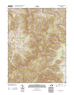
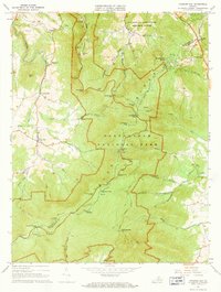 1967 Chester Gap1968 Print · USGSThe Blue Ridge high country is captured here in the late sixties, where the nascent Blue Ridge Mts Estates meets the established wilderness of the national park. Genealogists and hikers can trace the Appalachian Trail past Boyds Mill, Browntown Ch, and the Williams Cem.2 unique versions available
 - 1972 Map of Chester Gap, 1977 Print
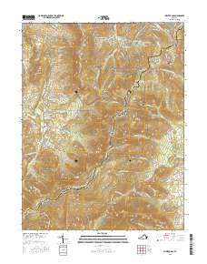
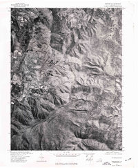 1972 Chester Gap1977 Print · USGSThe Blue Ridge foothills of northern Virginia are captured in this early 1970s aerial survey just as the landscape was beginning a new chapter of growth. Researchers can trace rural property lines and historic road patterns around Browntown and Chester Gap.
 - 1986 Map of Front Royal
 1986 Front Royal1986 Print · USGSThe northern Shenandoah Valley and the Blue Ridge crest are captured here in the mid-eighties as modern highways began to bypass historic valley towns. Researchers can trace ancestral connections near Peola Mills, navigate the gaps like Manassas Gap, or study the river bends around Luray.3 unique versions available
 - 1994 Map of Chester Gap, 1997 Print
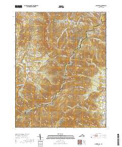
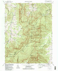 1994 Chester Gap1997 Print · USGSThe Blue Ridge highlands at the end of the twentieth century reveal a landscape where mountain recreation meets deep-rooted Virginia history. Researchers can trace the winding Appalachian Trail past family landmarks like Williams Cem and the small crossroads of Browntown.
 - 2010 Map of Chester Gap, 2010 Print
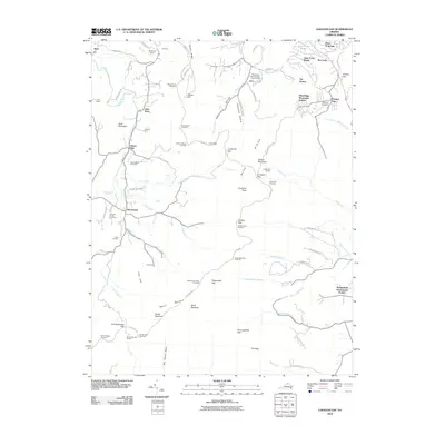 2010 Chester Gap2010 Print · USGSCovers Blue Ridge Mountains Estates, including Chester Gap, Shenandoah Homesteads Project, and other nearby areas
 - 2013 Map of Chester Gap, 2013 Print
 2013 Chester Gap2013 Print · USGSCovers Blue Ridge Mountains Estates, including Chester Gap, Shenandoah Homesteads Project, and other nearby areas
 - 2016 Map of Chester Gap, 2016 Print
 2016 Chester Gap2016 Print · USGSCovers Blue Ridge Mountains Estates, including Chester Gap, Shenandoah Homesteads Project, and other nearby areas
 - 2019 Map of Chester Gap, 2019 Print
 2019 Chester Gap2019 Print · USGSCovers Blue Ridge Mountains Estates, including Chester Gap, Shenandoah Homesteads Project, and other nearby areas
 - 2022 Map of Chester Gap, 2022 Print
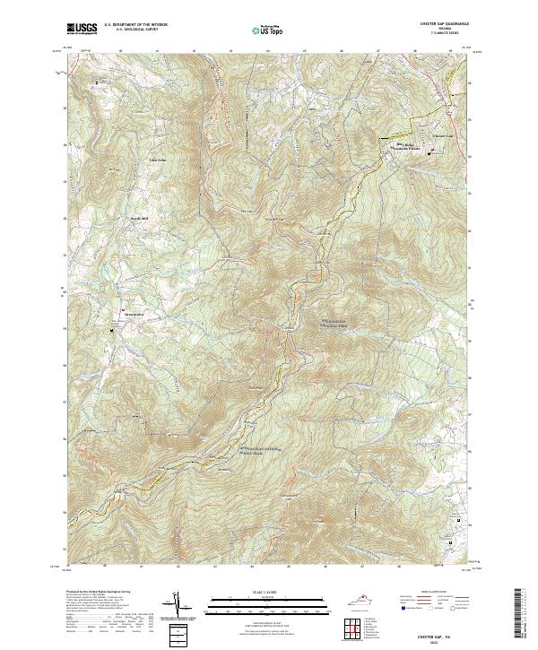 2022 Chester Gap2022 Print · USGSThe high crests of the Blue Ridge meet the historical settlements of Rappahannock and Warren counties in this recent survey. Researchers can locate family landmarks like the John Jackson Updike Farm Cem or trace the path of the Appalachian National Scenic Trail through Hogwallow Flat.
End of results
Showing maps 1-15 of 15
Frequently asked questions
- What are the different types of historical maps available for Blue Ridge Mountains Estates?
- What is the oldest map of Blue Ridge Mountains Estates?
- Where can I purchase historical maps of Blue Ridge Mountains Estates for my home or office?
- Where can I download high-res historical maps of Blue Ridge Mountains Estates?
- Are there historical topographic maps available for Blue Ridge Mountains Estates?
- Is there historical aerial imagery available for Blue Ridge Mountains Estates?
- Where are historical maps of Blue Ridge Mountains Estates sourced from?