1960s Maps of Carytown, Richmond
Explore 2 historic maps of Carytown from the 1960s. These maps offer a rare glimpse into what life looked like during the 1960s — showing old roads, neighborhoods, homes, and landmarks that have changed or disappeared over time.
Whether you're researching your family's past, planning a metal detecting trip, or studying how Carytown's landscape evolved across the 1960s, these high-resolution maps are a powerful tool for exploring the history of this region.
- Focus on a specific era: All maps on this page are from the 1960s, giving you a focused view of this time period.
- See what’s changed: Compare century-old streets, trails, and buildings to today's modern landscape using overlays and satellite layers.
- Research with precision: Use these maps for genealogy, historical research, land use analysis, or educational projects.
- View, download, or print: Maps are fully viewable online in high resolution, and can be downloaded or printed for your own records.
Start exploring Carytown's history through authentic maps from the 1960s. This is your window into the past.
Carytown, Richmond maps
(2)- 1964 Map of Richmond
 1964 Richmond1964 Print · USGSCoastal and central Virginia are mapped during the mid-twentieth century, showing the critical intersection of rail, river, and military life. Genealogists can trace family roots through rural county seats like Amelia or find vanished coastal neighborhoods near Phoebus and Hilton Village.
 - 1964 Map of Richmond, 1966 Print
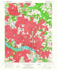 1964 Richmond1966 Print · USGSRichmond and its riverfront suburbs come alive in the mid-1960s, showing the intersection of historic urban density and new interstate-era development. Genealogists and historians can trace extensive burial grounds like Hollywood Cemetery or visit the campus of Virginia Union University.8 unique versions available
End of results
Showing maps 1-2 of 2
Frequently asked questions
- What are the different types of historical maps available for Carytown?
- What is the oldest map of Carytown?
- Where can I purchase historical maps of Carytown for my home or office?
- Where can I download high-res historical maps of Carytown?
- Are there historical topographic maps available for Carytown?
- Is there historical aerial imagery available for Carytown?
- Where are historical maps of Carytown sourced from?