Old Maps of Bells Valley, Virginia for Metal Detecting
Plan your next treasure hunt with 12 historic maps of Bells Valley. Find old homesites, ghost towns, trails, and gathering spots that may be lost to time — perfect for identifying promising metal detecting locations.
- Locate forgotten sites: Uncover places like long-lost settlements, abandoned rail lines, or gathering spots.
- Plan better hunts: Use map overlays combined with LiDAR or satellite views to narrow in on historically rich areas.
- Made for detectorists: Thousands of hobbyists use these maps to discover relics, coins, and hidden history.
Use these historic maps to boost your research and find new opportunities beneath the surface of Bells Valley.
Bells Valley, VA maps
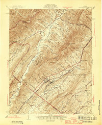
(12)- 1894 Map of Staunton, 1897 Print
 1894 Staunton1897 Print · USGSThe Shenandoah Valley was a hub of rail commerce and mountain industry in the 1890s, centered on the growing city of Staunton. Genealogists and historians can trace defunct rail stops and early industry at Giant Mills, Milnesville, and Stribling Spgs.8 unique versions available
 - 1943 Map of Craigsville, 1961 Print
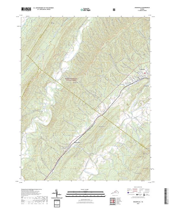
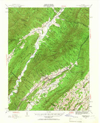 1943 Craigsville1961 Print · USGSThe Virginia mountains in the early 1940s reveal a landscape of rail-dependent valley towns and isolated mountain gaps. You can trace family roots through rural landmarks like Griffin Ch, the Wilderness Sch, and the high peak at Elliott Knob.
 - 1945 Map of Craigsville
 1945 Craigsville1945 Print · USGSAugusta and Bath counties are shown here in the mid-1940s, when the rail lines still dictated the growth of mountain valley towns. Researchers can trace the Chesapeake and Ohio RR through Craigsville or locate rural sites like Rocky Spring Ch and Wilderness Sch.2 unique versions available
 - 1949 Map of Charlottesville
 1949 Charlottesville1949 Print · USGSThe Shenandoah Valley and Blue Ridge appear in the late 1940s as a thriving corridor of rail and river commerce. Researchers can trace the mid-century footprints of Harrisonburg, Staunton, and Culpeper alongside the historic routes of the Southern Railway.2 unique versions available
 - 1956 Map of Charlottesville, 1966 Print
 1956 Charlottesville1966 Print · USGSThe Shenandoah Valley and Blue Ridge are captured in detail during the mid-1960s as the modern interstate system began to emerge. Genealogists and historians can trace rail-connected hubs like Waynesboro or follow the river paths of the Rapidan River and Rivanna River.4 unique versions available
 - 1967 Map of Craigsville, 1969 Print
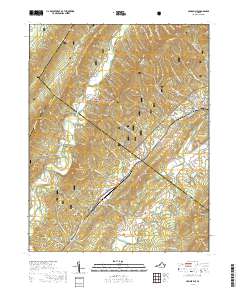
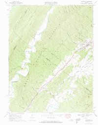 1967 Craigsville1969 Print · USGSAugusta and Rockbridge counties are shown in the late sixties, where the Chesapeake and Ohio railway follows the narrow valley floors. Genealogists and historians can locate the Drive-in Theater, several Quarry sites, and country churches like Lebanon Ch and Little River Ch.2 unique versions available
 - 1986 Map of Staunton
 1986 Staunton1986 Print · USGSThe Shenandoah Valley and Allegheny Highlands meet in the mid-1980s, revealing a landscape of historic mountain towns and thermal resorts. Genealogists and historians can trace institutional landmarks like Mary Baldwin College or follow the legacy of the Chesapeake and Ohio Railroad through Craigsville and Swoope.2 unique versions available
 - 2011 Map of Craigsville, 2011 Print
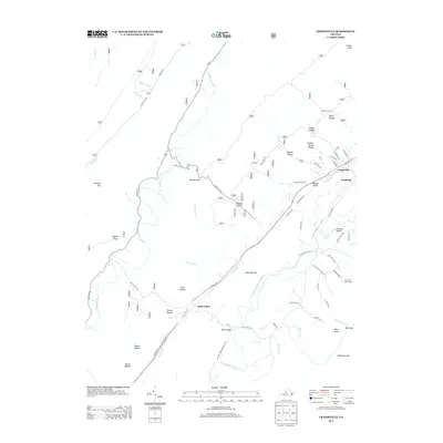
 2011 Craigsville2011 Print · USGSCovers Bells Valley, including Craigsville, Augusta County, and other nearby areas
 - 2013 Map of Craigsville, 2013 Print
 2013 Craigsville2013 Print · USGSCovers Bells Valley, including Craigsville, Augusta County, and other nearby areas
 - 2016 Map of Craigsville, 2016 Print
 2016 Craigsville2016 Print · USGSCovers Bells Valley, including Craigsville, Augusta County, and other nearby areas
 - 2019 Map of Craigsville, 2019 Print
 2019 Craigsville2019 Print · USGSCovers Bells Valley, including Craigsville, Augusta County, and other nearby areas
 - 2022 Map of Craigsville, 2022 Print
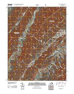
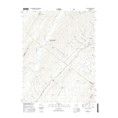
 2022 Craigsville2022 Print · USGSThe mountain valleys of western Augusta County are mapped here in the early 2020s, showing the intersection of forest lands and rural communities. Genealogists and hikers can trace landmarks like Craigsville Memorial Cemetery, Bells Valley, and the many hollows tucked under Great North Mountain.
End of results
Showing maps 1-12 of 12
Top cities near Bells Valley
Frequently asked questions
- What are the different types of historical maps available for Bells Valley?
- What is the oldest map of Bells Valley?
- Where can I purchase historical maps of Bells Valley for my home or office?
- Where can I download high-res historical maps of Bells Valley?
- Are there historical topographic maps available for Bells Valley?
- Is there historical aerial imagery available for Bells Valley?
- Where are historical maps of Bells Valley sourced from?