1990s Maps of Bergton, Virginia
Explore 1 historic maps of Bergton from the 1990s. These maps offer a rare glimpse into what life looked like during the 1990s — showing old roads, neighborhoods, homes, and landmarks that have changed or disappeared over time.
Whether you're researching your family's past, planning a metal detecting trip, or studying how Bergton's landscape evolved across the 1990s, these high-resolution maps are a powerful tool for exploring the history of this region.
- Focus on a specific era: All maps on this page are from the 1990s, giving you a focused view of this time period.
- See what’s changed: Compare century-old streets, trails, and buildings to today's modern landscape using overlays and satellite layers.
- Research with precision: Use these maps for genealogy, historical research, land use analysis, or educational projects.
- View, download, or print: Maps are fully viewable online in high resolution, and can be downloaded or printed for your own records.
Start exploring Bergton's history through authentic maps from the 1990s. This is your window into the past.
Bergton, VA maps
(1)- 1994 Map of Bergton, 1997 Print
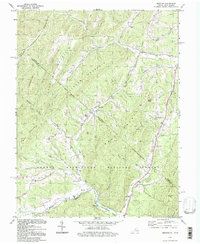 1994 Bergton1997 Print · USGSRockingham County and the West Virginia borderlands are documented here during the mid-nineties as the rural landscape of the Shenandoah Valley meets the mountain ridges. Researchers can trace local genealogy through sites like Bergton Sch, Jenkins Chapel, and the family-named hollows along Crab Run.
End of results
Showing maps 1-1 of 1
Top cities near Bergton
- Broadway historical maps
- Petersburg historical maps
- Timberville historical maps
- Basye historical maps
- Singers Glen historical maps
Frequently asked questions
- What are the different types of historical maps available for Bergton?
- What is the oldest map of Bergton?
- Where can I purchase historical maps of Bergton for my home or office?
- Where can I download high-res historical maps of Bergton?
- Are there historical topographic maps available for Bergton?
- Is there historical aerial imagery available for Bergton?
- Where are historical maps of Bergton sourced from?