1940s Maps of Canton, Virginia
Explore 2 historic maps of Canton from the 1940s. These maps offer a rare glimpse into what life looked like during the 1940s — showing old roads, neighborhoods, homes, and landmarks that have changed or disappeared over time.
Whether you're researching your family's past, planning a metal detecting trip, or studying how Canton's landscape evolved across the 1940s, these high-resolution maps are a powerful tool for exploring the history of this region.
- Focus on a specific era: All maps on this page are from the 1940s, giving you a focused view of this time period.
- See what’s changed: Compare century-old streets, trails, and buildings to today's modern landscape using overlays and satellite layers.
- Research with precision: Use these maps for genealogy, historical research, land use analysis, or educational projects.
- View, download, or print: Maps are fully viewable online in high resolution, and can be downloaded or printed for your own records.
Start exploring Canton's history through authentic maps from the 1940s. This is your window into the past.
Canton, VA maps
(2)- 1946 Map of Stickleyville, 1970 Print
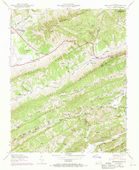 1946 Stickleyville1970 Print · USGSLee and Scott counties are captured here in the mid-twentieth century as small mountain communities remained centered around gap roads and river forks. Researchers can trace family sites like Odd Fellows Cem or locate the historic Daniel Boone Trail near Stickleyville.2 unique versions available
 - 1948 Map of Stickleyville, 1949 Print
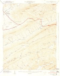 1948 Stickleyville1949 Print · USGSIn the late 1940s, the rural ridges of Lee and Scott Counties remained a land of family-named hollows and mountain gaps. Genealogists and historians can trace the foundations of Stickleyville, find local landmarks like The Sinks, and locate several family cemeteries and country schools like Larmer School.3 unique versions available
End of results
Showing maps 1-2 of 2
Top cities near Canton
- Church Hill historical maps
- Big Stone Gap historical maps
- Rogersville historical maps
- Pennington Gap historical maps
- Surgoinsville historical maps
- Dryden historical maps
See more
Frequently asked questions
- What are the different types of historical maps available for Canton?
- What is the oldest map of Canton?
- Where can I purchase historical maps of Canton for my home or office?
- Where can I download high-res historical maps of Canton?
- Are there historical topographic maps available for Canton?
- Is there historical aerial imagery available for Canton?
- Where are historical maps of Canton sourced from?