Old Maps of Burdette, Virginia for Metal Detecting
Plan your next treasure hunt with 11 historic maps of Burdette. Find old homesites, ghost towns, trails, and gathering spots that may be lost to time — perfect for identifying promising metal detecting locations.
- Locate forgotten sites: Uncover places like long-lost settlements, abandoned rail lines, or gathering spots.
- Plan better hunts: Use map overlays combined with LiDAR or satellite views to narrow in on historically rich areas.
- Made for detectorists: Thousands of hobbyists use these maps to discover relics, coins, and hidden history.
Use these historic maps to boost your research and find new opportunities beneath the surface of Burdette.
Burdette, VA maps
(11)- 1920 Map of Ivor
 1920 Ivor1920 Print · USGSCoastal plain life in Southampton and Isle of Wight counties is captured here just after the Great War, when rail and river travel still shaped the landscape. Genealogists can locate family landmarks like Tucker Swamp Church, Crumplers School, and Millfield Millpond.2 unique versions available
 - 1944 Map of Sedley, 1961 Print
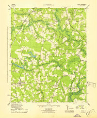
 1944 Sedley1961 Print · USGSCoastal Virginia's farming and milling communities are captured here in the mid-1940s as the rail network shaped local growth. Researchers can locate the Rosenwald Sch, early mill sites like Johnson Millpond, and crossroads hamlets such as Pulleys Crossroads.
 - 1945 Map of Sedley
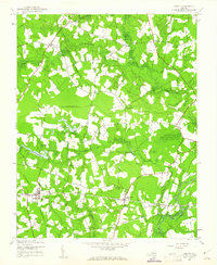
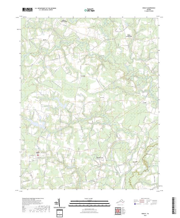
 1945 Sedley1945 Print · USGSSouthampton County was a landscape of swamp-fed millponds and rural schoolhouses during the mid-forties. Researchers can trace the heritage of local settlements from Sedley to Berlin and locate specific sites like the Rosenwald Sch or Whitefields Millpond.
 - 1953 Map of Norfolk, 1954 Print
 1953 Norfolk1954 Print · USGSCoastal Virginia and northeastern North Carolina appear here during the post-war industrial boom, showing the critical rail-and-sea connections of Hampton Roads. Genealogists can trace family roots through rural landmarks like Gethsemane Ch, the Caledonia State Prison Farm, and the vast interior of the Dismal Swamp.4 unique versions available
 - 1968 Map of Sedley, 1970 Print
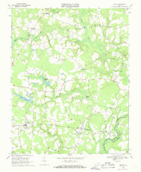 1968 Sedley1970 Print · USGSCoastal Virginia's marshlands and small rail towns come to life in the late sixties as the timber and water economy thrives. Genealogists can trace family footprints through rural landmarks like Pulleys Crossroads, Ebenezer Ch, and Whitefields Millpond.2 unique versions available
 - 1985 Map of Norfolk, 1986 Print
 1985 Norfolk1986 Print · USGSThe Tidewater region in the mid-eighties shows the dense urban expansion of the coastal cities alongside the preservation of the Great Dismal Swamp. Researchers can trace rural family-named crossroads and historic transit routes like the Seaboard Coast Line or find Somerton and Lake Drummond.3 unique versions available
 - 2010 Map of Sedley, 2010 Print
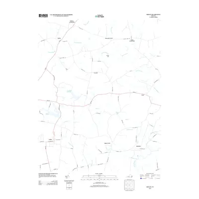
 2010 Sedley2010 Print · USGSCovers Burdette, including Sedley, Black Creek, and other nearby areas
 - 2013 Map of Sedley, 2013 Print
 2013 Sedley2013 Print · USGSCovers Burdette, including Sedley, Black Creek, and other nearby areas
 - 2016 Map of Sedley, 2016 Print
 2016 Sedley2016 Print · USGSCovers Burdette, including Sedley, Black Creek, and other nearby areas
 - 2019 Map of Sedley, 2019 Print
 2019 Sedley2019 Print · USGSCovers Burdette, including Sedley, Black Creek, and other nearby areas
 - 2022 Map of Sedley, 2022 Print
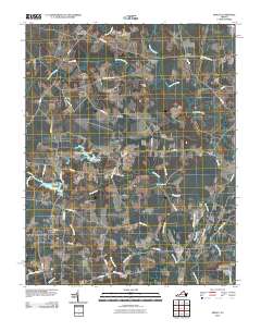
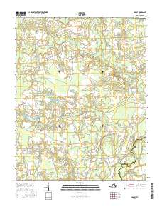
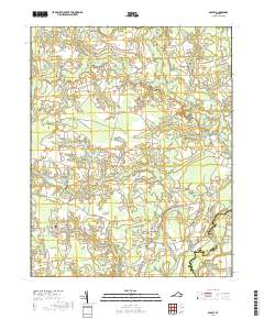
 2022 Sedley2022 Print · USGSCoastal plain settlements and extensive river swamps define this Southampton County region as it appeared recently. Genealogists and local historians can trace family-named routes and hamlets like Pulleys Crossroads, Berlin, and the historic Sedley rail corridor.
End of results
Showing maps 1-11 of 11
Top cities near Burdette
- Franklin historical maps
- Windsor historical maps
- Courtland historical maps
- Wakefield historical maps
- Camptown historical maps
- Sedley historical maps
See more
Frequently asked questions
- What are the different types of historical maps available for Burdette?
- What is the oldest map of Burdette?
- Where can I purchase historical maps of Burdette for my home or office?
- Where can I download high-res historical maps of Burdette?
- Are there historical topographic maps available for Burdette?
- Is there historical aerial imagery available for Burdette?
- Where are historical maps of Burdette sourced from?