1940s Maps of Doles Crossroads, Virginia
Explore 2 historic maps of Doles Crossroads from the 1940s. These maps offer a rare glimpse into what life looked like during the 1940s — showing old roads, neighborhoods, homes, and landmarks that have changed or disappeared over time.
Whether you're researching your family's past, planning a metal detecting trip, or studying how Doles Crossroads's landscape evolved across the 1940s, these high-resolution maps are a powerful tool for exploring the history of this region.
- Focus on a specific era: All maps on this page are from the 1940s, giving you a focused view of this time period.
- See what’s changed: Compare century-old streets, trails, and buildings to today's modern landscape using overlays and satellite layers.
- Research with precision: Use these maps for genealogy, historical research, land use analysis, or educational projects.
- View, download, or print: Maps are fully viewable online in high resolution, and can be downloaded or printed for your own records.
Start exploring Doles Crossroads's history through authentic maps from the 1940s. This is your window into the past.
Doles Crossroads, VA maps
(2)- 1944 Map of Sedley, 1961 Print
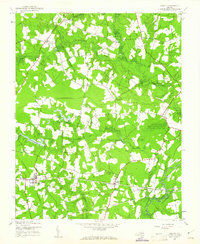 1944 Sedley1961 Print · USGSCoastal Virginia's farming and milling communities are captured here in the mid-1940s as the rail network shaped local growth. Researchers can locate the Rosenwald Sch, early mill sites like Johnson Millpond, and crossroads hamlets such as Pulleys Crossroads.
 - 1945 Map of Sedley
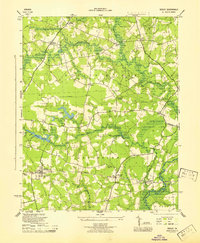 1945 Sedley1945 Print · USGSSouthampton County was a landscape of swamp-fed millponds and rural schoolhouses during the mid-forties. Researchers can trace the heritage of local settlements from Sedley to Berlin and locate specific sites like the Rosenwald Sch or Whitefields Millpond.
End of results
Showing maps 1-2 of 2
Top cities near Doles Crossroads
- Franklin historical maps
- Windsor historical maps
- Waverly historical maps
- Courtland historical maps
- Wakefield historical maps
- Camptown historical maps
See more
Frequently asked questions
- What are the different types of historical maps available for Doles Crossroads?
- What is the oldest map of Doles Crossroads?
- Where can I purchase historical maps of Doles Crossroads for my home or office?
- Where can I download high-res historical maps of Doles Crossroads?
- Are there historical topographic maps available for Doles Crossroads?
- Is there historical aerial imagery available for Doles Crossroads?
- Where are historical maps of Doles Crossroads sourced from?