Old Maps of Dory, Virginia
Explore 13 old maps of Dory, spanning from 1919 to today. These high-resolution historic maps reveal how streets, neighborhoods, landmarks, and natural features evolved over time — perfect for genealogy, metal detecting, research, and local history exploration.
What you can do with these maps:
- See how Dory changed over time: Compare historical maps to modern-day views to trace roads, homesites, rail lines & more.
- View detailed metadata: Each map includes creators, publishers, year, scale, and archive source.
- Overlay maps with satellite & LiDAR: Visualize the past alongside modern tools to explore terrain & human change.
- Trusted historical sources: Maps sourced from the USGS, Library of Congress, and other archives.
- Access maps your way: View online, download high-res files, or order prints for personal or research use.
Start exploring old maps of Dory to uncover forgotten places, hidden landmarks, and the deep history beneath your feet.
Dory, VA maps
(13)- 1919 Map of Homeville
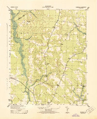
 1919 Homeville1919 Print · USGSCoastal Virginia during the late teens was defined by a landscape of river crossings and timbered swamplands along the Nottoway River. Genealogists and historians can trace family-named schools and vanished millponds, including Cabin Point School, Darden Millpond, and the settlement of Sebrell.
 - 1920 Map of Homeville
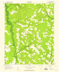
 1920 Homeville1920 Print · USGSCoastal plain life in Sussex and Southampton counties thrived along the rails and rivers in the early twentieth century. Researchers can trace the legacy of small communities and crossroads schools like Sebrell, Hickory Hill School, and the Union Hill Church near the Nottoway River.3 unique versions available
 - 1943 Map of Vicksville
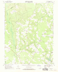
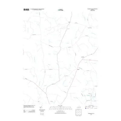
 1943 Vicksville1943 Print · USGSSouthampton County during the Second World War shows a rural landscape of small crossroads and swampy bottomlands. Researchers can trace family sites near Vicksville, Thornton Store, and a cluster of local landmarks like Cabin Point School.
 - 1953 Map of Norfolk, 1954 Print
 1953 Norfolk1954 Print · USGSCoastal Virginia and northeastern North Carolina appear here during the post-war industrial boom, showing the critical rail-and-sea connections of Hampton Roads. Genealogists can trace family roots through rural landmarks like Gethsemane Ch, the Caledonia State Prison Farm, and the vast interior of the Dismal Swamp.4 unique versions available
 - 1957 Map of Vicksville, 1958 Print
 1957 Vicksville1958 Print · USGSCoastal plain Virginia in the late fifties was a landscape of rail-linked crossroads and dense bottomland swamps. Genealogists and historians can trace family locations near Vicksville, St Lukes Ch, and several rural schoolhouses like Brown Doyle Sch.
 - 1969 Map of Vicksville, 1970 Print
 1969 Vicksville1970 Print · USGSSouthampton County during the late 1960s was a landscape of rail-linked hamlets and expansive wetlands. Genealogists and researchers can locate family sites near Vicksville, St Lukes Ch, and the crossings of the NORFOLK AND WESTERN railroad.3 unique versions available
 - 1984 Map of Emporia, 1986 Print
 1984 Emporia1986 Print · USGSSouthside Virginia and the North Carolina borderlands are captured here in the mid-1980s, centered on the transit hub of Emporia. Researchers can trace old rail corridors like the Seaboard System or locate historic sites including Fort Christanna and White Oak Ch.
 - 1990 Map of Emporia
 1990 Emporia1990 Print · USGSThe Southside Virginia borderlands are captured here in the late twentieth century, showing the critical rail and river networks of the region. Genealogists and local historians can trace family roots through rural communities like Alberta, Boykins, and Dolphin along the Meherrin River.
 - 2010 Map of Vicksville, 2010 Print
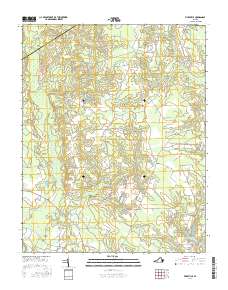
 2010 Vicksville2010 Print · USGSCovers Dory, including Beales, Vicksville, and other nearby areas
 - 2013 Map of Vicksville, 2013 Print
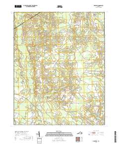
 2013 Vicksville2013 Print · USGSCovers Dory, including Beales, Vicksville, and other nearby areas
 - 2016 Map of Vicksville, 2016 Print
 2016 Vicksville2016 Print · USGSCovers Dory, including Beales, Vicksville, and other nearby areas
 - 2019 Map of Vicksville, 2019 Print
 2019 Vicksville2019 Print · USGSCovers Dory, including Beales, Vicksville, and other nearby areas
 - 2022 Map of Vicksville, 2022 Print
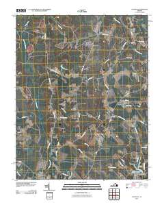
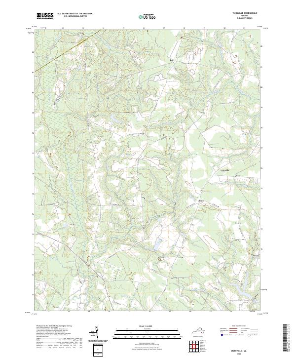 2022 Vicksville2022 Print · USGSSouthampton County and neighboring Sussex County are mapped here in the early 2020s, showing a landscape defined by expansive wetlands. Genealogists and local historians can trace the rural communities of Vicksville, Dory, and Beales, alongside family-named landmarks like Darden Millpond.
End of results
Showing maps 1-13 of 13
Top cities near Dory
- Franklin historical maps
- Waverly historical maps
- Courtland historical maps
- Wakefield historical maps
- Camptown historical maps
- Sedley historical maps
See more
Frequently asked questions
- What are the different types of historical maps available for Dory?
- What is the oldest map of Dory?
- Where can I purchase historical maps of Dory for my home or office?
- Where can I download high-res historical maps of Dory?
- Are there historical topographic maps available for Dory?
- Is there historical aerial imagery available for Dory?
- Where are historical maps of Dory sourced from?