1960s Maps of Olivers Corner, Virginia
Explore 2 historic maps of Olivers Corner from the 1960s. These maps offer a rare glimpse into what life looked like during the 1960s — showing old roads, neighborhoods, homes, and landmarks that have changed or disappeared over time.
Whether you're researching your family's past, planning a metal detecting trip, or studying how Olivers Corner's landscape evolved across the 1960s, these high-resolution maps are a powerful tool for exploring the history of this region.
- Focus on a specific era: All maps on this page are from the 1960s, giving you a focused view of this time period.
- See what’s changed: Compare century-old streets, trails, and buildings to today's modern landscape using overlays and satellite layers.
- Research with precision: Use these maps for genealogy, historical research, land use analysis, or educational projects.
- View, download, or print: Maps are fully viewable online in high resolution, and can be downloaded or printed for your own records.
Start exploring Olivers Corner's history through authentic maps from the 1960s. This is your window into the past.
Olivers Corner, VA maps
(2)- 1961 Map of Washington
 1961 Washington1961 Print · USGSThe mid-Atlantic region in the late fifties is presented in remarkable detail, from the Blue Ridge foothills to the Chesapeake Eastern Shore. Researchers can trace historic river landings and military sites like Mount Vernon, Fort Belvoir, and Point Lookout.2 unique versions available
 - 1966 Map of Brokenburg, 1968 Print
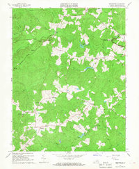 1966 Brokenburg1968 Print · USGSSpotsylvania County is shown in the mid-1960s, capturing the rural intersections and hallowed ground of the National Military Park. Researchers can trace Civil War landmarks like Battle Trench and old crossroads at Todds Tavern and Brokenburg.3 unique versions available
End of results
Showing maps 1-2 of 2
Top cities near Olivers Corner
- Fredericksburg historical maps
- Lake of the Woods historical maps
- Spotsylvania Courthouse historical maps
- Falmouth historical maps
- Lake Land'Or historical maps
- Southern Gateway historical maps
See more
Frequently asked questions
- What are the different types of historical maps available for Olivers Corner?
- What is the oldest map of Olivers Corner?
- Where can I purchase historical maps of Olivers Corner for my home or office?
- Where can I download high-res historical maps of Olivers Corner?
- Are there historical topographic maps available for Olivers Corner?
- Is there historical aerial imagery available for Olivers Corner?
- Where are historical maps of Olivers Corner sourced from?