1900s (20th Century) Maps of Kenva Heights, Staunton
Explore 7 historic maps of Kenva Heights from the 1900s (20th Century). These maps offer a rare glimpse into what life looked like during the 1900s — showing old roads, neighborhoods, homes, and landmarks that have changed or disappeared over time.
Whether you're researching your family's past, planning a metal detecting trip, or studying how Kenva Heights's landscape evolved across the 1900s, these high-resolution maps are a powerful tool for exploring the history of this region.
- Focus on a specific era: All maps on this page are from the 1900s, giving you a focused view of this time period.
- See what’s changed: Compare century-old streets, trails, and buildings to today's modern landscape using overlays and satellite layers.
- Research with precision: Use these maps for genealogy, historical research, land use analysis, or educational projects.
- View, download, or print: Maps are fully viewable online in high resolution, and can be downloaded or printed for your own records.
Start exploring Kenva Heights's history through authentic maps from the 1900s. This is your window into the past.
Kenva Heights, Staunton maps
(7)- 1944 Map of Staunton, 1961 Print
 1944 Staunton1961 Print · USGSThe Shenandoah Valley during the mid-forties remains a landscape of rail-connected trade centers and rural crossroads. Researchers can trace family roots through numerous country landmarks like Green Hill Cem, Franks Mill, and Jerusalem Chapel.2 unique versions available
 - 1947 Map of Staunton
 1947 Staunton1947 Print · USGSAugusta County at the end of the Second World War shows a vibrant Shenandoah Valley hub centered on the railroad crossing at Staunton. Genealogists can locate family landmarks like Glebe Cem, St Johns Ch, and the outlying settlement of Stuarts Draft.2 unique versions available
 - 1949 Map of Charlottesville
 1949 Charlottesville1949 Print · USGSThe Shenandoah Valley and Blue Ridge appear in the late 1940s as a thriving corridor of rail and river commerce. Researchers can trace the mid-century footprints of Harrisonburg, Staunton, and Culpeper alongside the historic routes of the Southern Railway.2 unique versions available
 - 1956 Map of Charlottesville, 1966 Print
 1956 Charlottesville1966 Print · USGSThe Shenandoah Valley and Blue Ridge are captured in detail during the mid-1960s as the modern interstate system began to emerge. Genealogists and historians can trace rail-connected hubs like Waynesboro or follow the river paths of the Rapidan River and Rivanna River.4 unique versions available
 - 1964 Map of Staunton, 1966 Print
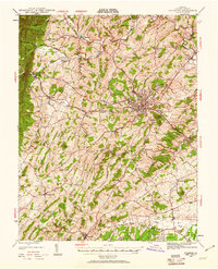
 1964 Staunton1966 Print · USGSStaunton thrived as a Shenandoah Valley institutional and rail hub during the mid-sixties. Researchers can trace the grounds of Mary Baldwin College, find ancestors at the Staunton National Cem, and locate old industrial sites like Franks Mill.4 unique versions available
 - 1986 Map of Staunton
 1986 Staunton1986 Print · USGSThe Shenandoah Valley and Allegheny Highlands meet in the mid-1980s, revealing a landscape of historic mountain towns and thermal resorts. Genealogists and historians can trace institutional landmarks like Mary Baldwin College or follow the legacy of the Chesapeake and Ohio Railroad through Craigsville and Swoope.2 unique versions available
 - 1998 Map of Staunton, 2001 Print
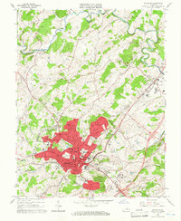
 1998 Staunton2001 Print · USGSStaunton and the Shenandoah Valley are depicted in the late nineties, showcasing the city's growth and its deep-seated educational and medical institutions. Researchers can locate Staunton National Cem, the Woodrow Wilson Birthplace, and historical mills like Quicks Mill along the river.
End of results
Showing maps 1-7 of 7
Frequently asked questions
- What are the different types of historical maps available for Kenva Heights?
- What is the oldest map of Kenva Heights?
- Where can I purchase historical maps of Kenva Heights for my home or office?
- Where can I download high-res historical maps of Kenva Heights?
- Are there historical topographic maps available for Kenva Heights?
- Is there historical aerial imagery available for Kenva Heights?
- Where are historical maps of Kenva Heights sourced from?