Old Maps of Buckton, Virginia for Academic Research
Study the evolution of Buckton with 15 high-resolution historic maps. Whether you're teaching, researching, or modeling changes in land use, these maps provide essential visual documentation of urban, environmental, and geographic change.
- Analyze long-term change: Track patterns in development, transportation, and natural features.
- Ideal for environmental or urban studies: Support academic projects with primary historical map data.
- Use in the classroom or lab: Educators and researchers rely on these maps to bring historical context to life.
These maps are a powerful tool for teaching, research, and visualizing how Buckton has changed over the decades.
Buckton, VA maps
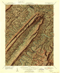
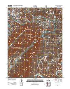
(15)- 1893 Map of Luray, 1898 Print
 1893 Luray1898 Print · USGSThe Shenandoah Valley in the 1890s was a land of steep mountain ridges and vital new railways. Genealogists and historians can trace old homesteads and depots along the Shenandoah Valley Railroad or find remote hamlets like Seven Fountains and Browntown.
 - 1905 Map of Luray, 1910 Print
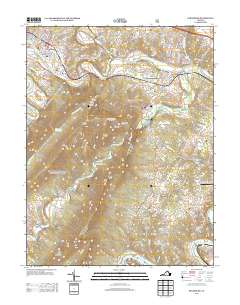
 1905 Luray1910 Print · USGSThe Blue Ridge and Shenandoah Valley are frozen in time just after the turn of the century, showing the critical rail networks and mountain gaps of the period. Genealogists can trace family names and settlements like Luray, Front Royal, and Strasburg along the Shenandoah Valley Railroad.4 unique versions available
 - 1947 Map of Strasburg, 1955 Print
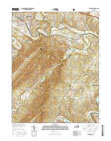
 1947 Strasburg1955 Print · USGSThe Shenandoah Valley during the late 1940s reveals a landscape defined by the winding North and South Forks of the river and the steep ridges of Massanutten. Genealogists can locate rural landmarks like Saint Davids Church, Bentonville, and the Mt Hebron Ch Cem.7 unique versions available
 - 1949 Map of Charlottesville
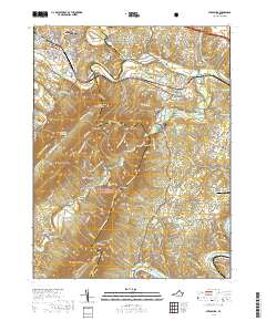
 1949 Charlottesville1949 Print · USGSThe Shenandoah Valley and Blue Ridge appear in the late 1940s as a thriving corridor of rail and river commerce. Researchers can trace the mid-century footprints of Harrisonburg, Staunton, and Culpeper alongside the historic routes of the Southern Railway.2 unique versions available
 - 1950 Map of Strasburg
 1950 Strasburg1950 Print · USGSThe northern Shenandoah Valley is shown just after the war, defined by the winding forks of the river and the massive ridges of Massanutten Mountain. Genealogists and historians can trace family sites at Mt Hebron Cemetery, Goode Mill, and the mountain-bound community of Seven Fountains.2 unique versions available
 - 1956 Map of Charlottesville, 1966 Print
 1956 Charlottesville1966 Print · USGSThe Shenandoah Valley and Blue Ridge are captured in detail during the mid-1960s as the modern interstate system began to emerge. Genealogists and historians can trace rail-connected hubs like Waynesboro or follow the river paths of the Rapidan River and Rivanna River.4 unique versions available
 - 1966 Map of Strasburg, 1973 Print
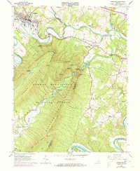 1966 Strasburg1973 Print · USGSThe Shenandoah Valley during the mid-1960s shows a mix of mountain wilderness and riverside rail hubs. Trace local history through the Elizabeth Furnace Recreational Area ruins, the Otterburn Sch, and established crossroads like Waterlick and Buckton.2 unique versions available
 - 1972 Map of Strasburg, 1977 Print
 1972 Strasburg1977 Print · USGSStrasburg and the Shenandoah Valley are captured in high-altitude detail during the early 1970s. Local researchers can trace the winding North Fork Shenandoah River as it passes Strasburg and the rural community of Waterlick.
 - 1986 Map of Front Royal
 1986 Front Royal1986 Print · USGSThe northern Shenandoah Valley and the Blue Ridge crest are captured here in the mid-eighties as modern highways began to bypass historic valley towns. Researchers can trace ancestral connections near Peola Mills, navigate the gaps like Manassas Gap, or study the river bends around Luray.3 unique versions available
 - 1994 Map of Strasburg, 1997 Print
 1994 Strasburg1997 Print · USGSThe Shenandoah Valley remains a vital rail and river corridor in the 1990s as the mountains frame a landscape of legacy and leisure. Trace the intersection of the Southern railroad at Strasburg, find old rural landmarks like Bennett Chapel, or explore the complex terrain of the Elizabeth Furnace Recreational Area.
 - 2011 Map of Strasburg, 2011 Print
 2011 Strasburg2011 Print · USGSCovers Buckton, including Strasburg, Bethel, and other nearby areas
 - 2013 Map of Strasburg, 2013 Print
 2013 Strasburg2013 Print · USGSCovers Buckton, including Strasburg, Bethel, and other nearby areas
 - 2016 Map of Strasburg, 2016 Print
 2016 Strasburg2016 Print · USGSCovers Buckton, including Strasburg, Bethel, and other nearby areas
 - 2019 Map of Strasburg, 2019 Print
 2019 Strasburg2019 Print · USGSCovers Buckton, including Strasburg, Bethel, and other nearby areas
 - 2022 Map of Strasburg, 2022 Print
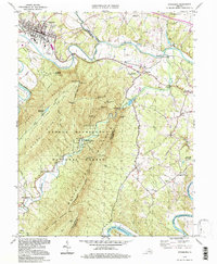
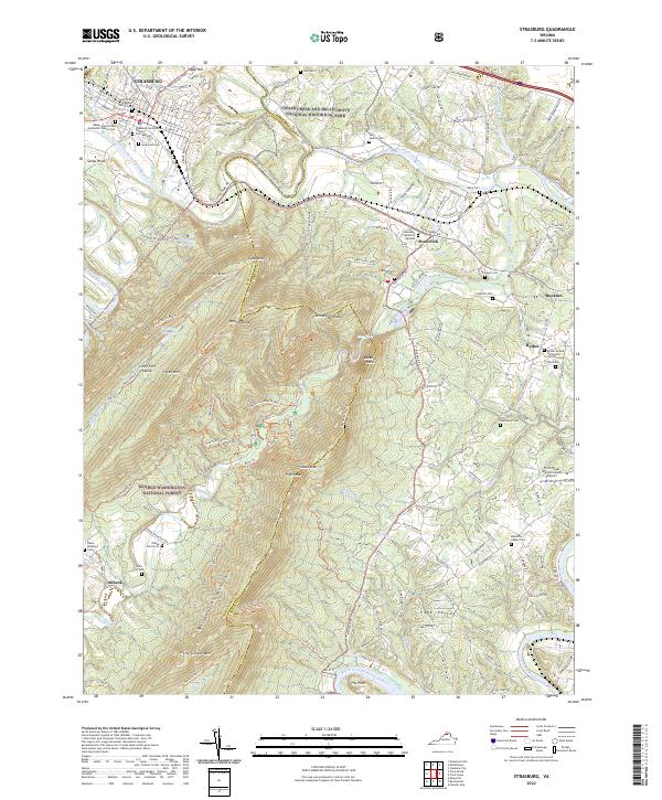 2022 Strasburg2022 Print · USGSThe Shenandoah Valley at the foot of Massanutten Mountain comes to life in this detailed recent survey of the Strasburg area. Genealogists and local historians can trace family roots through numerous sites like Hite Family Cem, Bennetts Chapel Cem, and Bethel.
End of results
Showing maps 1-15 of 15
Top cities near Buckton
- Front Royal historical maps
- Strasburg historical maps
- Shenandoah Farms historical maps
- Stephens City historical maps
- Middletown historical maps
- Apple Mountain Lake historical maps
See more
Frequently asked questions
- What are the different types of historical maps available for Buckton?
- What is the oldest map of Buckton?
- Where can I purchase historical maps of Buckton for my home or office?
- Where can I download high-res historical maps of Buckton?
- Are there historical topographic maps available for Buckton?
- Is there historical aerial imagery available for Buckton?
- Where are historical maps of Buckton sourced from?