Old Maps of Potomac Beach, Colonial Beach for Academic Research
Study the evolution of Potomac Beach with 21 high-resolution historic maps. Whether you're teaching, researching, or modeling changes in land use, these maps provide essential visual documentation of urban, environmental, and geographic change.
- Analyze long-term change: Track patterns in development, transportation, and natural features.
- Ideal for environmental or urban studies: Support academic projects with primary historical map data.
- Use in the classroom or lab: Educators and researchers rely on these maps to bring historical context to life.
These maps are a powerful tool for teaching, research, and visualizing how Potomac Beach has changed over the decades.
Potomac Beach, Colonial Beach maps
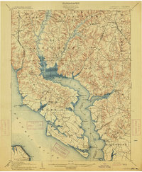
(21)- 1894 Map of Wicomico
 1894 Wicomico1894 Print · USGSThe Southern Maryland tidewater and Virginia's Northern Neck are captured here in the 1890s, when river wharves and early railroads still dictated local life. Trace the old ferry crossings at Ludlow Ferry and historic landing sites like Plowdens Wharf and Wilkerson Wharf.
 - 1895 Map of Wicomico
 1895 Wicomico1895 Print · USGSSouthern Maryland and the Virginia shore come alive in this late nineteenth-century survey of the Potomac and Wicomico watersheds. Genealogists and historians can trace old river landings like Plowdens Wharf, early rail routes, and established communities from Charlotte Hall to Chaptico.
 - 1895 Map of Nomini
 1895 Nomini1895 Print · USGSSouthern Maryland and the Virginia tidewater shores meet along the Potomac in this late nineteenth-century survey. Genealogists can trace family holdings and river landings from Charlotte Hall down to Sotterly and the Nomini Ferry.
 - 1898 Map of Nomini
 1898 Nomini1898 Print · USGSMaryland and Virginia's Tidewater region comes alive in the late nineteenth century as a world of river landings, rail terminals, and rural crossroads. Researchers can trace the maritime economy through Nomini Ferry and Stone Wharf, or locate ancestral homesteads near Charlotte Hall and Potomac Mills.5 unique versions available
 - 1902 Map of Wicomico
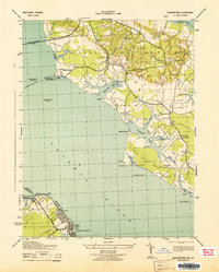
 1902 Wicomico1902 Print · USGSCoastal Maryland at the turn of the century shows a landscape tied to the tides and the tracks. Trace the vital waterfront economy through Ludlow Ferry and Plowdens Wharf, or follow the path of the Southern Maryland R. R. past Charlotte Hall.5 unique versions available
 - 1911 Map of Wicomico, 1961 Print
 1911 Wicomico1961 Print · USGSSouthern Maryland's river-dependent landscape is documented here during the early twentieth century, showing the tidewater border of Charles and St Marys counties. Genealogists can trace family-named points and wharves like Lancaster Wharf, the Laidlow Ferry, and the rail terminus at Popes Creek.
 - 1914 Map of Wicomico
 1914 Wicomico1914 Print · USGSSouthern Maryland's riverfront life is captured here during the early twentieth century, showing a landscape of tidal creeks and busy steamboat landings. Genealogists can trace family footprints near Charlotte Hall, find old crossings like Ludlow Ferry, or locate historic maritime hubs like Bushwood Wharf.4 unique versions available
 - 1920 Map of Wicomico
 1920 Wicomico1920 Print · USGSThe Potomac and Wicomico riverfronts appear here as they were just after the Great War, when steamboat wharves and ferries still anchored local commerce. Trace the old rail lines to Bel Alton Cox Sta or locate long-standing landmarks like Charlotte Hall and Ludlow Ferry.
 - 1943 Map of Morgantown
 1943 Morgantown1943 Print · USGSThe Potomac and Wicomico riverfronts come alive in this wartime survey of the Maryland-Virginia borderlands. Genealogists and local historians can trace family-named landmarks like Harris Lot and Bachelors Hope Pt or locate old community centers such as Old Christ Ch and the Tompkinsville Sch.
 - 1948 Map of Washington
 1948 Washington1948 Print · USGSThe Potomac and Chesapeake regions in the late 1940s reveal a landscape of expanding military reach and deep-rooted Tidewater settlements. Trace old rail corridors like the Richmond Fredericksburg & Potomac RR or locate landmarks like the Wakefield Washington Monument and St. Marys College.2 unique versions available
 - 1953 Map of Morgantown, 1954 Print
 1953 Morgantown1954 Print · USGSMaryland's tidewater necks and the Virginia riverfront are captured here in the early fifties as the region's bridge-and-road network expanded. Researchers can trace historic church sites like Old Christ Church and early landings such as Wilkerson Wharf and Morgantown.3 unique versions available
 - 1957 Map of Washington, 1966 Print
 1957 Washington1966 Print · USGSThe mid-Atlantic region during the mid-fifties and early sixties reveals a landscape of growing suburbs and vital military outposts. Researchers can trace historic river towns and shorelines from Alexandria to the Hooper Islands and St Clements Island.5 unique versions available
 - 1961 Map of Washington
 1961 Washington1961 Print · USGSThe mid-Atlantic region in the late fifties is presented in remarkable detail, from the Blue Ridge foothills to the Chesapeake Eastern Shore. Researchers can trace historic river landings and military sites like Mount Vernon, Fort Belvoir, and Point Lookout.2 unique versions available
 - 1968 Map of Colonial Beach North, 1972 Print
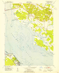
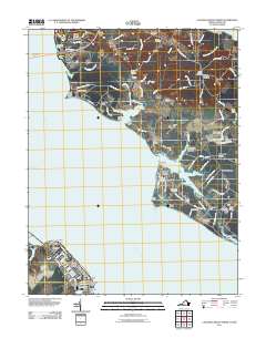
 1968 Colonial Beach North1972 Print · USGSThe Potomac River shoreline in Maryland and Virginia comes alive in the late sixties, showcasing the riverside culture and industry of the day. Trace family roots at Old Christ Ch or Holy Ghost Ch, and explore the coastal layout of Colonial Beach and Morgantown.5 unique versions available
 - 1983 Map of Leonardtown, 1984 Print
 1983 Leonardtown1984 Print · USGSSouthern Maryland and the Northern Neck of Virginia are shown in the early eighties as a mosaic of historic tidewater settlements and modern installations. Trace family roots and shoreline changes near St Marys City, Leonardtown, and Colonial Beach.2 unique versions available
 - 1989 Map of Washington
 1989 Washington1989 Print · USGSThe Potomac River valley and Chesapeake Bay are shown in comprehensive detail during the late 1980s. Genealogists and historians can trace the transition from urban Alexandria to the rural Northern Neck, locating landmarks like Mount Vernon and Stratford Hall.
 - 2011 Map of Colonial Beach North, 2011 Print
 2011 Colonial Beach North2011 Print · USGSCovers Potomac Beach, including Colonial Beach, Mount Victoria, and other nearby areas
 - 2013 Map of Colonial Beach North, 2013 Print
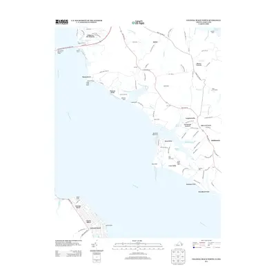 2013 Colonial Beach North2013 Print · USGSCovers Potomac Beach, including Colonial Beach, Mount Victoria, and other nearby areas
 - 2016 Map of Colonial Beach North, 2016 Print
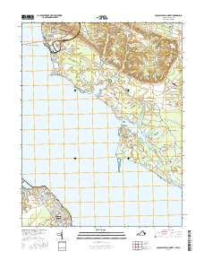 2016 Colonial Beach North2016 Print · USGSCovers Potomac Beach, including Colonial Beach, Mount Victoria, and other nearby areas
 - 2019 Map of Colonial Beach North, 2019 Print
 2019 Colonial Beach North2019 Print · USGSCovers Potomac Beach, including Colonial Beach, Mount Victoria, and other nearby areas
 - 2022 Map of Colonial Beach North, 2022 Print
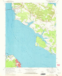
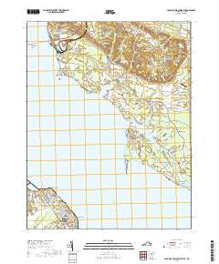
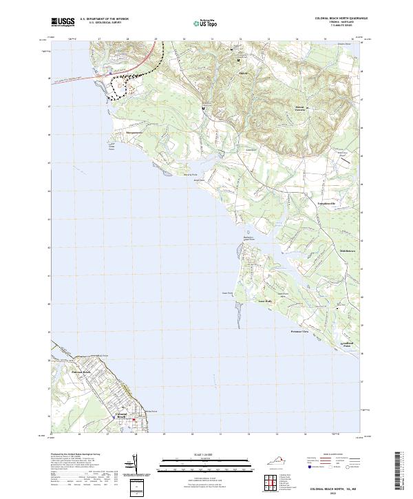 2022 Colonial Beach North2022 Print · USGSThe Potomac River shoreline near the Maryland-Virginia border comes into focus in this recent survey. Local historians can trace old community centers and cemeteries like Shiloh Community Church Cem and settlements such as Morgantown and Tompkinsville.
End of results
Showing maps 1-21 of 21
Frequently asked questions
- What are the different types of historical maps available for Potomac Beach?
- What is the oldest map of Potomac Beach?
- Where can I purchase historical maps of Potomac Beach for my home or office?
- Where can I download high-res historical maps of Potomac Beach?
- Are there historical topographic maps available for Potomac Beach?
- Is there historical aerial imagery available for Potomac Beach?
- Where are historical maps of Potomac Beach sourced from?