Old Maps of Westmoreland County, Virginia
Explore 152 old maps of Westmoreland County, spanning from 1889 to today. These high-resolution historic maps reveal how streets, neighborhoods, landmarks, and natural features evolved over time — perfect for genealogy, metal detecting, research, and local history exploration.
What you can do with these maps:
- See how Westmoreland County changed over time: Compare historical maps to modern-day views to trace roads, homesites, rail lines & more.
- View detailed metadata: Each map includes creators, publishers, year, scale, and archive source.
- Overlay maps with satellite & LiDAR: Visualize the past alongside modern tools to explore terrain & human change.
- Trusted historical sources: Maps sourced from the USGS, Library of Congress, and other archives.
- Access maps your way: View online, download high-res files, or order prints for personal or research use.
Start exploring old maps of Westmoreland County to uncover forgotten places, hidden landmarks, and the deep history beneath your feet.
Westmoreland County, VA maps
(152)- 1889 Map of Fredericksburg
 1889 Fredericksburg1889 Print · USGSThe Tidewater region of Virginia and Maryland comes into focus in the late 1880s, centered on the river-and-rail hub of Fredericksburg. Genealogists can trace early landmarks like Rappahannock Academy, Bull Church, and Saunders Wharf.
 - 1892 Map of Fredericksburg
 1892 Fredericksburg1892 Print · USGSCoastal Virginia and Maryland are captured here in the late nineteenth century, showing a landscape of river-port towns and historic crossroads. Researchers can locate vanished landmarks and family sites like Rappahannock Academy, Whites Mill, and the riverside Port Royal.
 - 1892 Map of Piney Point
 1892 Piney Point1892 Print · USGSThe Potomac River tidewater is captured in the early 1890s, bridging the maritime communities of Maryland and Virginia. Genealogists can trace family lands near Kinsale, Nomini Grove, and the historic crossing at Mount Holly (Nomini Ferry).
 - 1892 Map of Montross
 1892 Montross1892 Print · USGSThe Northern Neck of Virginia is shown here in the 1890s, when life revolved around the deep waters of the Potomac and Rappahannock. Genealogists can trace old family landing sites and settlements such as Montross, Stratford, and Potomac Mills.5 unique versions available
 - 1894 Map of Wicomico
 1894 Wicomico1894 Print · USGSThe Southern Maryland tidewater and Virginia's Northern Neck are captured here in the 1890s, when river wharves and early railroads still dictated local life. Trace the old ferry crossings at Ludlow Ferry and historic landing sites like Plowdens Wharf and Wilkerson Wharf.
 - 1894 Map of Fredericksburg
 1894 Fredericksburg1894 Print · USGSThe Tidewater and Piedmont regions of Virginia meet in the late nineteenth century at the head of the Rappahannock River. Local historians can trace early inland commerce through rural centers like Nindes Store, the Rappahannock Academy, and Stafford.10 unique versions available
 - 1894 Map of Piney Point
 1894 Piney Point1894 Print · USGSThe Lower Potomac during the late nineteenth century was a world of landings, ferries, and river-dependent villages. Genealogists and historians can trace old homesteads and crossings near Mount Holly (Nomini Ferry), Kinsale, and Valley Lee.
 - 1895 Map of Wicomico
 1895 Wicomico1895 Print · USGSSouthern Maryland and the Virginia shore come alive in this late nineteenth-century survey of the Potomac and Wicomico watersheds. Genealogists and historians can trace old river landings like Plowdens Wharf, early rail routes, and established communities from Charlotte Hall to Chaptico.
 - 1895 Map of Nomini
 1895 Nomini1895 Print · USGSSouthern Maryland and the Virginia tidewater shores meet along the Potomac in this late nineteenth-century survey. Genealogists can trace family holdings and river landings from Charlotte Hall down to Sotterly and the Nomini Ferry.
 - 1895 Map of Piney Point
 1895 Piney Point1895 Print · USGSThe Potomac River and its intricate Virginia and Maryland shorelines are revealed here in the late nineteenth century. Genealogists can trace family roots through landings and settlements like Kinsale, Hague, and Mount Holly (Nomini Ferry).
 - 1895 Map of Montross
 1895 Montross1895 Print · USGSWestmoreland and Richmond counties are shown in the 1890s as a thriving river-based economy on the Northern Neck peninsula. Genealogists and historians can trace family-named landings and settlements like Wirt Wharf, Montross, and Potomac Mills.2 unique versions available
 - 1898 Map of Nomini
 1898 Nomini1898 Print · USGSMaryland and Virginia's Tidewater region comes alive in the late nineteenth century as a world of river landings, rail terminals, and rural crossroads. Researchers can trace the maritime economy through Nomini Ferry and Stone Wharf, or locate ancestral homesteads near Charlotte Hall and Potomac Mills.5 unique versions available
 - 1901 Map of Piney Point
 1901 Piney Point1901 Print · USGSThe Potomac River tidewater at the opening of the twentieth century was a landscape of remote landings and river-bound commerce. Researchers can trace historic ferry crossings at Mount Holly, find the L.H. at Piney Point, or locate old mill sites like Clifton Mills.5 unique versions available
 - 1902 Map of Wicomico
 1902 Wicomico1902 Print · USGSCoastal Maryland at the turn of the century shows a landscape tied to the tides and the tracks. Trace the vital waterfront economy through Ludlow Ferry and Plowdens Wharf, or follow the path of the Southern Maryland R. R. past Charlotte Hall.5 unique versions available
 - 1911 Map of Wicomico, 1961 Print
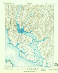 1911 Wicomico1961 Print · USGSSouthern Maryland's river-dependent landscape is documented here during the early twentieth century, showing the tidewater border of Charles and St Marys counties. Genealogists can trace family-named points and wharves like Lancaster Wharf, the Laidlow Ferry, and the rail terminus at Popes Creek.
 - 1914 Map of Wicomico
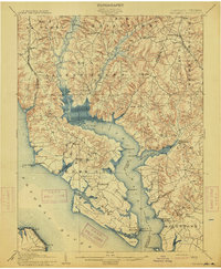 1914 Wicomico1914 Print · USGSSouthern Maryland's riverfront life is captured here during the early twentieth century, showing a landscape of tidal creeks and busy steamboat landings. Genealogists can trace family footprints near Charlotte Hall, find old crossings like Ludlow Ferry, or locate historic maritime hubs like Bushwood Wharf.4 unique versions available
 - 1917 Map of Morattico
 1917 Morattico1917 Print · USGSThe Northern Neck of Virginia is shown here in the years before the Great War, when the Rappahannock River was a busy Steamboat Route. Genealogists can locate family landmarks like Gordys Millpond, Lively, and the Marvin Grove Camp in this detailed look at early rural life.
 - 1918 Map of Tappahannock
 1918 Tappahannock1918 Print · USGSThe Tidewater region during the first World War comes alive on this sheet, centered on the historic river crossing at Tappahannock. Researchers can trace the active Steamboat Route, old river landings like Bowlers Wharf, and rural landmarks including St Pauls Church.2 unique versions available
 - 1918 Map of Morattico
 1918 Morattico1918 Print · USGSThe Northern Neck region relied heavily on the Rappahannock waterfront during the early twentieth century, when steamboats were still the primary connection to the outside world. Researchers can trace ancestral home sites and community centers from Lodge and Nuttsville to historic landmarks like Gibeon Church and Downings Mill.3 unique versions available
 - 1919 Map of Tappahannock, 1938 Print
 1919 Tappahannock1938 Print · USGSCoastal life along the Rappahannock River is meticulously charted here in the years following the Great War. Genealogists and historians can trace the foundations of Essex and Richmond counties through landmarks like Millers Tavern, the Rappahannock Industrial Academy, and Mt Airy Millpond.
 - 1920 Map of Wicomico
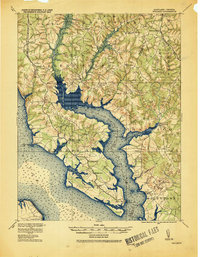 1920 Wicomico1920 Print · USGSThe Potomac and Wicomico riverfronts appear here as they were just after the Great War, when steamboat wharves and ferries still anchored local commerce. Trace the old rail lines to Bel Alton Cox Sta or locate long-standing landmarks like Charlotte Hall and Ludlow Ferry.
 - 1926 Map of Morattico, 1943 Print
 1926 Morattico1943 Print · USGSThe Rappahannock River and Northern Neck are captured in the mid-1920s, showing a landscape defined by tidewater commerce and rural tradition. Genealogists can trace family roots through numerous churches and schools like Totuskey Church, Folly School, and Sharps.
 - 1930 Map of Wakefield
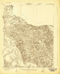 1930 Wakefield1930 Print · USGSWestmoreland County and the Northern Neck appear here in the early thirties, defined by a historic riverfront landscape and rural hamlets. Researchers can locate the Birthplace of Washington and Monroe Birthplace alongside old river ports like Leedstown and Steve Landing.
 - 1932 Map of Wakefield
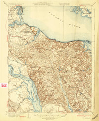 1932 Wakefield1932 Print · USGSWestmoreland County at the start of the 1930s shows a landscape defined by the great bends of the Potomac and Rappahannock Rivers. Researchers can trace ancestral locations near the George Washington Birthplace or find local landmarks like Potomac Mills and Monroe Hall.2 unique versions available
 - 1942 Map of Occupacia
 1942 Occupacia1942 Print · USGSEssex County's riverfront and rural interior are documented here during the early 1940s, showing a landscape of crossroads settlements and timber resources. Genealogists and historians can trace family locations near Vauters Church, Bethlehem Fork, and the Lumber Mill near Iraville.
Showing maps 1-25 of 152
Top cities of Westmoreland County
Frequently asked questions
- What are the different types of historical maps available for Westmoreland County?
- What is the oldest map of Westmoreland County?
- Where can I purchase historical maps of Westmoreland County for my home or office?
- Where can I download high-res historical maps of Westmoreland County?
- Are there historical topographic maps available for Westmoreland County?
- Is there historical aerial imagery available for Westmoreland County?
- Where are historical maps of Westmoreland County sourced from?