2020s Maps of Westmoreland County, Virginia
Explore 15 historic maps of Westmoreland County from the 2020s. These maps offer a rare glimpse into what life looked like during the 2020s — showing old roads, neighborhoods, homes, and landmarks that have changed or disappeared over time.
Whether you're researching your family's past, planning a metal detecting trip, or studying how Westmoreland County's landscape evolved across the 2020s, these high-resolution maps are a powerful tool for exploring the history of this region.
- Focus on a specific era: All maps on this page are from the 2020s, giving you a focused view of this time period.
- See what’s changed: Compare century-old streets, trails, and buildings to today's modern landscape using overlays and satellite layers.
- Research with precision: Use these maps for genealogy, historical research, land use analysis, or educational projects.
- View, download, or print: Maps are fully viewable online in high resolution, and can be downloaded or printed for your own records.
Start exploring Westmoreland County's history through authentic maps from the 2020s. This is your window into the past.
Westmoreland County, VA maps
(15)- 2022 Map of Lottsburg, 2022 Print
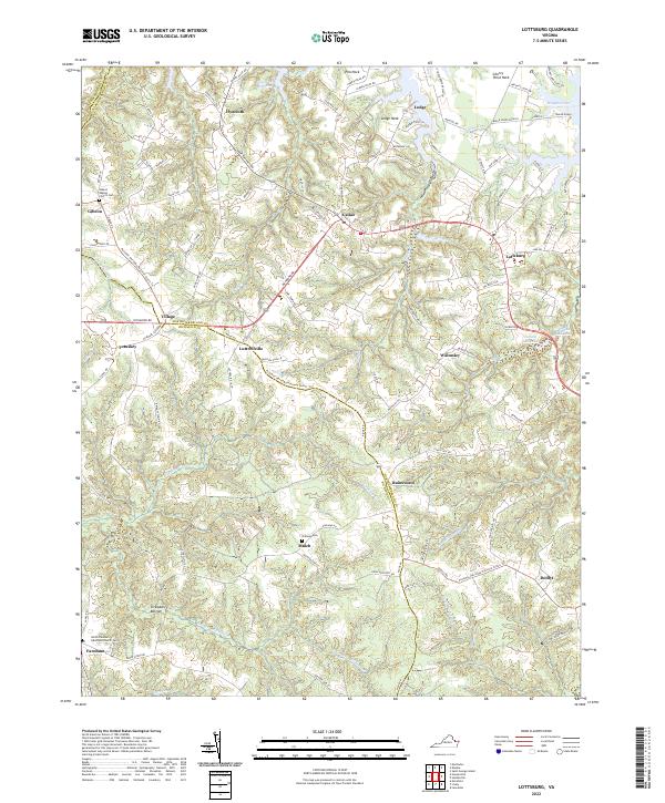 2022 Lottsburg2022 Print · USGSThe Northern Neck of Virginia is shown here in the early twenty-first century, where tidewater peninsulas meet historic crossroads. Researchers can trace land tracts near Cherry Point Neck or locate family sites at Gibeon Baptist Church Cem and Strawberry Bottom.
 - 2022 Map of Tappahannock, 2022 Print
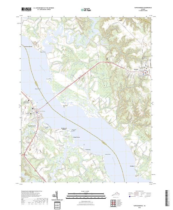 2022 Tappahannock2022 Print · USGSThe Rappahannock River divides Richmond and Essex counties in this contemporary view of Virginia's historic Tidewater region. Researchers can trace local heritage through the Essex County Courthouse, Tayloe Cem, and Ferry Point.
 - 2022 Map of Haynesville, 2022 Print
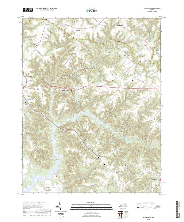 2022 Haynesville2022 Print · USGSThe Virginia Northern Neck remains a landscape of deep-rooted rural communities and winding waterways in this modern era survey. Genealogists and researchers can trace local families through many rural burial grounds like Beulah Baptist Church Cem and Lyells Chapel Baptist Church/Cem.
 - 2022 Map of Champlain, 2022 Print
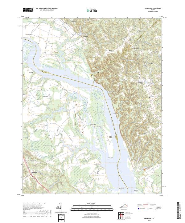 2022 Champlain2022 Print · USGSThis Northern Neck and Essex County landscape remains defined by its historical river landings and sprawling marshlands. Genealogists and local researchers can trace family landmarks like Foneswood, Smith Mt Hill, and the Rappahannock Baptist Church along the river's winding reaches.
 - 2022 Map of Machodoc, 2022 Print
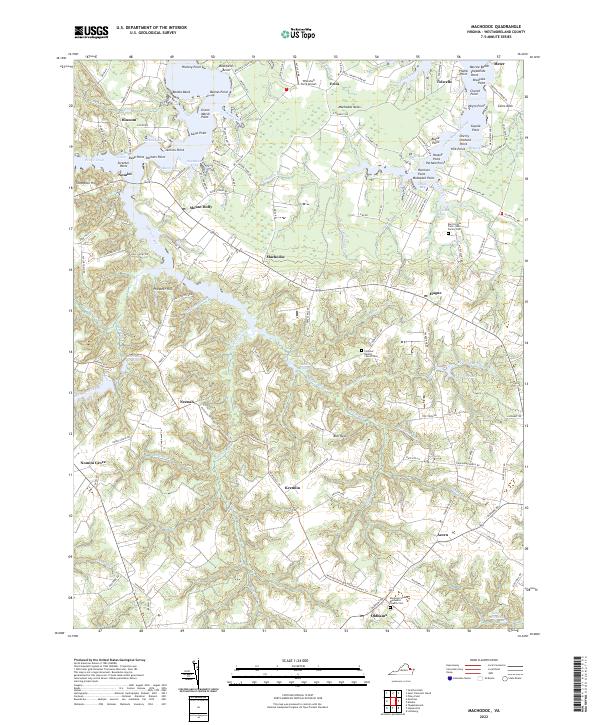 2022 Machodoc2022 Print · USGSWestmoreland County’s historic Northern Neck is revealed here as a network of tidal creeks and family lands in the early 2020s. Researchers can locate significant sites like the Burnt House Field - Lee Family Cem and trace old water-powered sites such as Beales Millpond near Machodoc.
 - 2022 Map of Stratford Hall, 2022 Print
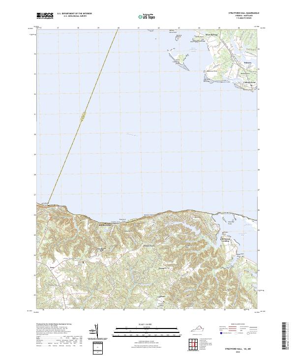 2022 Stratford Hall2022 Print · USGSThe Potomac River shoreline near the Westmoreland cliffs appears in this recent survey, capturing the rural character of Virginia's Northern Neck. Researchers can trace historic family landmarks such as Stratford Hall, Currioman Landing, and the Shiloh Baptist Church Cem.
 - 2022 Map of Montross, 2022 Print
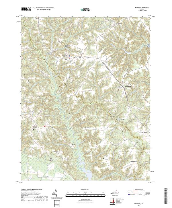 2022 Montross2022 Print · USGSThe Northern Neck of Virginia is shown here in the 2020s, centered on the county seat of Montross. Genealogists and local historians can trace rural family settlements and historic congregations at Nomini Grove, Tallent Town, and New Zion Baptist Church Cem.
 - 2022 Map of Colonial Beach South, 2022 Print
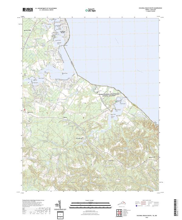 2022 Colonial Beach South2022 Print · USGSWestmoreland County’s riverfront is captured here in the early twenty-first century, centered on the birthplace of a president and the tidal reaches of the Potomac River. Researchers can locate family landmarks like Monroe Hall, find the Washington Cem, and trace the rural crossroads of Oak Grove and Potomac Mills.
 - 2022 Map of Kinsale, 2022 Print
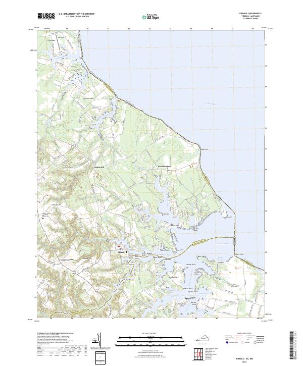 2022 Kinsale2022 Print · USGSThe Northern Neck’s waterfront character is well-preserved in this modern era, focusing on the intricate estuaries of the Potomac River and Yeocomico River. Researchers can trace local lineage and land use through features like Carmel United Methodist Church Cem, Kinsale, and Pecatone Neck.
 - 2022 Map of Colonial Beach North, 2022 Print
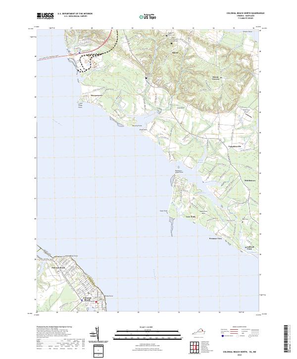 2022 Colonial Beach North2022 Print · USGSThe Potomac River shoreline near the Maryland-Virginia border comes into focus in this recent survey. Local historians can trace old community centers and cemeteries like Shiloh Community Church Cem and settlements such as Morgantown and Tompkinsville.
 - 2022 Map of Dahlgren, 2022 Print
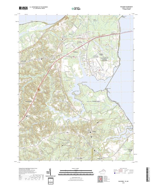 2022 Dahlgren2022 Print · USGSThe Potomac shoreline at the Maryland-Virginia border is defined here by military history and rural community life. Genealogists can trace family names through numerous burial sites like Spy Hill Cem, Bumbrey Cem, and Little Ark Baptist Church Cem.
 - 2022 Map of Rollins Fork, 2022 Print
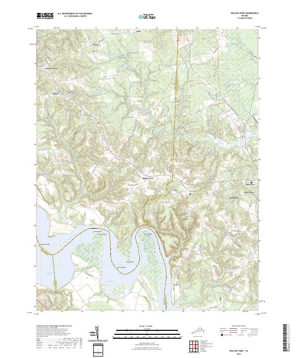 2022 Rollins Fork2022 Print · USGSThe northern neck of Virginia where the Rappahannock River bends sharply reveals a landscape of tidal bays and historic crossroads. Genealogists and historians can trace family locations and community hubs like Oak Grove, Nash Town, and Shiloh.
 - 2022 Map of Loretto, 2022 Print
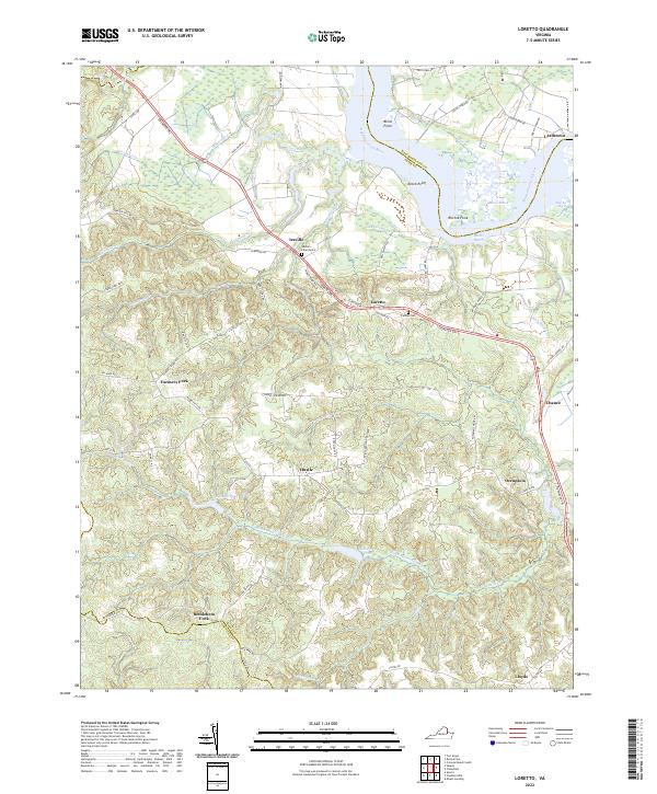 2022 Loretto2022 Print · USGSThe Rappahannock River defines this corner of the Northern Neck, where rural crossroads and marshlands meet. Researchers can trace land tracts and community history through Vauters Churchyard, the Carmel Cem, and established points like Leedstown and Bethlehem Fork.
 - 2023 Map of Piney Point, 2023 Print
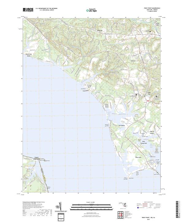 2023 Piney Point2023 Print · USGSCoastal St. Mary's County appears here in the early 21st century, showing the established communities and shoreline of the Potomac. Genealogists and researchers can trace family-named sites like McKay Beach or locate records at the Holy Face Parish Cem and Great Mills.
 - 2023 Map of Saint Clements Island, 2023 Print
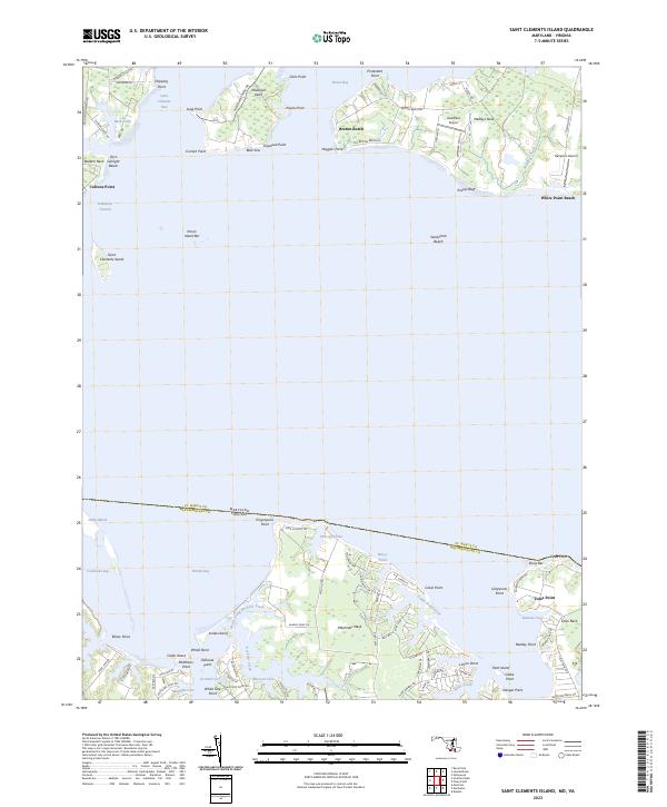 2023 Saint Clements Island2023 Print · USGSThe Potomac River crossings and colonial-era tidewater peninsulas of Maryland and Virginia are detailed in this recent coastal survey. Researchers can trace landforms and local hubs like Coltons Point, Saint Clements Island, and the waterfront at Coles Point.
End of results
Showing maps 1-15 of 15
Top cities of Westmoreland County
Frequently asked questions
- What are the different types of historical maps available for Westmoreland County?
- What is the oldest map of Westmoreland County?
- Where can I purchase historical maps of Westmoreland County for my home or office?
- Where can I download high-res historical maps of Westmoreland County?
- Are there historical topographic maps available for Westmoreland County?
- Is there historical aerial imagery available for Westmoreland County?
- Where are historical maps of Westmoreland County sourced from?