1960s Maps of Westmoreland County, Virginia
Explore 17 historic maps of Westmoreland County from the 1960s. These maps offer a rare glimpse into what life looked like during the 1960s — showing old roads, neighborhoods, homes, and landmarks that have changed or disappeared over time.
Whether you're researching your family's past, planning a metal detecting trip, or studying how Westmoreland County's landscape evolved across the 1960s, these high-resolution maps are a powerful tool for exploring the history of this region.
- Focus on a specific era: All maps on this page are from the 1960s, giving you a focused view of this time period.
- See what’s changed: Compare century-old streets, trails, and buildings to today's modern landscape using overlays and satellite layers.
- Research with precision: Use these maps for genealogy, historical research, land use analysis, or educational projects.
- View, download, or print: Maps are fully viewable online in high resolution, and can be downloaded or printed for your own records.
Start exploring Westmoreland County's history through authentic maps from the 1960s. This is your window into the past.
Westmoreland County, VA maps
(17)- 1961 Map of Washington
 1961 Washington1961 Print · USGSThe mid-Atlantic region in the late fifties is presented in remarkable detail, from the Blue Ridge foothills to the Chesapeake Eastern Shore. Researchers can trace historic river landings and military sites like Mount Vernon, Fort Belvoir, and Point Lookout.2 unique versions available
 - 1964 Map of Richmond
 1964 Richmond1964 Print · USGSCoastal and central Virginia are mapped during the mid-twentieth century, showing the critical intersection of rail, river, and military life. Genealogists can trace family roots through rural county seats like Amelia or find vanished coastal neighborhoods near Phoebus and Hilton Village.
 - 1968 Map of Rollins Fork, 1971 Print
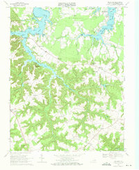
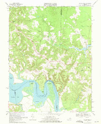 1968 Rollins Fork1971 Print · USGSNorthern Neck life in the late sixties centers on the river and rural crossroads. Researchers can trace family sites at Nash Town and Rollins Fork or locate the Colonial Beach Dragway and Greenlaw Wharf.
 - 1968 Map of Champlain, 1971 Print
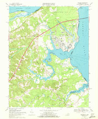
 1968 Champlain1971 Print · USGSThe Rappahannock River defines this late-1960s Tidewater landscape at the meeting of Essex and Westmoreland Counties. Genealogists and historians can trace old riverfront hubs like Leedstown and Carters Wharf alongside rural landmarks such as Ephesus Ch.4 unique versions available
 - 1968 Map of Lottsburg, 1971 Print
 1968 Lottsburg1971 Print · USGSThe Northern Neck in the late sixties shows a landscape of tidal creeks and millponds before modern development altered the rural character of these coastal counties. Trace family roots and local history through Henderson Ch, the crossroads at Village, and the waterfront at Wrights Cove.3 unique versions available
 - 1968 Map of Colonial Beach South, 1971 Print
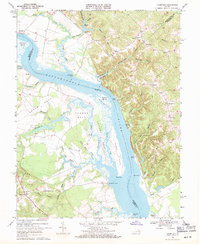
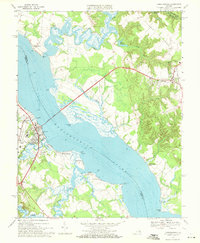
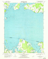
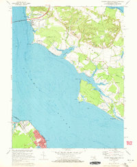
 1968 Colonial Beach South1971 Print · USGSThe Westmoreland County tidewater is preserved here in the late sixties, where presidential history meets the Potomac shoreline. Researchers can trace ancestral sites like Wakefield Mansion or explore rural crossroads such as Monroe Hall and Potomac Mills.4 unique versions available
 - 1968 Map of Machodoc, 1971 Print
 1968 Machodoc1971 Print · USGSThe Northern Neck’s tidal reaches and rural crossroads are captured in the late sixties as old water-bound settlements began to modernize. Researchers can locate family landmarks from Coles Point to Nomini Grove, including historic sites like Beales Wharf and Salem Ch.2 unique versions available
 - 1968 Map of Tappahannock, 1971 Print
 1968 Tappahannock1971 Print · USGSThe Rappahannock River waterfront in the late sixties reveals a landscape of established river towns and growing coastal communities. Researchers can trace local landmarks like St Margarets Church, the Downing Bridge, and the historic layout of Warsaw.4 unique versions available
 - 1968 Map of Kinsale, 1972 Print
 1968 Kinsale1972 Print · USGSThe Westmoreland waterfront and Northern Neck are captured here in the late sixties, showing a landscape deeply tied to the Yeocomico and Potomac rivers. Researchers can trace historic parish sites and family-named landings like Yeocomico Ch, Kinsale, and Harryhogan.4 unique versions available
 - 1968 Map of Montross, 1972 Print
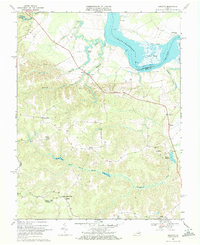
 1968 Montross1972 Print · USGSCoastal Virginia in the late sixties reveals a network of tidewater settlements and millponds across the Northern Neck. Genealogists can trace family names through landmarks like Tallent Town, Weavers Millpond, and local congregations at Welcome Grove Ch and New Zion Ch.2 unique versions available
 - 1968 Map of St Clements Island, 1972 Print
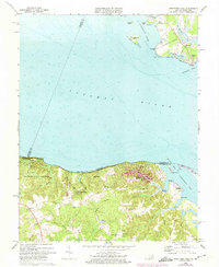
 1968 St Clements Island1972 Print · USGSThe Potomac River shoreline at the Maryland and Virginia border is captured here during the late sixties, showing the transition from rural landings to coastal communities. Local researchers can trace family-named points and coves like Blue Sow, Coles Point, and the landmark Stone Cross on St Clements Island.5 unique versions available
 - 1968 Map of Loretto, 1972 Print
 1968 Loretto1972 Print · USGSThe Rappahannock River and the rural crossroads of Essex County are captured here in the late sixties. Researchers can trace ancestral locations near Vauters Ch, locate the riverside landing at Saunders Wharf, or explore the reaches of Black Water Swamp.4 unique versions available
 - 1968 Map of Haynesville, 1972 Print
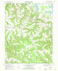
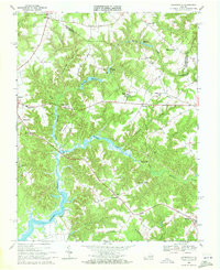 1968 Haynesville1972 Print · USGSNorthern Neck tobacco and timber country is documented here in the late sixties, centered on the Totuskey Creek basin. Genealogists and historians can trace Warsaw and Farnham alongside sites like State Prison Camp No 17 and Lyells Chapel.3 unique versions available
 - 1968 Map of Piney Point, 1972 Print
 1968 Piney Point1972 Print · USGSCoastal St. Mary's County comes into sharp focus during the late 1960s as a thriving maritime and residential corridor. Genealogists and local historians can trace the development of Tall Timbers, locate St Georges Ch, and find the historic Lighthouse at Piney Point.4 unique versions available
 - 1968 Map of Dahlgren, 1972 Print
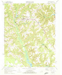
 1968 Dahlgren1972 Print · USGSThe northern neck of Virginia in the late sixties reveals a landscape of high-tech naval defense and deep-rooted rural communities. Trace the grounds of the Dahlgren Weapons Laboratory or locate family sites like Bumbry Cem and Carruthers Corner.2 unique versions available
 - 1968 Map of Colonial Beach North, 1972 Print
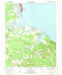
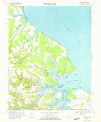
 1968 Colonial Beach North1972 Print · USGSThe Potomac River shoreline in Maryland and Virginia comes alive in the late sixties, showcasing the riverside culture and industry of the day. Trace family roots at Old Christ Ch or Holy Ghost Ch, and explore the coastal layout of Colonial Beach and Morgantown.5 unique versions available
 - 1968 Map of Stratford Hall, 1974 Print
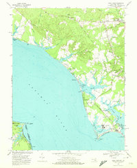
 1968 Stratford Hall1974 Print · USGSThe Westmoreland County shoreline comes alive in the late sixties, showcasing the historic Lee estate and the river-dependent life of the Northern Neck. Researchers can trace land use from Stratford Hall to the riverfront at Currioman Landing and Coltons Point.2 unique versions available
End of results
Showing maps 1-17 of 17
Top cities of Westmoreland County
Frequently asked questions
- What are the different types of historical maps available for Westmoreland County?
- What is the oldest map of Westmoreland County?
- Where can I purchase historical maps of Westmoreland County for my home or office?
- Where can I download high-res historical maps of Westmoreland County?
- Are there historical topographic maps available for Westmoreland County?
- Is there historical aerial imagery available for Westmoreland County?
- Where are historical maps of Westmoreland County sourced from?