Old Maps of Big Stone Gap, Virginia for Metal Detecting
Plan your next treasure hunt with 41 historic maps of Big Stone Gap. Find old homesites, ghost towns, trails, and gathering spots that may be lost to time — perfect for identifying promising metal detecting locations.
- Locate forgotten sites: Uncover places like long-lost settlements, abandoned rail lines, or gathering spots.
- Plan better hunts: Use map overlays combined with LiDAR or satellite views to narrow in on historically rich areas.
- Made for detectorists: Thousands of hobbyists use these maps to discover relics, coins, and hidden history.
Use these historic maps to boost your research and find new opportunities beneath the surface of Big Stone Gap.
Big Stone Gap, VA maps
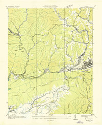
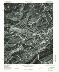
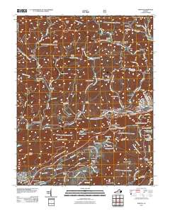
(41)- 1894 Map of Estillville, 1909 Print
 1894 Estillville1909 Print · USGSThe Appalachian highlands at the turn of the century show a landscape of isolated mountain hollows and emerging rail hubs. Genealogists can trace family footprints across river crossings like Speer Ferry and vanished industry at Zion Mills or Brick Store.3 unique versions available
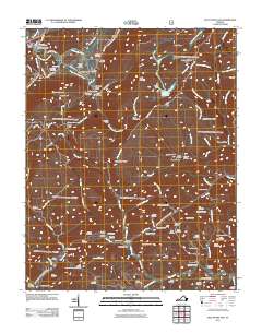
 - 1920 Map of Wise
 1920 Wise1920 Print · USGSThe coal and rail country of Southwest Virginia is captured here in the years following the Great War. Genealogists can locate family landmarks such as Fort Blackmore, Grays School, and the scattered settlements of Dunbar and Esserville.
 - 1921 Map of Big Stone Gap
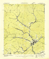
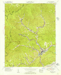
 1921 Big Stone Gap1921 Print · USGSIn the early 1920s, the coal and rail networks of Wise and Lee Counties were at their peak. Genealogists and historians can trace old settlements and rural hubs like Keokee, Johnsons Mill PO, and Stonega along the Southern RR and the Powell River.
 - 1921 Map of Wise
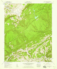
 1921 Wise1921 Print · USGSWise County in the early twentieth century was a landscape of coal-town industry and mountain schools. Search for family roots in settlements like Norton, Big Stone Gap, and Glamorgan, or locate rural landmarks such as Cox Chapel and Buffalo School.2 unique versions available
 - 1922 Map of Big Stone Gap
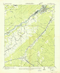
 1922 Big Stone Gap1922 Print · USGSSouthwest Virginia's coal and rail corridors are captured here in the early 1920s, showing the height of industrial development in the Cumberland Mountains. Trace family roots and vanished landmarks near Appalachia, Keokee, and the historic Seminary School along the Powell River.
 - 1929 Map of Big Stone Gap
 1929 Big Stone Gap1929 Print · USGSThe coal and rail networks of the Kentucky-Virginia border country are frozen in time just before the Great Depression. Genealogists and historians can trace family roots through mountain settlements like Lynch, Keokee, and Appalachia, or locate landmarks such as Robbins Chapel and Cluttis Post Office.3 unique versions available
 - 1935 Map of Norton
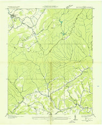
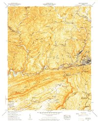
 1935 Norton1935 Print · USGSIn the mid-1930s, the coal fields of Wise County were a hive of industrial activity centered around rail junctions and company towns. Researchers can trace the lineage of local families at Legion Memorial Cem and locate specific mine sites like Stonega Coal No 125 or the CCC Camp P 63.
 - 1935 Map of Appalachia
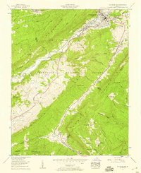
 1935 Appalachia1935 Print · USGSThe Virginia-Kentucky borderlands hummed with coal and rail activity in the mid-1930s. Genealogists and industrial historians can trace family locations through numerous company towns like Roda and Arno, or locate the Interstate Shops and Yards.
 - 1935 Map of East Stone Gap
 1935 East Stone Gap1935 Print · USGSThe Powell Valley region of Southwest Virginia is shown here in the mid-1930s as the rail and river economy shaped the landscape. Researchers can trace the Southern RR through Elverton Station and locate community landmarks like Dortons Chapel and Cracker Neck Sch.
 - 1935 Map of Olinger
 1935 Olinger1935 Print · USGSBig Stone Gap and the surrounding coal ridges of Southwest Virginia are captured here in the mid-1930s. Genealogists and local historians can trace family locations near Seminary Sch, Olinger, and church sites like Robinette Chapel or Union Ch.
 - 1955 Map of Johnson City
 1955 Johnson City1955 Print · USGSEast Tennessee and the bordering highlands of Virginia and Kentucky appear here during the post-war industrial boom. You can trace the complex network of mountain ridges and new TVA lakes, from Johnson City to the coalfields near Middlesboro and Lynch.
 - 1955 Map of Appalachia, 1956 Print
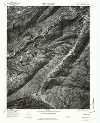
 1955 Appalachia1956 Print · USGSThe coal country of the Kentucky and Virginia border comes into focus in the mid-1950s, showing a landscape defined by mountain mines and rail hubs. Researchers can trace the industrial layout of Stonega and Appalachia, alongside local landmarks like Osaka Sch and Kilbourn Cem.6 unique versions available
 - 1957 Map of East Stone Gap, 1959 Print
 1957 East Stone Gap1959 Print · USGSWise and Scott Counties are shown here during the late fifties, as traditional mountain communities began adapting to modern infrastructure. Genealogists can trace family lines through dozens of remote sites like Durham Chapel, Stanleytown, and the Barker Cem.4 unique versions available
 - 1957 Map of Norton, 1959 Print
 1957 Norton1959 Print · USGSWise County in the late fifties was a landscape defined by coal and iron, where ridges like Rogers Ridge were heavily shaped by extensive strip mines. Researchers can trace the heritage of small communities and family plots at Kelly View, Gardner School, and Stidham Cem.8 unique versions available
 - 1957 Map of Big Stone Gap, 1959 Print
 1957 Big Stone Gap1959 Print · USGSBig Stone Gap and the surrounding mountain ridges are shown here in the late fifties, during a period of transition for these Appalachian rail towns. Genealogists can locate dozens of family burial sites such as Jones Cem and landmarks like Turkey Cove Seminary or Irondale.6 unique versions available
 - 1957 Map of Johnson City, 1966 Print
 1957 Johnson City1966 Print · USGSUpper East Tennessee and Southwest Virginia are shown here during the mid-sixties transition of the Appalachians. Researchers can trace the industrial rail hubs of Kingsport, the sprawling waters of Cherokee Lake, and the historic Cumberland Gap.
 - 1960 Map of Johnson City
 1960 Johnson City1960 Print · USGSUpper East Tennessee and the surrounding tri-state area are shown in the mid-fifties during the height of the TVA reservoir era. Trace the industrial rail lines of the Southern and Louisville and Nashville between Kingsport and Johnson City.
 - 1963 Map of Johnson City
 1963 Johnson City1963 Print · USGSThe Tri-Cities and the surrounding Appalachian ridges are shown in detail during the early sixties, highlighting the era's vital rail and river networks. Genealogists and historians can trace the routes of the Clinchfield RR and locate settlements from Rogersville to Elizabethton.
 - 1976 Map of Appalachia, 1981 Print
 1976 Appalachia1981 Print · USGSThe coal country of Wise County is captured in the mid-seventies, showing the density of mountain hollow settlements. Genealogists and researchers can trace the specific layouts of coal towns like Roda, Stonega, and Derby along the banks of Callahan Creek.
 - 1976 Map of Big Stone Gap, 1981 Print
 1976 Big Stone Gap1981 Print · USGSBig Stone Gap and the surrounding coal country are shown in mid-seventies detail through this high-altitude orthophoto. Researchers can trace the development of mountain settlements like Exeter, Seminary, and Jasper along the banks of the Powell River.
 - 1981 Map of Bristol
 1981 Bristol1981 Print · USGSAppalachia and the Tri-Cities region are shown at a peak of industrial and rail development in the early eighties. Researchers can trace the Clinchfield Railroad through the mountains or find local landmarks like King College and the Holston Army Ammunition Plant.2 unique versions available
 - 2011 Map of Big Stone Gap, 2011 Print
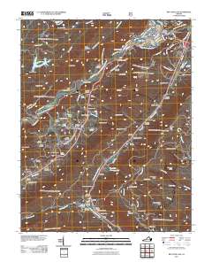 2011 Big Stone Gap2011 Print · USGSCovers Big Stone Gap, including Tito, Olinger, and other nearby areas
 - 2011 Map of Appalachia, 2011 Print
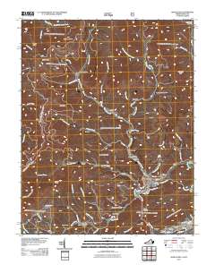 2011 Appalachia2011 Print · USGSCovers Big Stone Gap, including Appalachia, Osaka, and other nearby areas
 - 2011 Map of Norton, 2011 Print
 2011 Norton2011 Print · USGSCovers Big Stone Gap, including Norton, Big Stone Gap East, and other nearby areas
 - 2011 Map of East Stone Gap, 2011 Print
 2011 East Stone Gap2011 Print · USGSCovers Big Stone Gap, including East Stone Gap, Duncan Mill, and other nearby areas
Showing maps 1-25 of 41
Top cities near Big Stone Gap
- Norton historical maps
- Wise historical maps
- Cumberland historical maps
- Gate City historical maps
- Weber City historical maps
- Appalachia historical maps
See more
Frequently asked questions
- What are the different types of historical maps available for Big Stone Gap?
- What is the oldest map of Big Stone Gap?
- Where can I purchase historical maps of Big Stone Gap for my home or office?
- Where can I download high-res historical maps of Big Stone Gap?
- Are there historical topographic maps available for Big Stone Gap?
- Is there historical aerial imagery available for Big Stone Gap?
- Where are historical maps of Big Stone Gap sourced from?