1930s Maps of Stinson, Virginia
Explore 2 historic maps of Stinson from the 1930s. These maps offer a rare glimpse into what life looked like during the 1930s — showing old roads, neighborhoods, homes, and landmarks that have changed or disappeared over time.
Whether you're researching your family's past, planning a metal detecting trip, or studying how Stinson's landscape evolved across the 1930s, these high-resolution maps are a powerful tool for exploring the history of this region.
- Focus on a specific era: All maps on this page are from the 1930s, giving you a focused view of this time period.
- See what’s changed: Compare century-old streets, trails, and buildings to today's modern landscape using overlays and satellite layers.
- Research with precision: Use these maps for genealogy, historical research, land use analysis, or educational projects.
- View, download, or print: Maps are fully viewable online in high resolution, and can be downloaded or printed for your own records.
Start exploring Stinson's history through authentic maps from the 1930s. This is your window into the past.
Stinson, VA maps
(2)- 1931 Map of Rural Retreat
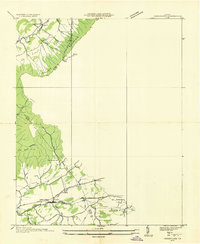
 1931 Rural Retreat1931 Print · USGSSouthwestern Virginia in the early 1930s is defined by its ridge-and-valley terrain and the rail-and-road corridor of the Norfolk and Western. Genealogists can trace local landmarks like Wasson Cem, Roberts Mill, and the Old Iron Mine near Sugar Grove.
 - 1935 Map of Groseclose
 1935 Groseclose1935 Print · USGSWythe County, Virginia, is captured in the mid-1930s along the vital Holston River transportation corridor. Genealogists and local historians can trace family land near Groseclose and Old Mt Airy, or locate community centers like Bethany Ch and Murpheyville Sch.
End of results
Showing maps 1-2 of 2
Top cities near Stinson
- Wytheville historical maps
- Marion historical maps
- Tazewell historical maps
- Rural Retreat historical maps
- Gratton historical maps
- Bland historical maps
See more
Frequently asked questions
- What are the different types of historical maps available for Stinson?
- What is the oldest map of Stinson?
- Where can I purchase historical maps of Stinson for my home or office?
- Where can I download high-res historical maps of Stinson?
- Are there historical topographic maps available for Stinson?
- Is there historical aerial imagery available for Stinson?
- Where are historical maps of Stinson sourced from?