Old Maps of Anatone, Washington
Explore 12 old maps of Anatone, spanning from 1944 to today. These high-resolution historic maps reveal how streets, neighborhoods, landmarks, and natural features evolved over time — perfect for genealogy, metal detecting, research, and local history exploration.
What you can do with these maps:
- See how Anatone changed over time: Compare historical maps to modern-day views to trace roads, homesites, rail lines & more.
- View detailed metadata: Each map includes creators, publishers, year, scale, and archive source.
- Overlay maps with satellite & LiDAR: Visualize the past alongside modern tools to explore terrain & human change.
- Trusted historical sources: Maps sourced from the USGS, Library of Congress, and other archives.
- Access maps your way: View online, download high-res files, or order prints for personal or research use.
Start exploring old maps of Anatone to uncover forgotten places, hidden landmarks, and the deep history beneath your feet.
Anatone, WA maps
(12)- 1944 Map of Anatone, 1959 Print
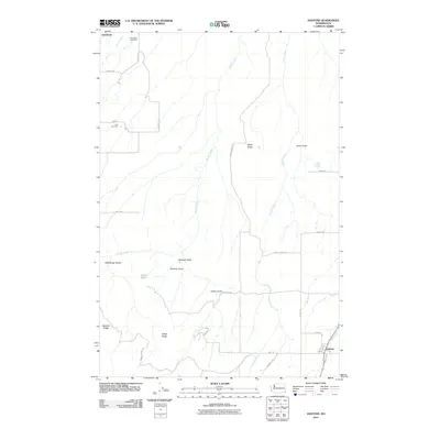
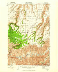 1944 Anatone1959 Print · USGSAsotin County high country in the mid-1940s reveals a landscape of deep canyons and high ranching plateaus above the Grande Ronde River. Researchers can trace old upland sites like the Ausman Ranch, the rural Lake Sch, and the fire lookout at Big Butte.
 - 1946 Map of Anatone
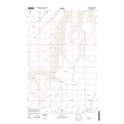
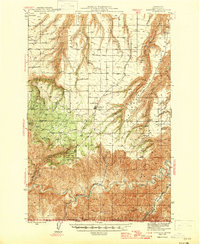 1946 Anatone1946 Print · USGSAsotin County ranching and timberlands are captured here in the mid-1940s, from the high Anatone plateau down to the deep river canyons. Genealogists and historians can locate the Ausman Ranch, Lake Sch, and the Big Butte Lookout.
 - 1955 Map of Pullman, 1963 Print
 1955 Pullman1963 Print · USGSThe Palouse and Clearwater regions are captured here in the mid-1950s, showing the height of the rail-and-river economy. Genealogists and historians can trace rail lines like the Camas Prairie RR, find local landmarks like Whitman County Memorial Cem, and locate early academic centers at Washington State University and the University of Idaho.3 unique versions available
 - 1958 Map of Pullman
 1958 Pullman1958 Print · USGSThe Palouse and Clearwater regions are captured here in the late fifties, showing the vital river-and-rail connection between eastern Washington and northern Idaho. Local historians can trace the paths of the Camas Prairie RR and Union Pacific RR as they serve towns like Colfax, Kamiah, and Nezperce.2 unique versions available
 - 1971 Map of Anatone, 1973 Print
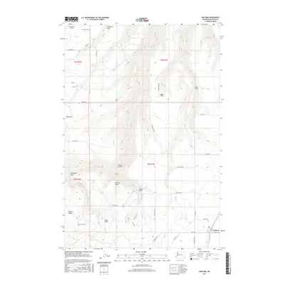
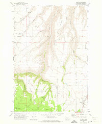 1971 Anatone1973 Print · USGSAsotin County high country in the early seventies shows a landscape of deep gulches and upland ranching centers. Trace family history at Lake School, Cloverland Cem, and the small settlement of Anatone, where the plateau meets the national forest.2 unique versions available
 - 1981 Map of Clarkston
 1981 Clarkston1981 Print · USGSNorthwestern river life and mountain terrain meet in the early eighties as the Snake River carves through the landscape. Researchers can trace rail history along the Camas Prairie Railroad and locate smaller settlements like Peola and Anatone.2 unique versions available
 - 1995 Map of Anatone, 1998 Print
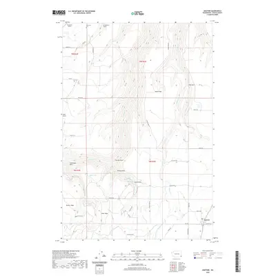
 1995 Anatone1998 Print · USGSAsotin County settlement and geography are frozen in time here during the mid-nineties. Genealogists and researchers can trace local family landmarks and rural infrastructure, from the Lake School and Cloverland Cemetery to the remote corners of Huber Ridge.
 - 2011 Map of Anatone, 2011 Print
 2011 Anatone2011 Print · USGSCovers Anatone, including Asotin County, United States, and other nearby areas
 - 2014 Map of Anatone, 2014 Print
 2014 Anatone2014 Print · USGSCovers Anatone, including Asotin County, United States, and other nearby areas
 - 2017 Map of Anatone, 2017 Print
 2017 Anatone2017 Print · USGSCovers Anatone, including Asotin County, United States, and other nearby areas
 - 2020 Map of Anatone, 2020 Print
 2020 Anatone2020 Print · USGSCovers Anatone, including Asotin County, United States, and other nearby areas
 - 2023 Map of Anatone, 2023 Print
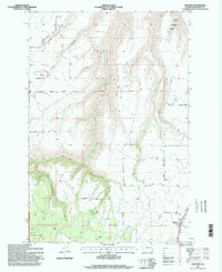
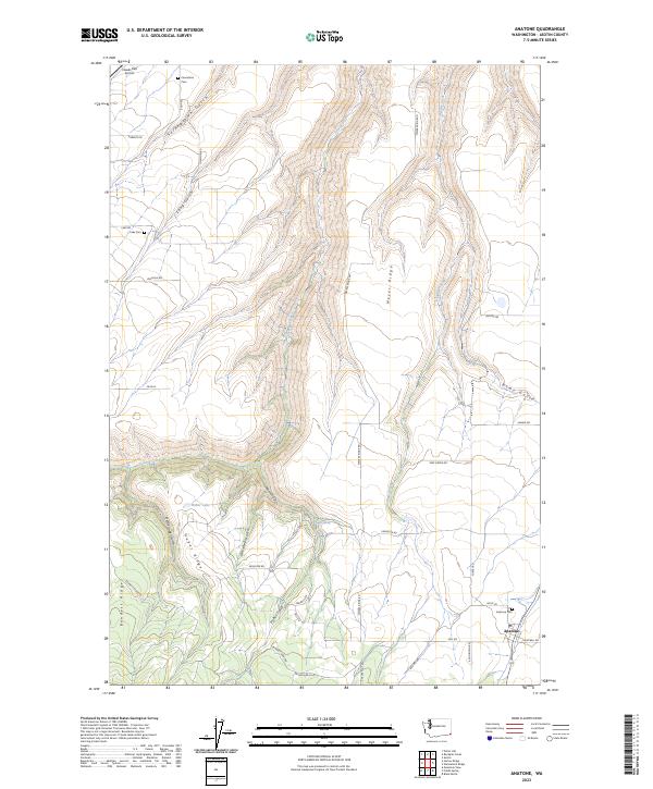 2023 Anatone2023 Print · USGSThe high ridges and deep gulches of Asotin County are recorded here in modern detail. Researchers can locate family roots at Anatone Cemetery or trace the geography of the uplands through Meyer Ridge and the waters of Huber Lake.
End of results
Showing maps 1-12 of 12
Top cities near Anatone
Frequently asked questions
- What are the different types of historical maps available for Anatone?
- What is the oldest map of Anatone?
- Where can I purchase historical maps of Anatone for my home or office?
- Where can I download high-res historical maps of Anatone?
- Are there historical topographic maps available for Anatone?
- Is there historical aerial imagery available for Anatone?
- Where are historical maps of Anatone sourced from?