Old Maps of Highland, Washington for Academic Research
Study the evolution of Highland with 11 high-resolution historic maps. Whether you're teaching, researching, or modeling changes in land use, these maps provide essential visual documentation of urban, environmental, and geographic change.
- Analyze long-term change: Track patterns in development, transportation, and natural features.
- Ideal for environmental or urban studies: Support academic projects with primary historical map data.
- Use in the classroom or lab: Educators and researchers rely on these maps to bring historical context to life.
These maps are a powerful tool for teaching, research, and visualizing how Highland has changed over the decades.
Highland, WA maps
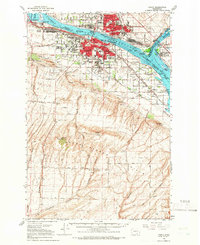
(11)- 1917 Map of Pasco
 1917 Pasco1917 Print · USGSThe confluence of the Columbia and Snake rivers in the early twentieth century shows a region being reshaped by irrigation and rail. Genealogists can trace family holdings and rural schoolhouses like Baxter School, the Farnsworth Ranch, and the Zimmerman Ferry.4 unique versions available
 - 1953 Map of Walla Walla, 1964 Print
 1953 Walla Walla1964 Print · USGSSoutheast Washington enters the atomic and hydroelectric age in the mid-twentieth century as new dams reshape the desert landscape. You can trace the development of the Hanford Works, identify remote rail stops like Novara Siding, and locate the historic Dry Creek Cem.3 unique versions available
 - 1958 Map of Walla Walla
 1958 Walla Walla1958 Print · USGSThe Tri-Cities and Walla Walla region are captured here during the mid-century expansion of atomic energy and river infrastructure. Genealogists and historians can trace the early layout of Richland (AEC), the rural Hatton and Washtucna settlements, and landmarks like Palouse Falls State Park.
 - 1964 Map of Pasco, 1966 Print
 1964 Pasco1966 Print · USGSThe Tri-Cities region underwent significant postwar transformation as irrigation and infrastructure reshaped the Columbia Basin in the 1960s. Researchers can trace the development of Pasco and Kennewick, locating sites like Vista Field and Desert Lawn Memorial Park.
 - 1964 Map of Pasco, 1967 Print
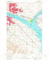 1964 Pasco1967 Print · USGSThe Tri-Cities region underwent significant transformation in the mid-sixties as the newly formed Lake Wallula reshaped the riverfronts. Genealogists and historians can trace the development of PASCO and KENNEWICK, locating long-standing landmarks like City View Cem and the Port of Pasco.2 unique versions available
 - 1992 Map of Pasco
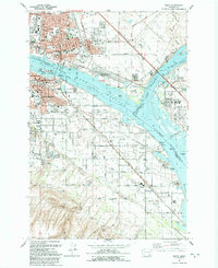 1992 Pasco1992 Print · USGSThe Tri-Cities area thrived during the early nineties as a vital rail and river hub at the meeting of the Columbia and Snake rivers. Genealogists and historians can trace local landmarks like City View Cem, St Patrick Sch, and the Port of Pasco.
 - 2011 Map of Pasco, 2011 Print
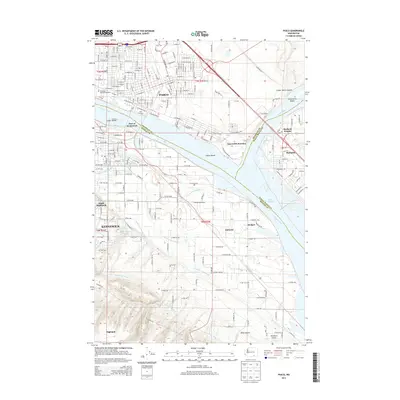
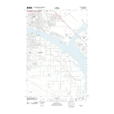 2011 Pasco2011 Print · USGSCovers Highland, including Kennewick, Pasco, and other nearby areas
 - 2014 Map of Pasco, 2014 Print
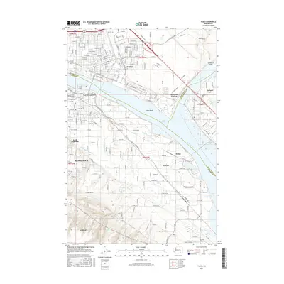
 2014 Pasco2014 Print · USGSCovers Highland, including Kennewick, Pasco, and other nearby areas
 - 2017 Map of Pasco, 2017 Print
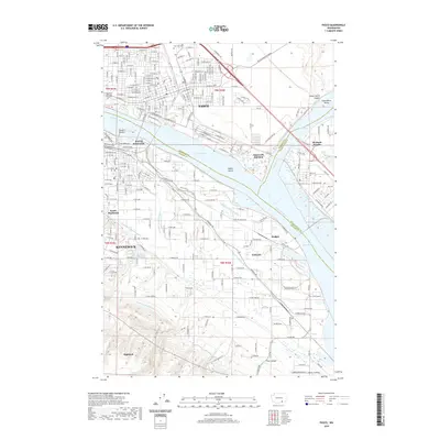
 2017 Pasco2017 Print · USGSCovers Highland, including Kennewick, Pasco, and other nearby areas
 - 2020 Map of Pasco, 2020 Print
 2020 Pasco2020 Print · USGSCovers Highland, including Kennewick, Pasco, and other nearby areas
 - 2023 Map of Pasco, 2023 Print
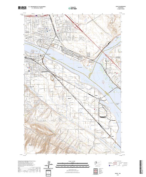 2023 Pasco2023 Print · USGSThe Tri-Cities region comes into focus during its modern era of river-bound commerce and irrigation. Researchers can trace the layout of PASCO and KENNEWICK, locating key sites like the Franklin County Courthouse and the rail corridors at Ainsworth Junction.
End of results
Showing maps 1-11 of 11
Top cities near Highland
- Kennewick historical maps
- Pasco historical maps
- Richland historical maps
- Finley historical maps
- Umatilla historical maps
- Burbank historical maps
Frequently asked questions
- What are the different types of historical maps available for Highland?
- What is the oldest map of Highland?
- Where can I purchase historical maps of Highland for my home or office?
- Where can I download high-res historical maps of Highland?
- Are there historical topographic maps available for Highland?
- Is there historical aerial imagery available for Highland?
- Where are historical maps of Highland sourced from?