Old Maps of Ruby, Benton County for Academic Research
Study the evolution of Ruby with 11 high-resolution historic maps. Whether you're teaching, researching, or modeling changes in land use, these maps provide essential visual documentation of urban, environmental, and geographic change.
- Analyze long-term change: Track patterns in development, transportation, and natural features.
- Ideal for environmental or urban studies: Support academic projects with primary historical map data.
- Use in the classroom or lab: Educators and researchers rely on these maps to bring historical context to life.
These maps are a powerful tool for teaching, research, and visualizing how Ruby has changed over the decades.
Ruby, Benton County maps
(11)- 1917 Map of Pasco
 1917 Pasco1917 Print · USGSThe confluence of the Columbia and Snake rivers in the early twentieth century shows a region being reshaped by irrigation and rail. Genealogists can trace family holdings and rural schoolhouses like Baxter School, the Farnsworth Ranch, and the Zimmerman Ferry.4 unique versions available
 - 1951 Map of Richland, 1955 Print
 1951 Richland1955 Print · USGSBenton County undergoes a massive industrial shift during the early Cold War era as the atomic age reshapes the desert landscape. You can trace the early footprint of the Hanford Works, the growth of RICHLAND, and the vital irrigation systems like the Columbia Canal.3 unique versions available
 - 1953 Map of Walla Walla, 1964 Print
 1953 Walla Walla1964 Print · USGSSoutheast Washington enters the atomic and hydroelectric age in the mid-twentieth century as new dams reshape the desert landscape. You can trace the development of the Hanford Works, identify remote rail stops like Novara Siding, and locate the historic Dry Creek Cem.3 unique versions available
 - 1958 Map of Walla Walla
 1958 Walla Walla1958 Print · USGSThe Tri-Cities and Walla Walla region are captured here during the mid-century expansion of atomic energy and river infrastructure. Genealogists and historians can trace the early layout of Richland (AEC), the rural Hatton and Washtucna settlements, and landmarks like Palouse Falls State Park.
 - 1978 Map of Richland
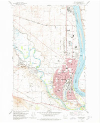 1978 Richland1978 Print · USGSRichland and West Richland are shown in the late seventies as the region functioned as a critical hub for energy and atomic research. Researchers can trace the industrial layout of the Hanford Works or locate local landmarks like the Westie Drive-in Theatre and Resthaven Cem.
 - 1992 Map of Richland
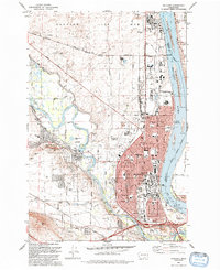 1992 Richland1992 Print · USGSRichland and the edge of the Hanford Site are captured here during the early nineties, showing a city deeply integrated with the Columbia and Yakima rivers. Genealogists and local historians can locate Sunset Mem Gardens and Washington State University, or trace the Richland Terminal RR.
 - 2011 Map of Richland, 2011 Print
 2011 Richland2011 Print · USGSCovers Ruby, including Pasco, Richland, and other nearby areas
 - 2014 Map of Richland, 2014 Print
 2014 Richland2014 Print · USGSCovers Ruby, including Pasco, Richland, and other nearby areas
 - 2017 Map of Richland, 2017 Print
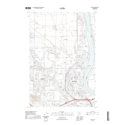
 2017 Richland2017 Print · USGSCovers Ruby, including Pasco, Richland, and other nearby areas
 - 2020 Map of Richland, 2020 Print
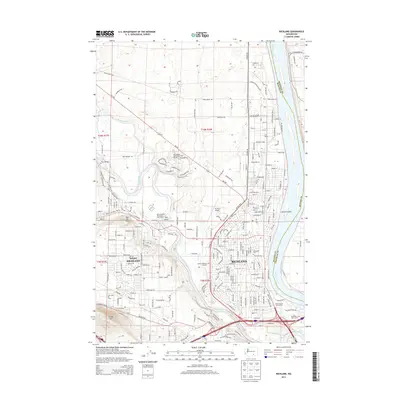
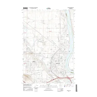
 2020 Richland2020 Print · USGSCovers Ruby, including Pasco, Richland, and other nearby areas
 - 2023 Map of Richland, 2023 Print
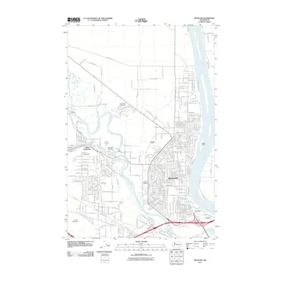
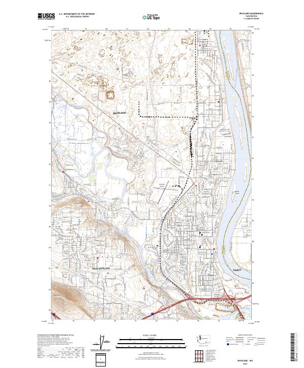 2023 Richland2023 Print · USGSRichland and the surrounding river basin are shown at the height of their modern development, centered on the historic confluence of two major waterways. Researchers can trace the layout of Resthaven Cem, the Washington State University Tri - Cities campus, and the extensive Columbia Canal network.
End of results
Showing maps 1-11 of 11
Frequently asked questions
- What are the different types of historical maps available for Ruby?
- What is the oldest map of Ruby?
- Where can I purchase historical maps of Ruby for my home or office?
- Where can I download high-res historical maps of Ruby?
- Are there historical topographic maps available for Ruby?
- Is there historical aerial imagery available for Ruby?
- Where are historical maps of Ruby sourced from?