1980s Maps of La Push, Washington
Explore 2 historic maps of La Push from the 1980s. These maps offer a rare glimpse into what life looked like during the 1980s — showing old roads, neighborhoods, homes, and landmarks that have changed or disappeared over time.
Whether you're researching your family's past, planning a metal detecting trip, or studying how La Push's landscape evolved across the 1980s, these high-resolution maps are a powerful tool for exploring the history of this region.
- Focus on a specific era: All maps on this page are from the 1980s, giving you a focused view of this time period.
- See what’s changed: Compare century-old streets, trails, and buildings to today's modern landscape using overlays and satellite layers.
- Research with precision: Use these maps for genealogy, historical research, land use analysis, or educational projects.
- View, download, or print: Maps are fully viewable online in high resolution, and can be downloaded or printed for your own records.
Start exploring La Push's history through authentic maps from the 1980s. This is your window into the past.
La Push, WA maps
(2)- 1982 Map of La Push
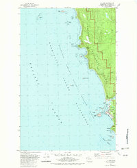 1982 La Push1982 Print · USGSCoastal Clallam County in the early eighties shows the intersection of tribal lands and federal wilderness at the mouth of the Quillayute River. Local historians can trace the development of La Push including its US Coast Guard Station and the Chilean Memorial Monument.2 unique versions available
 - 1988 Map of Forks
 1988 Forks1988 Print · USGSThe Olympic Peninsula's western coastline and timber heartland are documented here in the late eighties, from the high ridges to the Pacific shelf. Local researchers can trace the coastal settlements of La Push and Mora or locate remote sites like Destruction Island.
End of results
Showing maps 1-2 of 2
Top cities near La Push
Frequently asked questions
- What are the different types of historical maps available for La Push?
- What is the oldest map of La Push?
- Where can I purchase historical maps of La Push for my home or office?
- Where can I download high-res historical maps of La Push?
- Are there historical topographic maps available for La Push?
- Is there historical aerial imagery available for La Push?
- Where are historical maps of La Push sourced from?