Old Maps of Greater Brush Prairie, Clark County for Academic Research
Study the evolution of Greater Brush Prairie with 49 high-resolution historic maps. Whether you're teaching, researching, or modeling changes in land use, these maps provide essential visual documentation of urban, environmental, and geographic change.
- Analyze long-term change: Track patterns in development, transportation, and natural features.
- Ideal for environmental or urban studies: Support academic projects with primary historical map data.
- Use in the classroom or lab: Educators and researchers rely on these maps to bring historical context to life.
These maps are a powerful tool for teaching, research, and visualizing how Greater Brush Prairie has changed over the decades.
Greater Brush Prairie, Clark County maps
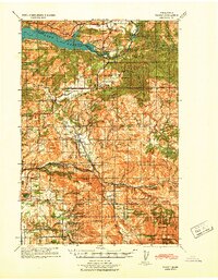
(49)- 1897 Map of Portland
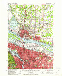
 1897 Portland1897 Print · USGSThe Portland and Vancouver riverfronts appear here at a pivotal moment in the 1890s. Trace the early city street grids and rail terminals alongside landmark sites like Vancouver Barracks, Portland University, and Swan Island.2 unique versions available
 - 1905 Map of Portland
 1905 Portland1905 Print · USGSGreater Portland and Vancouver are seen here during the era of the Lewis and Clark Exposition, when river traffic and early electric rail lines defined the region. Researchers can locate the Lewis and Clark Centennial Exposition, the historic Vancouver Barracks, and Munday's Ferry.8 unique versions available
 - 1918 Map of Troutdale
 1918 Troutdale1918 Print · USGSEast of Portland in the late nineteen-teens, the riverfront and rail lines were transforming the landscape of Multnomah County. Genealogists and historians can trace family roots at the Multnomah County Farm, Sundial Ranch, and small rural schools like Cedar School.2 unique versions available
 - 1934 Map of Troutdale
 1934 Troutdale1934 Print · USGSThe Columbia River shoreline and the wooded hills of Clark County come alive in this mid-1930s survey of the riverfront. Researchers can trace early rural life through Washougal and local landmarks like Fern Prairie Grange, Lackamas Lake, and the Silver Star Mine.
 - 1940 Map of Portland
 1940 Portland1940 Print · USGSThe Portland and Vancouver riverfronts are captured here just before the massive industrial shifts of the mid-century. Genealogists and historians can locate early landmarks like Vancouver Barracks, the University of Portland, and Mundays Ferry.4 unique versions available
 - 1940 Map of La Center
 1940 La Center1940 Print · USGSClark County, Washington, is shown just before the war as a landscape of river-valley farms and timber outposts. Researchers can trace family roots through named intersections like Dollar Corner and Scotton Corner or locate vanished sites like the Ariel School.
 - 1941 Map of Yacolt
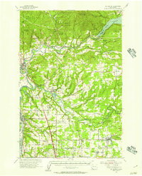
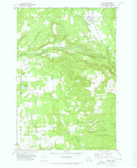
 1941 Yacolt1941 Print · USGSIn the early 1940s, Clark County's timber and river country centered on the rail-connected town of Yacolt. Researchers can trace old homesteads and landmarks like Golden Wonder Mine, Riverview School, and the remote Sunset Guard Sta.
 - 1941 Map of Camas
 1941 Camas1941 Print · USGSThe Columbia River corridor is captured here just before the mid-century, showing the bustling industrial towns of Camas and Washougal alongside a rural network of country schools. Genealogists and historians can trace family roots through landmarks like the Silver Star Mine, Cemetery Hill, and dozens of local schoolhouses such as Harmony Sch.
 - 1942 Map of Camas
 1942 Camas1942 Print · USGSThe Columbia River corridor is captured here in the early 1940s, showing the industrial heart of Camas and the rural outskirts of Gresham. Genealogists and historians can trace early schools like Twelvemile Corner Sch and the location of the Silver Star Mine.2 unique versions available
 - 1948 Map of Vancouver, 1957 Print
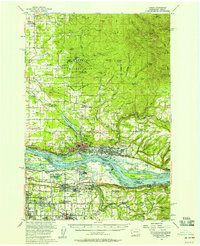
 1948 Vancouver1957 Print · USGSPost-war growth transforms the river valleys of the Pacific Northwest as the timber and rail economy thrives. Trace family roots in Tillamook or Oregon City, and locate vanished landmarks like the spit at Bayocean or the Skamania Mine.
 - 1950 Map of Vancouver
 1950 Vancouver1950 Print · USGSCoastal Oregon and the lower Columbia River valley are captured in detail just after the war. Researchers can trace historic rail routes like the Southern Pacific or locate early settlements such as Vernonia, Gaston, and the Grand Ronde Indian Reservation.
 - 1950 Map of Vancouver, 1951 Print
 1950 Vancouver1951 Print · USGSThe Pacific Northwest urban corridor meets the rugged coast in the years following the war, showing the expansion of Portland and Vancouver. Genealogists and historians can trace the reach of the Southern Pacific RR and locate coastal communities like Tillamook, Seaside, and Tolovana Park.
 - 1954 Map of Battle Ground, 1955 Print
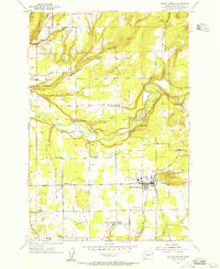 1954 Battle Ground1955 Print · USGSBattle Ground and the surrounding Clark County countryside are captured here in the mid-fifties as the rural landscape centered on river and rail. Trace the vanished Bee Tree Sch (Aband), the early buildings of Columbia Academy, and the small-town layout of Meadow Glade and Dollar Corner.3 unique versions available
 - 1954 Map of Orchards, 1956 Print
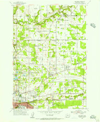 1954 Orchards1956 Print · USGSGreater Vancouver and the Fourth Plain are captured here in the mid-fifties, during a period of steady suburban expansion into the surrounding orchards. Genealogists can locate family names at Wilson Cemetery and Bethel Cem or trace rural school sites like Glenwood School.
 - 1954 Map of Lacamas Creek, 1956 Print
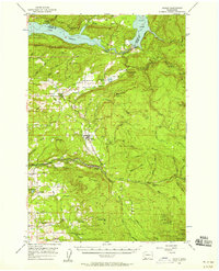
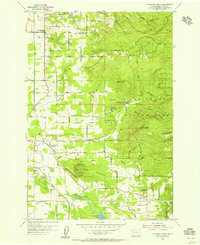 1954 Lacamas Creek1956 Print · USGSMid-century Clark County comes into focus as a landscape of rural crossroads and military outposts before the arrival of modern suburban expansion. Genealogists and historians can trace family-named sites like Brunner Hill or locate the historic China Ditch and Camp Bonneville.4 unique versions available
 - 1954 Map of La Center, 1957 Print
 1954 La Center1957 Print · USGSThe Clark and Cowlitz county borderlands in the mid-1950s show a mix of river-valley agriculture and rugged uplands. Researchers can trace rural school consolidation at Enterprise Sch or locate ancestors at Highland Cem and Dublin Cem.2 unique versions available
 - 1954 Map of Camas, 1958 Print
 1954 Camas1958 Print · USGSThe Columbia River corridor in the mid-fifties shows the industrial growth of Camas and Washougal alongside the evolving suburbs of Gresham and Troutdale. Researchers can trace old school districts like Norway Sch and follow the S P & S RY through the river valley.3 unique versions available
 - 1956 Map of Yacolt, 1958 Print
 1956 Yacolt1958 Print · USGSIn the mid-1950s, the Clark County foothills were a landscape of logging camps and river power before the height of modernization. Researchers can trace the Northern Pacific Railroad route or locate family sites at Gravel Point Cem and the settlement of Venersborg.2 unique versions available
 - 1958 Map of Vancouver, 1968 Print
 1958 Vancouver1968 Print · USGSThe Lower Columbia and Willamette valleys thrive in the late sixties as major rail and river hubs. Genealogists and historians can trace the development of Portland, identify the grounds of Camp Withycombe, and locate coastal landmarks from Tillamook Head to Garibaldi.3 unique versions available
 - 1961 Map of Orchards
 1961 Orchards1961 Print · USGSThe northern reaches of Vancouver and its surrounding plains are seen here in the early sixties, as suburban growth met rural industry. Genealogists and researchers can find many burials at Bethel Cem and Sifton Cem, or trace local landmarks like Scholls Airport.4 unique versions available
 - 1961 Map of Portland, 1963 Print
 1961 Portland1963 Print · USGSThe Columbia River waterfront and the growing suburbs of the early sixties come to life in this detailed survey of the Oregon-Washington border. Researchers can trace the legacy of Vanport City, find the St. Johns Cemetery, or locate the Fort Vancouver National Monument.3 unique versions available
 - 1964 Map of Vancouver
 1964 Vancouver1964 Print · USGSThe Pacific Northwest interior and coast are shown here in the 1960s, from the Portland metropolitan hub to the rugged Pacific shoreline. Researchers can trace the legacy of the Grand Ronde Indian Reservation, the early layout of McMinnville, and the maritime approaches near Tillamook Head.
 - 1971 Map of Yacolt, 1973 Print
 1971 Yacolt1973 Print · USGSClark County settlement and industry are captured here in the early seventies as timber and rail lines defined the landscape. Researchers can find ancestral sites at Gravel Point Cem and trace the winding Portland and Northern RR through Yacolt.2 unique versions available
 - 1975 Map of Orchards, 1977 Print
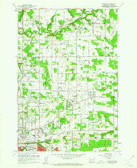
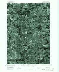 1975 Orchards1977 Print · USGSClark County was rapidly evolving in the mid-seventies as suburban infrastructure began to overlay the older agricultural grid. Trace the growth of Orchards and Sifton or follow the riparian corridor of Salmon Creek through these historic aerial views.
 - 1979 Map of Vancouver, 1980 Print
 1979 Vancouver1980 Print · USGSThe Portland and Vancouver metropolitan area is captured here in the late seventies, showing the dense nexus of river, rail, and air transit. Genealogists and local historians can trace the footprints of Vancouver Barracks, Lincoln Memorial Park Cem, and the old rail lines of the Burlington Northern.2 unique versions available
Showing maps 1-25 of 49
Frequently asked questions
- What are the different types of historical maps available for Greater Brush Prairie?
- What is the oldest map of Greater Brush Prairie?
- Where can I purchase historical maps of Greater Brush Prairie for my home or office?
- Where can I download high-res historical maps of Greater Brush Prairie?
- Are there historical topographic maps available for Greater Brush Prairie?
- Is there historical aerial imagery available for Greater Brush Prairie?
- Where are historical maps of Greater Brush Prairie sourced from?