1900s (20th Century) Maps of Dulwich, Washington
Explore 9 historic maps of Dulwich from the 1900s (20th Century). These maps offer a rare glimpse into what life looked like during the 1900s — showing old roads, neighborhoods, homes, and landmarks that have changed or disappeared over time.
Whether you're researching your family's past, planning a metal detecting trip, or studying how Dulwich's landscape evolved across the 1900s, these high-resolution maps are a powerful tool for exploring the history of this region.
- Focus on a specific era: All maps on this page are from the 1900s, giving you a focused view of this time period.
- See what’s changed: Compare century-old streets, trails, and buildings to today's modern landscape using overlays and satellite layers.
- Research with precision: Use these maps for genealogy, historical research, land use analysis, or educational projects.
- View, download, or print: Maps are fully viewable online in high resolution, and can be downloaded or printed for your own records.
Start exploring Dulwich's history through authentic maps from the 1900s. This is your window into the past.
Dulwich, WA maps
(9)- 1936 Map of Marcus
 1936 Marcus1936 Print · USGSUpper Stevens County was a hub of mining and rail transport in the mid-1930s, where the Kettle River meets the Columbia River. Genealogists can trace family roots through numerous rural landmarks like Napoleon Sch and the Old Catholic Mission.
 - 1942 Map of Marcus
 1942 Marcus1942 Print · USGSUpper Stevens County in the late thirties shows a rugged landscape of rail-connected river towns and mountain mines. Trace family roots at the Old Catholic Mission or locate early industrial sites like the Kettle River Mine and Meyers Falls.3 unique versions available
 - 1948 Map of Orient, 1960 Print
 1948 Orient1960 Print · USGSIn the late 1940s, the remote valley of the Kettle River was a lifeline for border communities along the Great Northern rail line. Genealogists and historians can trace the foundations of local life through labels for the Barstow Sch, the Orient Ranger Station, and the Kettle River Mine.
 - 1951 Map of Orient
 1951 Orient1951 Print · USGSThe Kettle River valley at the onset of the fifties serves as a vital corridor for the Great Northern railroad. Genealogists and historians can trace riverside settlements from Laurier to Barstow, alongside the Talisman Mine and Barstow Sch.2 unique versions available
 - 1954 Map of Okanogan, 1964 Print
 1954 Okanogan1964 Print · USGSNorth Central Washington’s interior comes into focus during the mid-fifties, showing the rise of the Columbia River reservoir system. Genealogists and historians can trace the Great Northern rail line and locate historical mining operations at the Mountain Lion Mine or Gold Hill Mine.2 unique versions available
 - 1958 Map of Okanogan
 1958 Okanogan1958 Print · USGSThe Okanogan River valley and the Colville Indian Reservation are shown here in the late fifties, during a period of established river and rail commerce. Researchers can trace the Great Northern line through Oroville or locate landmarks like the Knowlton School and Orient Ranger Station.
 - 1969 Map of Orient, 1971 Print
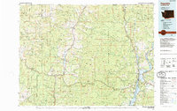
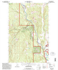
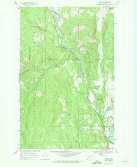 1969 Orient1971 Print · USGSThe Kettle River valley in the late 1960s remains a rugged corridor of mining and rail transit along the Stevens and Ferry County line. Genealogists and historians can trace the riverside communities of Orient and Barstow or locate the Hidden Treasure Mine and Kelly Hill Cemetery.2 unique versions available
 - 1984 Map of Republic
 1984 Republic1984 Print · USGSThe Okanogan Highlands and Kettle River Range are shown in the mid-1980s, documenting a landscape shaped by mining and timber. Genealogists can trace old settlements like Bodie and Toroda, or locate historic workings such as the Knob Hill Mine and First Thought Mine.
 - 1992 Map of Orient, 1996 Print
 1992 Orient1996 Print · USGSNortheastern Washington’s river-and-rail corridor is captured here in the 1990s as the Kettle River snakes through the canyonlands. Genealogists and historians can locate the Kelly Hill Cemetery and trace the mining sites of Globe Mine and Hidden Treasure Mine.
End of results
Showing maps 1-9 of 9
Top cities near Dulwich
Frequently asked questions
- What are the different types of historical maps available for Dulwich?
- What is the oldest map of Dulwich?
- Where can I purchase historical maps of Dulwich for my home or office?
- Where can I download high-res historical maps of Dulwich?
- Are there historical topographic maps available for Dulwich?
- Is there historical aerial imagery available for Dulwich?
- Where are historical maps of Dulwich sourced from?