Old Maps of Levey, Washington
Explore 12 old maps of Levey, spanning from 1915 to today. These high-resolution historic maps reveal how streets, neighborhoods, landmarks, and natural features evolved over time — perfect for genealogy, metal detecting, research, and local history exploration.
What you can do with these maps:
- See how Levey changed over time: Compare historical maps to modern-day views to trace roads, homesites, rail lines & more.
- View detailed metadata: Each map includes creators, publishers, year, scale, and archive source.
- Overlay maps with satellite & LiDAR: Visualize the past alongside modern tools to explore terrain & human change.
- Trusted historical sources: Maps sourced from the USGS, Library of Congress, and other archives.
- Access maps your way: View online, download high-res files, or order prints for personal or research use.
Start exploring old maps of Levey to uncover forgotten places, hidden landmarks, and the deep history beneath your feet.
Levey, WA maps
(12)- 1915 Map of Wallulah
 1915 Wallulah1915 Print · USGSThe convergence of the Snake and Columbia rivers in the mid-1910s reveals a landscape defined by steam power and irrigation. Genealogists and rail historians can trace early settlements like Attalia and Two Rivers alongside the path of the Oregon-Washington RR & Nav Co.
 - 1918 Map of Wallula, 1942 Print
 1918 Wallula1942 Print · USGSThe river-and-rail hubs of the Walla Walla Valley are captured here as they appeared between the world wars. Researchers can trace the path of the Wallula Ferry, locate early country schools like Frog Hallow School, and follow the complex rail lines through Eureka.2 unique versions available
 - 1953 Map of Walla Walla, 1964 Print
 1953 Walla Walla1964 Print · USGSSoutheast Washington enters the atomic and hydroelectric age in the mid-twentieth century as new dams reshape the desert landscape. You can trace the development of the Hanford Works, identify remote rail stops like Novara Siding, and locate the historic Dry Creek Cem.3 unique versions available
 - 1958 Map of Walla Walla
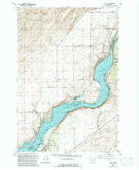
 1958 Walla Walla1958 Print · USGSThe Tri-Cities and Walla Walla region are captured here during the mid-century expansion of atomic energy and river infrastructure. Genealogists and historians can trace the early layout of Richland (AEC), the rural Hatton and Washtucna settlements, and landmarks like Palouse Falls State Park.
 - 1964 Map of Levey SE, 1965 Print
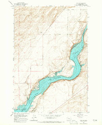 1964 Levey SE1965 Print · USGSThe Snake River corridor in the mid-sixties reveals a landscape reshaped by the waters of Lake Sacajawea. Genealogists and historians can trace rail-side settlements like Levey, Redd, and Ash alongside landmarks such as Fishhook Park and Levey Landing.
 - 1980 Map of Walla Walla
 1980 Walla Walla1980 Print · USGSThe Walla Walla Valley in the early eighties shows a landscape of deep-rooted agriculture and massive hydroelectric development. Researchers can trace the rail junctions at Wallula Junction, visit the historic Fort Walla Walla, or locate old landmarks like the Mountain View Cem.2 unique versions available
 - 1991 Map of Levey, 1992 Print
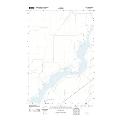
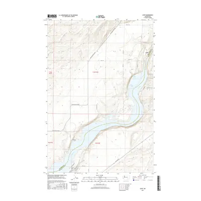
 1991 Levey1992 Print · USGSThe Snake River corridor in the early nineties shows a landscape reshaped by the waters of Lake Sacajawea. Researchers can trace riverside developments at Levey and Ash, or locate recreational landmarks like Fishhook Park and the rugged Juniper Dunes Wilderness.
 - 2011 Map of Levey, 2011 Print
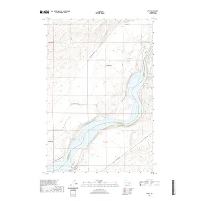
 2011 Levey2011 Print · USGSCovers Levey, including Redd, Ash, and other nearby areas
 - 2013 Map of Levey, 2013 Print
 2013 Levey2013 Print · USGSCovers Levey, including Redd, Ash, and other nearby areas
 - 2017 Map of Levey, 2017 Print
 2017 Levey2017 Print · USGSCovers Levey, including Redd, Ash, and other nearby areas
 - 2020 Map of Levey, 2020 Print
 2020 Levey2020 Print · USGSCovers Levey, including Redd, Ash, and other nearby areas
 - 2023 Map of Levey, 2023 Print
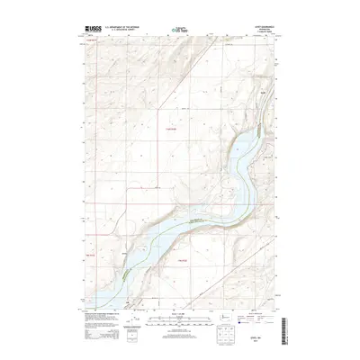
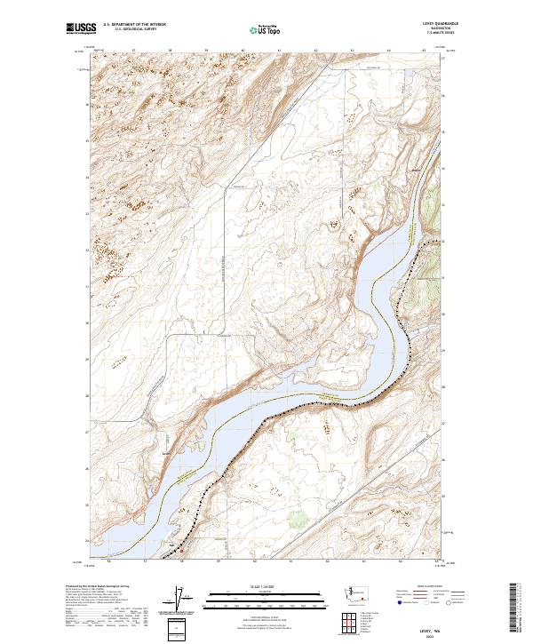 2023 Levey2023 Print · USGSThe Snake River corridor comes to life in this contemporary study of the Franklin County shoreline. Genealogists and local historians can trace the riverside clusters of Levey, Ash, and Redd along the Columbia Plateau State Park Trl.
End of results
Showing maps 1-12 of 12
Top cities near Levey
Frequently asked questions
- What are the different types of historical maps available for Levey?
- What is the oldest map of Levey?
- Where can I purchase historical maps of Levey for my home or office?
- Where can I download high-res historical maps of Levey?
- Are there historical topographic maps available for Levey?
- Is there historical aerial imagery available for Levey?
- Where are historical maps of Levey sourced from?