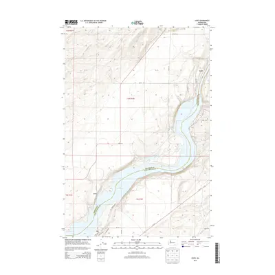
2013 Map of Levey
USGS Topo · Published 2013About this map
Lake Sacajawea and the winding course of the Snake River define this portion of the border between Franklin and Walla Walla counties. The small riverside community of Levey is central to the riverbank landscape, supported by localized infrastructure like Campground Rd and Harbor Blvd. To the south, Ash sits near the water’s edge, while the northern uplands around Redd are marked by a geometric grid of farm roads such as McClenny Rd and Murphy Rd. Several smaller water bodies, including Emma Lake and Dalton Lake, are situated along the river's bend, illustrating the complex hydrology of the valley. Local transit is anchored by Wa-124, which connects these river-adjacent settlements to the broader region.
Find a feature on this map
27 named features on this map. Tap any name to fly to it.
Don’t see what you’re looking for? This feature index may not catch every label — zoom into the map to look around manually.
Map Details
Editions of this 2013 Levey Map
This is the sole edition of this map. No revisions or reprints were ever made.
Other maps of this area

1915 · Wallulah
USGS Topo · 1:96,000

1918 · Wallula
USGS Topo · 1:125,000

1953 · Walla Walla
USGS Topo · 1:250,000

1958 · Walla Walla
USGS Topo · 1:250,000

1963 · Rye Grass Coulee
USGS Topo · 1:24,000

1964 · Levey SW
USGS Topo · 1:24,000

1964 · Levey SE
USGS Topo · 1:24,000

1964 · Slater
USGS Topo · 1:24,000

1964 · Levey NE
USGS Topo · 1:24,000

1964 · Humorist
USGS Topo · 1:24,000