
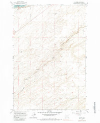
1964 Map of Slater
USGS Topo · Published 1965About this map
Lake Sacajawea and the Snake River define the northwestern corner of this mid-1960s landscape, where the water's edge meets a complex network of transportation infrastructure. The territory is marked by the heavy influence of the railroad industry, featuring the Union Pacific and Northern Pacific lines as they navigate the shifting elevations near Eureka Flat. Evidence of older transit routes is preserved in the Old RR Grade and various Jeep Trails that crisscross the terrain.
Find a feature on this map
15 named features on this map. Tap any name to fly to it.
Don’t see what you’re looking for? This feature index may not catch every label — zoom into the map to look around manually.
Map Details
Editions of this 1964 Slater Map
2 editions found
Other maps of this area

1915 · Wallulah
USGS Topo · 1:96,000

1918 · Wallula
USGS Topo · 1:125,000

1953 · Walla Walla
USGS Topo · 1:250,000

1958 · Walla Walla
USGS Topo · 1:250,000

1964 · Wallula
USGS Topo · 1:24,000

1964 · Zangar Junction
USGS Topo · 1:24,000

1964 · Levey SW
USGS Topo · 1:24,000

1964 · Levey SE
USGS Topo · 1:24,000

1964 · Humorist
USGS Topo · 1:24,000

1966 · Page
USGS Topo · 1:24,000