
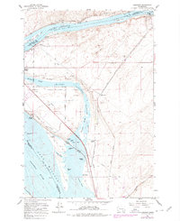
1964 Map of Humorist
USGS Topo · Published 1965About this map
Lake Wallula dominates the landscape at the meeting of the Snake River and the Columbia River, reflecting a mid-century period of massive hydroelectric and navigational transformation. The reservoir created by the McNary Dam stretches across the quadrangle, drowning former riverbanks and creating the intricate network of the Mc Nary National Wildlife Refuge. Within this riparian environment, numerous islands and ponds like Peavine Island, Tanglefoot Island, and Curlew Pond emerge from the backwaters, while Ice Harbor Dam regulates the eastern flow of the Snake into Lake Sacajawea.
Find a feature on this map
39 named features on this map. Tap any name to fly to it.
Don’t see what you’re looking for? This feature index may not catch every label — zoom into the map to look around manually.
Map Details
Editions of this 1964 Humorist Map
2 editions found
Other maps of this area

1915 · Wallulah
USGS Topo · 1:96,000

1917 · Pasco
USGS Topo · 1:125,000

1918 · Wallula
USGS Topo · 1:125,000

1953 · Walla Walla
USGS Topo · 1:250,000

1958 · Walla Walla
USGS Topo · 1:250,000

1964 · Wallula
USGS Topo · 1:24,000

1964 · Zangar Junction
USGS Topo · 1:24,000

1964 · Levey SW
USGS Topo · 1:24,000

1964 · Levey SE
USGS Topo · 1:24,000

1964 · Slater
USGS Topo · 1:24,000