1900s (20th Century) Maps of Beverly Beach, Washington
Explore 6 historic maps of Beverly Beach from the 1900s (20th Century). These maps offer a rare glimpse into what life looked like during the 1900s — showing old roads, neighborhoods, homes, and landmarks that have changed or disappeared over time.
Whether you're researching your family's past, planning a metal detecting trip, or studying how Beverly Beach's landscape evolved across the 1900s, these high-resolution maps are a powerful tool for exploring the history of this region.
- Focus on a specific era: All maps on this page are from the 1900s, giving you a focused view of this time period.
- See what’s changed: Compare century-old streets, trails, and buildings to today's modern landscape using overlays and satellite layers.
- Research with precision: Use these maps for genealogy, historical research, land use analysis, or educational projects.
- View, download, or print: Maps are fully viewable online in high resolution, and can be downloaded or printed for your own records.
Start exploring Beverly Beach's history through authentic maps from the 1900s. This is your window into the past.
Beverly Beach, WA maps
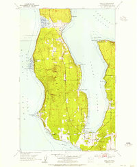
(6)- 1939 Map of Coupeville
 1939 Coupeville1939 Print · USGSWhidbey and Marrowstone Islands are captured in the late 1930s when military forts and ferry lines still dictated the rhythm of Puget Sound. Researchers can trace the grounds of Fort Casey, locate the Island County Courthouse, and find vanished coastal landmarks like Pratts Resort.
 - 1953 Map of Freeland, 1955 Print
 1953 Freeland1955 Print · USGSWhidbey Island in the early fifties shows a transition from rural homesteads to established coastal communities along Holmes Harbor. You can trace the maritime footprint of Bush Point and its Lighthouse or locate family sites near Freeland and Honeymoon Bay.6 unique versions available
 - 1957 Map of Victoria, 1960 Print
 1957 Victoria1960 Print · USGSThe San Juan Islands and the North Cascades coastline are shown in detail during the late fifties, a period of significant military and industrial presence. Researchers can trace historic rail lines like the Great Northern or locate sites such as the Whidbey Island Naval Air Sta and Friday Harbor.4 unique versions available
 - 1975 Map of Port Townsend, 1977 Print
 1975 Port Townsend1977 Print · USGSThe northern Puget Sound in the mid-seventies shows a landscape of military readiness and maritime industry. Researchers can trace the extensive Whidbey Island Naval Air Station or locate historic coastal defenses at Fort Casey Military Res and Fort Ebey Military Res.
 - 1993 Map of Port Townsend
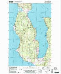
 1993 Port Townsend1993 Print · USGSThe Puget Sound and Whidbey Island are captured in the early nineties, showing a landscape defined by naval aviation and maritime trade. Genealogists and local historians can trace the development of Oak Harbor and Coupeville or locate family sites near the Arlington Municipal Cemetery and Ault Field.
 - 1998 Map of Freeland, 2003 Print
 1998 Freeland2003 Print · USGSWhidbey Island's central coast near the close of the century shows a unique mix of naval operations and seaside communities. Trace the shoreline from the Bush Point Lighthouse to the Lake Hancock Target Range or the quiet roads of Greenbank.
End of results
Showing maps 1-6 of 6
Top cities near Beverly Beach
- Everett historical maps
- Edmonds historical maps
- Lynnwood historical maps
- Oak Harbor historical maps
- Mukilteo historical maps
- Stanwood historical maps
See more
Frequently asked questions
- What are the different types of historical maps available for Beverly Beach?
- What is the oldest map of Beverly Beach?
- Where can I purchase historical maps of Beverly Beach for my home or office?
- Where can I download high-res historical maps of Beverly Beach?
- Are there historical topographic maps available for Beverly Beach?
- Is there historical aerial imagery available for Beverly Beach?
- Where are historical maps of Beverly Beach sourced from?