Old Maps of Discovery Junction, Washington for Academic Research
Study the evolution of Discovery Junction with 12 high-resolution historic maps. Whether you're teaching, researching, or modeling changes in land use, these maps provide essential visual documentation of urban, environmental, and geographic change.
- Analyze long-term change: Track patterns in development, transportation, and natural features.
- Ideal for environmental or urban studies: Support academic projects with primary historical map data.
- Use in the classroom or lab: Educators and researchers rely on these maps to bring historical context to life.
These maps are a powerful tool for teaching, research, and visualizing how Discovery Junction has changed over the decades.
Discovery Junction, WA maps
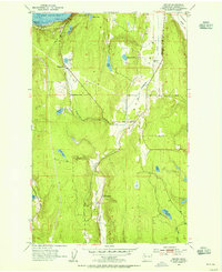
(12)- 1940 Map of Quilcene
 1940 Quilcene1940 Print · USGSThe Olympic Peninsula shoreline and timbered foothills are captured here during the late pre-war era, from the heights of Mt Walker to the depths of Dabob Bay. Researchers can trace early logging operations at Mc Cormack Lumber Co or locate civic landmarks like the Port Townsend Dam and US Fish Hatchery.
 - 1953 Map of Center, 1955 Print
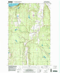
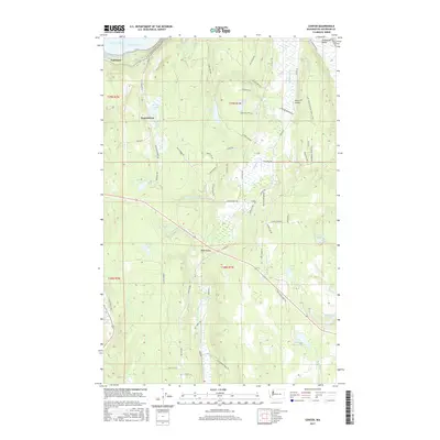
 1953 Center1955 Print · USGSThe rural Jefferson County landscape comes alive in the early fifties, showing the interplay of rail and road near the Olympic Peninsula coast. Genealogists and local historians can trace family locations near the Dabob School, the small settlement of Center, and the rail junction at Discovery Junction.3 unique versions available
 - 1958 Map of Seattle, 1966 Print
 1958 Seattle1966 Print · USGSThe Puget Sound region in the mid-fifties showcases a balance of urban growth and Olympic wilderness. Trace the industrial waterfronts of Tacoma, old naval facilities like Keyport Naval Res, and mountain peaks like Mount Constance.3 unique versions available
 - 1962 Map of Seattle
 1962 Seattle1962 Print · USGSThe Puget Sound region and Olympic Peninsula are shown at a peak of mid-century growth. Genealogists and historians can trace rail lines like the Pacific Coast RR or locate landmarks such as Fort Lawton and the Bothell Power Station.
 - 1975 Map of Seattle, 1977 Print
 1975 Seattle1977 Print · USGSThe Puget Sound region in the mid-seventies shows a landscape of rapid suburban growth and vital maritime industry. Researchers can trace the development of Eastside hubs like Bellevue or examine the rail and naval infrastructure of Bremerton and Paine Field.
 - 1992 Map of Seattle, 1993 Print
 1992 Seattle1993 Print · USGSThe Seattle metropolitan area and Puget Sound are shown here in the early nineties during a period of rapid suburban and technological growth. Researchers can trace the development of Mercer Island, locate the Bangor Naval Submarine Base, and study the industrial layout of Boeing Field.2 unique versions available
 - 1997 Map of Center, 2003 Print
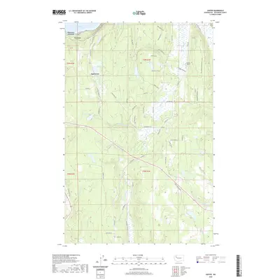
 1997 Center2003 Print · USGSThe Jefferson County interior meets the waters of Port Discovery in the late nineties, showing a landscape defined by timber and tide. Genealogists can locate family landmarks like the Dabob School, the settlement at Center, and several named lakes.
 - 2011 Map of Center, 2011 Print
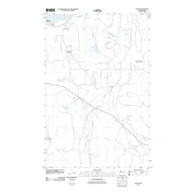 2011 Center2011 Print · USGSCovers Discovery Junction, including Fairmont, Eaglemount, and other nearby areas
 - 2014 Map of Center, 2014 Print
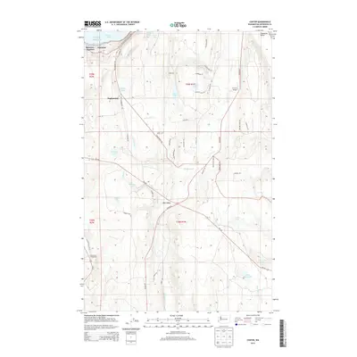 2014 Center2014 Print · USGSCovers Discovery Junction, including Fairmont, Eaglemount, and other nearby areas
 - 2017 Map of Center, 2017 Print
 2017 Center2017 Print · USGSCovers Discovery Junction, including Fairmont, Eaglemount, and other nearby areas
 - 2020 Map of Center, 2020 Print
 2020 Center2020 Print · USGSCovers Discovery Junction, including Fairmont, Eaglemount, and other nearby areas
 - 2023 Map of Center, 2023 Print
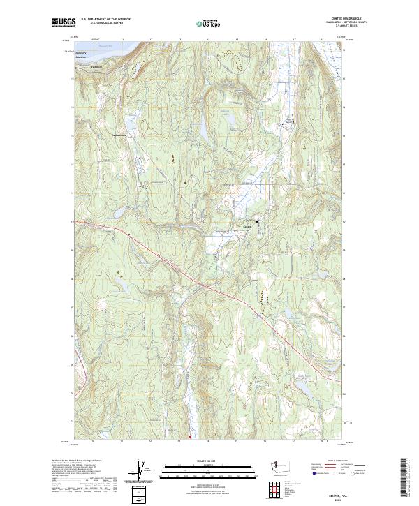 2023 Center2023 Print · USGSThe Olympic Peninsula lowlands near Jefferson County are mapped here in the early 2020s, showing a landscape of timbered ridges and small lakes. Researchers can locate Center Cem, Stacey's Airport, and the small settlement of Discovery Junction.
End of results
Showing maps 1-12 of 12
Top cities near Discovery Junction
- Poulsbo historical maps
- Port Townsend historical maps
- Sequim historical maps
- Port Hadlock historical maps
- Port Ludlow historical maps
- Coupeville historical maps
See more
Frequently asked questions
- What are the different types of historical maps available for Discovery Junction?
- What is the oldest map of Discovery Junction?
- Where can I purchase historical maps of Discovery Junction for my home or office?
- Where can I download high-res historical maps of Discovery Junction?
- Are there historical topographic maps available for Discovery Junction?
- Is there historical aerial imagery available for Discovery Junction?
- Where are historical maps of Discovery Junction sourced from?