Old Maps of Belfair, Bremerton
Explore 13 old maps of Belfair, spanning from 1936 to today. These high-resolution historic maps reveal how streets, neighborhoods, landmarks, and natural features evolved over time — perfect for genealogy, metal detecting, research, and local history exploration.
What you can do with these maps:
- See how Belfair changed over time: Compare historical maps to modern-day views to trace roads, homesites, rail lines & more.
- View detailed metadata: Each map includes creators, publishers, year, scale, and archive source.
- Overlay maps with satellite & LiDAR: Visualize the past alongside modern tools to explore terrain & human change.
- Trusted historical sources: Maps sourced from the USGS, Library of Congress, and other archives.
- Access maps your way: View online, download high-res files, or order prints for personal or research use.
Start exploring old maps of Belfair to uncover forgotten places, hidden landmarks, and the deep history beneath your feet.
Belfair, Bremerton maps
(13)- 1936 Map of Point Misery, 1958 Print
 1936 Point Misery1958 Print · USGSCommunities along the Hood Canal thrived on timber and maritime trade in the mid-1930s. Genealogists and historians can trace local landmarks like Seabeck, the Lewis Lumber Co, and the Brinnon Seabeck Ferry route.3 unique versions available
 - 1940 Map of Point Misery
 1940 Point Misery1940 Print · USGSCoastal life along the Hood Canal and Dabob Bay is caught in detail just before the mid-century, from timber operations to maritime crossings. Genealogists and historians can trace the Brinnon Seabeck Ferry, identify the Barney White Ranch, and locate the Seabeck Sch.
 - 1953 Map of Wildcat Lake, 1955 Print
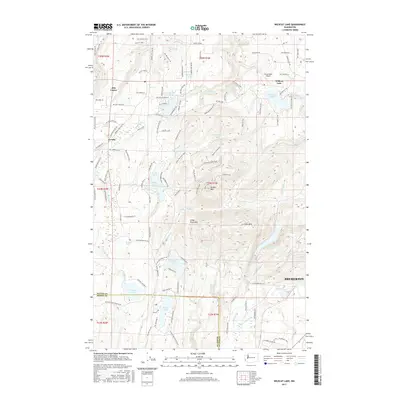
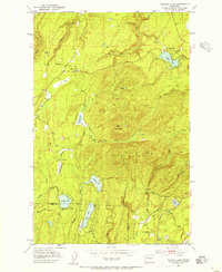 1953 Wildcat Lake1955 Print · USGSKitsap and Mason counties meet in this mid-century survey of the peninsula's forested interior and glacial lakes. Genealogists and local historians can trace small communities like Camp Union and Hite Center or locate the Barney White Ranch and McKenna Falls.4 unique versions available
 - 1958 Map of Seattle, 1966 Print
 1958 Seattle1966 Print · USGSThe Puget Sound region in the mid-fifties showcases a balance of urban growth and Olympic wilderness. Trace the industrial waterfronts of Tacoma, old naval facilities like Keyport Naval Res, and mountain peaks like Mount Constance.3 unique versions available
 - 1962 Map of Seattle
 1962 Seattle1962 Print · USGSThe Puget Sound region and Olympic Peninsula are shown at a peak of mid-century growth. Genealogists and historians can trace rail lines like the Pacific Coast RR or locate landmarks such as Fort Lawton and the Bothell Power Station.
 - 1975 Map of Seattle, 1977 Print
 1975 Seattle1977 Print · USGSThe Puget Sound region in the mid-seventies shows a landscape of rapid suburban growth and vital maritime industry. Researchers can trace the development of Eastside hubs like Bellevue or examine the rail and naval infrastructure of Bremerton and Paine Field.
 - 1992 Map of Seattle, 1993 Print
 1992 Seattle1993 Print · USGSThe Seattle metropolitan area and Puget Sound are shown here in the early nineties during a period of rapid suburban and technological growth. Researchers can trace the development of Mercer Island, locate the Bangor Naval Submarine Base, and study the industrial layout of Boeing Field.2 unique versions available
 - 1997 Map of Wildcat Lake, 2003 Print
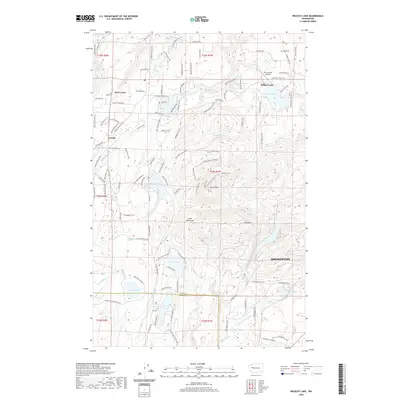
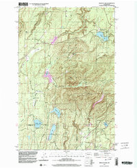 1997 Wildcat Lake2003 Print · USGSThe Kitsap Peninsula highlands appear in the late twentieth century as a landscape of mountain ridges and secluded lake communities. Researchers can trace the development of Camp Union, the sprawling Union River Reservoir, and family landmarks like the Barney White Ranch.
 - 2011 Map of Wildcat Lake, 2011 Print
 2011 Wildcat Lake2011 Print · USGSCovers Belfair, including Bremerton, Crosby, and other nearby areas
 - 2014 Map of Wildcat Lake, 2014 Print
 2014 Wildcat Lake2014 Print · USGSCovers Belfair, including Bremerton, Crosby, and other nearby areas
 - 2017 Map of Wildcat Lake, 2017 Print
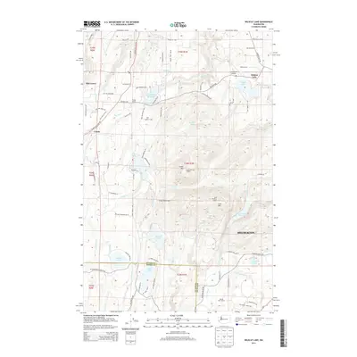
 2017 Wildcat Lake2017 Print · USGSCovers Belfair, including Bremerton, Crosby, and other nearby areas
 - 2020 Map of Wildcat Lake, 2020 Print
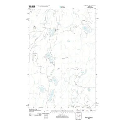
 2020 Wildcat Lake2020 Print · USGSCovers Belfair, including Bremerton, Crosby, and other nearby areas
 - 2023 Map of Wildcat Lake, 2023 Print
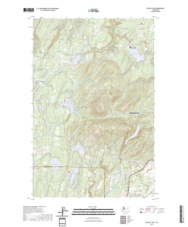 2023 Wildcat Lake2023 Print · USGSThe Great Peninsula west of Bremerton is shown in this contemporary study as a dense landscape of lakes and forested peaks. Researchers can trace the drainage of the Tahuya River or locate local landmarks like Leisureland Airpark and Hite Center.
End of results
Showing maps 1-13 of 13
Top cities near Belfair
- Tacoma historical maps
- Bremerton historical maps
- Bainbridge Island historical maps
- Silverdale historical maps
- Port Orchard historical maps
- Artondale historical maps
See more
Frequently asked questions
- What are the different types of historical maps available for Belfair?
- What is the oldest map of Belfair?
- Where can I purchase historical maps of Belfair for my home or office?
- Where can I download high-res historical maps of Belfair?
- Are there historical topographic maps available for Belfair?
- Is there historical aerial imagery available for Belfair?
- Where are historical maps of Belfair sourced from?