Old Maps of Mayfield, Washington for Genealogy
Trace your family roots with 14 historic maps of Mayfield. These high-res maps reveal old neighborhoods, homesites, landmarks, and streets — helping you uncover where your ancestors lived and how the area evolved over time.
- Explore historic neighborhoods: Identify where your relatives may have lived in the 1800s or 1900s.
- Compare maps over time: Trace the changes in streets, buildings, and landmarks for multi-generational research.
- Perfect for genealogy & ancestry research: Used by family historians and researchers to map out lineage and migration.
These maps are an incredible resource for exploring your personal connection to Mayfield's past.
Mayfield, WA maps
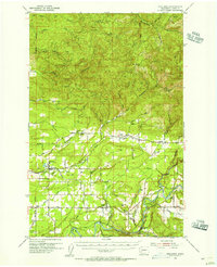
(14)- 1916 Map of Chehalis
 1916 Chehalis1916 Print · USGSDuring a period of rapid development along the Chehalis and Skookumchuck Rivers, these valleys supported a thriving network of timber camps and rail towns. Genealogists can trace family landmarks like Logan Hill School, the Centralia Seminary, and the Salmon Creek Mill.4 unique versions available
 - 1943 Map of Willapa
 1943 Willapa1943 Print · USGSPacific County's timber and rail corridor comes to life during the 1940s as industry follows the winding course of the Willapa River. Genealogists and historians can trace family roots through localized landmarks like Riverview Sch, Camp No 1, and the Willapa State Salmon Hatchery.
 - 1953 Map of Hoquiam
 1953 Hoquiam1953 Print · USGSSouthwest Washington in the early fifties shows a landscape shaped by timber, rail, and river commerce from the coast to the Cascades. Genealogists and historians can trace the development of timber towns like Ryderwood and the industrial hubs of Hoquiam and Kelso.2 unique versions available
 - 1954 Map of Onalaska, 1956 Print
 1954 Onalaska1956 Print · USGSLewis County in the mid-fifties is seen here as a network of river-valley settlements and timber-hauling rail lines. Researchers can trace the Cowlitz and Chehalis Railway through Onalaska or locate family sites like Alpha Cem and Cowlitz Prairie.3 unique versions available
 - 1957 Map of Hoquiam
 1957 Hoquiam1957 Print · USGSCoastal timber ports and inland rail hubs define Southwest Washington during the late fifties. Genealogists can trace early twentieth-century settlements like Bordeaux, Tono, and Cosmopolis alongside the expanding tracks of the Northern Pacific.
 - 1958 Map of Hoquiam, 1969 Print
 1958 Hoquiam1969 Print · USGSSouthwest Washington and the Columbia River estuary appear here in the mid-century, before major landscape shifts. Researchers can trace the rail lines of the Northern Pacific, locate the Fort Henness Site, or explore the Naselle Air Force Station.2 unique versions available
 - 1962 Map of Hoquiam
 1962 Hoquiam1962 Print · USGSSouthwest Washington in the late fifties is defined by the bustling timber ports of Hoquiam and the rail-linked commerce of the interior valleys. Genealogists and historians can trace the early footprints of settlements like Raymond and Pe Ell, or locate family sites at Grand Mound Cem and Odd Fellows Cem.
 - 1980 Map of Centralia
 1980 Centralia1980 Print · USGSThe rail and river corridors of southwestern Washington are captured here in the late twentieth century, showing the region's transition from resource extraction to managed forest land. Researchers can trace the industrial footprint of the Stoker Mine, the rails of the Union Pacific, and the early development of Centralia and Chehalis.
 - 1984 Map of Mayfield Lake
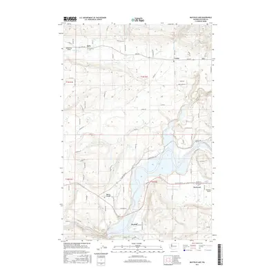
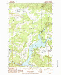 1984 Mayfield Lake1984 Print · USGSThe Cowlitz River valley is shown in the mid-eighties as a hub for both industry and outdoor recreation. Researchers can trace family roots at Shoestring Cem, locate the Mossyrock Trout Hatchery, and explore the rural layout of Salkum and Silver Creek.2 unique versions available
 - 2011 Map of Mayfield Lake, 2011 Print
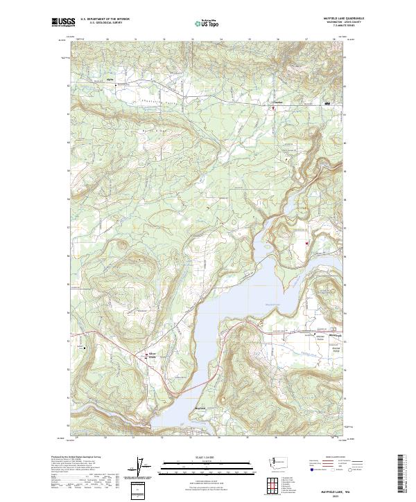
 2011 Mayfield Lake2011 Print · USGSCovers Mayfield, including Cinebar, Alpha, and other nearby areas
 - 2013 Map of Mayfield Lake, 2013 Print
 2013 Mayfield Lake2013 Print · USGSCovers Mayfield, including Cinebar, Alpha, and other nearby areas
 - 2017 Map of Mayfield Lake, 2017 Print
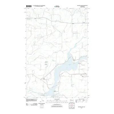
 2017 Mayfield Lake2017 Print · USGSCovers Mayfield, including Cinebar, Alpha, and other nearby areas
 - 2020 Map of Mayfield Lake, 2020 Print
 2020 Mayfield Lake2020 Print · USGSCovers Mayfield, including Cinebar, Alpha, and other nearby areas
 - 2023 Map of Mayfield Lake, 2023 Print
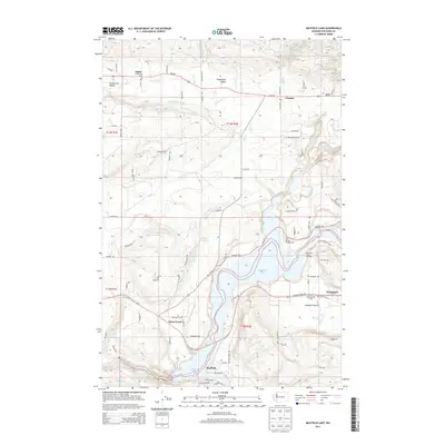
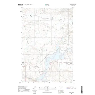
 2023 Mayfield Lake2023 Print · USGSLewis County as it appeared in the early 2020s shows a landscape defined by the expansive Mayfield Lake and the agricultural Shoestring Valley. Genealogists and local historians can locate several rural burying grounds including Shoestring Cem and Klickitat Cem near the town of Mossyrock.
End of results
Showing maps 1-14 of 14
Top cities near Mayfield
Frequently asked questions
- What are the different types of historical maps available for Mayfield?
- What is the oldest map of Mayfield?
- Where can I purchase historical maps of Mayfield for my home or office?
- Where can I download high-res historical maps of Mayfield?
- Are there historical topographic maps available for Mayfield?
- Is there historical aerial imagery available for Mayfield?
- Where are historical maps of Mayfield sourced from?