Old Maps of Ayock, Washington for Metal Detecting
Plan your next treasure hunt with 12 historic maps of Ayock. Find old homesites, ghost towns, trails, and gathering spots that may be lost to time — perfect for identifying promising metal detecting locations.
- Locate forgotten sites: Uncover places like long-lost settlements, abandoned rail lines, or gathering spots.
- Plan better hunts: Use map overlays combined with LiDAR or satellite views to narrow in on historically rich areas.
- Made for detectorists: Thousands of hobbyists use these maps to discover relics, coins, and hidden history.
Use these historic maps to boost your research and find new opportunities beneath the surface of Ayock.
Ayock, WA maps
(12)- 1938 Map of Mt Constance
 1938 Mt Constance1938 Print · USGSThe eastern Olympic Peninsula comes into focus in the 1930s as a land of massive peaks and nascent federal parks. Trace the early mining efforts at the Tubal Cain Mine, lookouts like Deer Park Lookout, and the shoreline at Eldon.4 unique versions available
 - 1947 Map of The Brothers, 1957 Print
 1947 The Brothers1957 Print · USGSThe Olympic Peninsula wilderness meets the shoreline in the late 1940s, showing the rugged interior before modern expansion. Researchers can locate the John Ahl Sch near Eldon or trace mountain trails to the Webb Lookout and The Brothers.3 unique versions available
 - 1950 Map of The Brothers
 1950 The Brothers1950 Print · USGSThe Jefferson County coast meets the Olympic peaks in the mid-century, capturing the area's transition from the Hood Canal shoreline to high wilderness. Researchers can trace early backcountry camps and coastal landmarks like John Ahl Sch, Camp Collins, and the Hamma Hamma Guard Sta.2 unique versions available
 - 1958 Map of Seattle, 1966 Print
 1958 Seattle1966 Print · USGSThe Puget Sound region in the mid-fifties showcases a balance of urban growth and Olympic wilderness. Trace the industrial waterfronts of Tacoma, old naval facilities like Keyport Naval Res, and mountain peaks like Mount Constance.3 unique versions available
 - 1962 Map of Seattle
 1962 Seattle1962 Print · USGSThe Puget Sound region and Olympic Peninsula are shown at a peak of mid-century growth. Genealogists and historians can trace rail lines like the Pacific Coast RR or locate landmarks such as Fort Lawton and the Bothell Power Station.
 - 1985 Map of Eldon
 1985 Eldon1985 Print · USGSThe western shores of Hood Canal come into focus in the mid-1980s, where the Olympic foothills meet the saltwater. Researchers can trace coastal landmarks like Eldon and Ayock Point or locate the interior Hamma Hamma F S Station and its surrounding camps.
 - 1988 Map of Mount Olympus
 1988 Mount Olympus1988 Print · USGSThe Olympic Peninsula's glacial heart is captured here in the late eighties, documenting the reach of permanent ice and river headwaters. Trace the contours of the Bailey Range and identify landmarks like Sol Duc Hot Springs and the Seven Lakes Basin.
 - 2011 Map of Eldon, 2011 Print
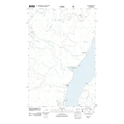 2011 Eldon2011 Print · USGSCovers Ayock, including Hamma Hamma, Kitsap County, and other nearby areas
 - 2014 Map of Eldon, 2014 Print
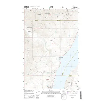 2014 Eldon2014 Print · USGSCovers Ayock, including Hamma Hamma, Kitsap County, and other nearby areas
 - 2017 Map of Eldon, 2017 Print
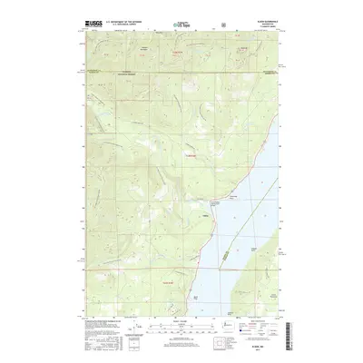 2017 Eldon2017 Print · USGSCovers Ayock, including Hamma Hamma, Kitsap County, and other nearby areas
 - 2020 Map of Eldon, 2020 Print
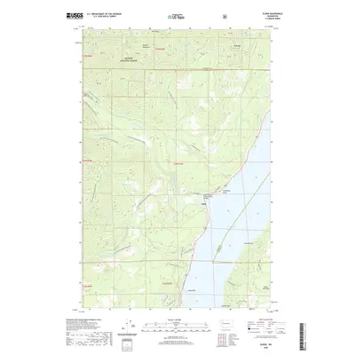 2020 Eldon2020 Print · USGSCovers Ayock, including Hamma Hamma, Kitsap County, and other nearby areas
 - 2023 Map of Eldon, 2023 Print
 2023 Eldon2023 Print · USGSThe eastern Olympic Peninsula shoreline meets the Hood Canal near Eldon in this modern topographical record. Researchers can trace forest access through the Olympic National Forest and locate specific coastal landmarks like Ayock Point and the Hamma Hamma River.
End of results
Showing maps 1-12 of 12
Top cities near Ayock
Frequently asked questions
- What are the different types of historical maps available for Ayock?
- What is the oldest map of Ayock?
- Where can I purchase historical maps of Ayock for my home or office?
- Where can I download high-res historical maps of Ayock?
- Are there historical topographic maps available for Ayock?
- Is there historical aerial imagery available for Ayock?
- Where are historical maps of Ayock sourced from?