Old Maps of Shelton, Washington for Hiking & Exploration
Hike through history with 16 historic maps of Shelton. Explore old trails, ghost towns, and forgotten backroads — perfect for outdoor adventurers and local explorers.
- Rediscover forgotten places: Map out old mining camps, roads, and footpaths that no longer exist on modern maps.
- Layer with modern tools: Combine with LiDAR or satellite views to plan hikes through historical terrain.
- Made for exploration: Popular among hikers, overlanders, and local history lovers.
Use these maps to find adventure and explore the hidden past of Shelton.
Shelton, WA maps
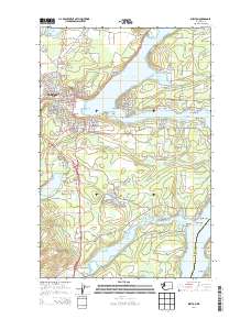
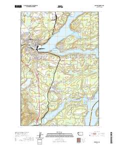
(16)- 1939 Map of Shelton
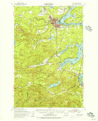
 1939 Shelton1939 Print · USGSSouth Puget Sound during the late thirties reveals a region defined by its timber-hauling railroads and intricate shorelines. Researchers can trace the legacy of early settlements and industry at Shelton, Kamilche, and transit points like Sawmill Sta or the Wilson Ranch.
 - 1953 Map of Shelton, 1956 Print
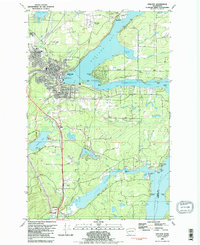
 1953 Shelton1956 Print · USGSThe Mason County waterfront and its timbered interior come alive in this mid-century survey of the inlets surrounding Shelton. Trace the legacy of rural education and military history at Bordeaux Sch, New Kamilche, and the Naval Auxiliary Air Station.2 unique versions available
 - 1958 Map of Seattle, 1966 Print
 1958 Seattle1966 Print · USGSThe Puget Sound region in the mid-fifties showcases a balance of urban growth and Olympic wilderness. Trace the industrial waterfronts of Tacoma, old naval facilities like Keyport Naval Res, and mountain peaks like Mount Constance.3 unique versions available
 - 1962 Map of Seattle
 1962 Seattle1962 Print · USGSThe Puget Sound region and Olympic Peninsula are shown at a peak of mid-century growth. Genealogists and historians can trace rail lines like the Pacific Coast RR or locate landmarks such as Fort Lawton and the Bothell Power Station.
 - 1981 Map of Shelton, 1982 Print
 1981 Shelton1982 Print · USGSThe Puget Sound shoreline near Shelton is documented here in the early eighties, showing the region's dense network of inlets and timber-driven infrastructure. Researchers can trace the Burlington Northern rail lines or locate landmarks like Shelton Mem Park (Cem) and the Drive-in Theater.2 unique versions available
 - 1988 Map of Shelton
 1988 Shelton1988 Print · USGSThe Olympic Peninsula's transition from high mountain wilderness to Puget Sound tideflats is captured here in the late eighties. Researchers can trace the path of the Logging Railroad or locate historical sites like Sanderson Field and the Skokomish Indian Reservation.
 - 2011 Map of Shelton Valley, 2011 Print
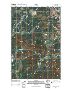 2011 Shelton Valley2011 Print · USGSCovers Shelton, including Dayton, Mason County, and other nearby areas
 - 2011 Map of Shelton, 2011 Print
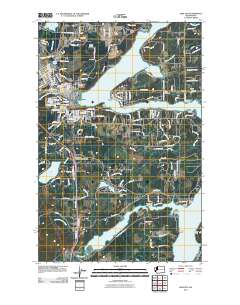 2011 Shelton2011 Print · USGSCovers Shelton, including Kamilche, Elizan Beach, and other nearby areas
 - 2014 Map of Shelton, 2014 Print
 2014 Shelton2014 Print · USGSCovers Shelton, including Kamilche, Elizan Beach, and other nearby areas
 - 2014 Map of Shelton Valley, 2014 Print
 2014 Shelton Valley2014 Print · USGSCovers Shelton, including Dayton, Mason County, and other nearby areas
 - 2017 Map of Shelton Valley, 2017 Print
 2017 Shelton Valley2017 Print · USGSCovers Shelton, including Dayton, Mason County, and other nearby areas
 - 2017 Map of Shelton, 2017 Print
 2017 Shelton2017 Print · USGSCovers Shelton, including Kamilche, Elizan Beach, and other nearby areas
 - 2020 Map of Shelton, 2020 Print
 2020 Shelton2020 Print · USGSCovers Shelton, including Kamilche, Elizan Beach, and other nearby areas
 - 2020 Map of Shelton Valley, 2020 Print
 2020 Shelton Valley2020 Print · USGSCovers Shelton, including Dayton, Mason County, and other nearby areas
 - 2023 Map of Shelton Valley, 2023 Print
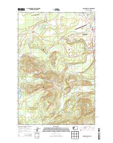
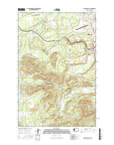
 2023 Shelton Valley2023 Print · USGSMason County’s timberlands and valley floors are shown in detail here during the early twenty-first century. Researchers can trace the drainage of Goldsborough Creek or locate local landmarks like Sanderson Field, Dayton Peak, and the settlement of Lost-Prairie.
 - 2023 Map of Shelton, 2023 Print
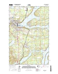
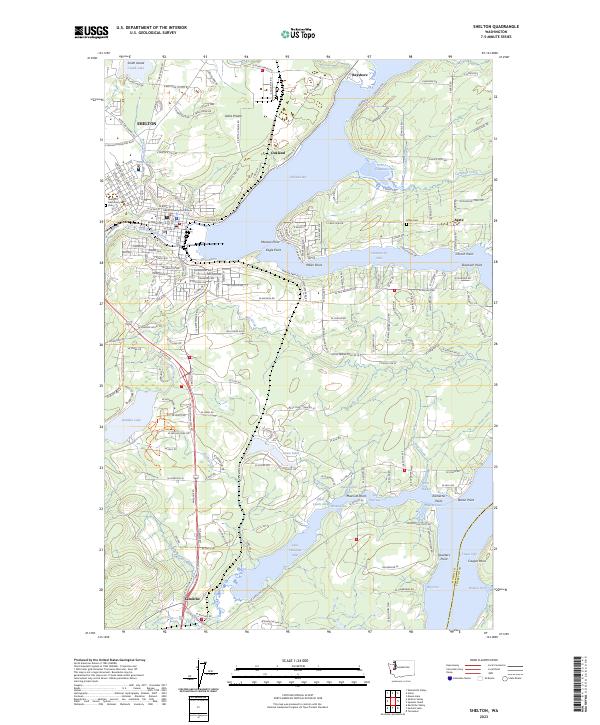 2023 Shelton2023 Print · USGSMason County's coastal landscape is captured here in the early twenty-first century, showing the established communities and intricate shoreline around Shelton. Researchers can trace local history through the Mason County Courthouse, find family sites at Miller Cem, and locate points like Eagle Point and Kamilche.
End of results
Showing maps 1-16 of 16
Top cities near Shelton
- Olympia historical maps
- Tumwater historical maps
- Kamilche historical maps
- McCleary historical maps
- Union historical maps
Top neighborhoods of Shelton
Frequently asked questions
- What are the different types of historical maps available for Shelton?
- What is the oldest map of Shelton?
- Where can I purchase historical maps of Shelton for my home or office?
- Where can I download high-res historical maps of Shelton?
- Are there historical topographic maps available for Shelton?
- Is there historical aerial imagery available for Shelton?
- Where are historical maps of Shelton sourced from?