Old Maps of Yacht Haven, Washington for Hiking & Exploration
Hike through history with 8 historic maps of Yacht Haven. Explore old trails, ghost towns, and forgotten backroads — perfect for outdoor adventurers and local explorers.
- Rediscover forgotten places: Map out old mining camps, roads, and footpaths that no longer exist on modern maps.
- Layer with modern tools: Combine with LiDAR or satellite views to plan hikes through historical terrain.
- Made for exploration: Popular among hikers, overlanders, and local history lovers.
Use these maps to find adventure and explore the hidden past of Yacht Haven.
Yacht Haven, WA maps
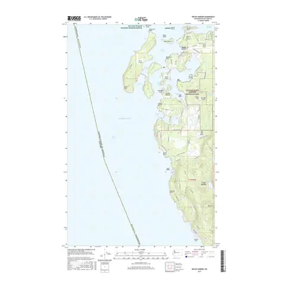
(8)- 1954 Map of Roche Harbor, 1957 Print
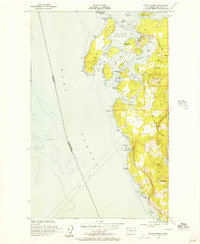 1954 Roche Harbor1957 Print · USGSSan Juan Island and Henry Island are captured in the 1950s, documenting the maritime life and historic sites of the Pacific Northwest. Trace the boundaries of the English Campsite (1859), locate local Quarries, and find the Lime Kiln Lighthouse.4 unique versions available
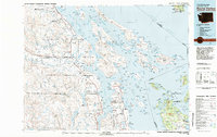
 - 1957 Map of Victoria, 1960 Print
 1957 Victoria1960 Print · USGSThe San Juan Islands and the North Cascades coastline are shown in detail during the late fifties, a period of significant military and industrial presence. Researchers can trace historic rail lines like the Great Northern or locate sites such as the Whidbey Island Naval Air Sta and Friday Harbor.4 unique versions available
 - 1981 Map of Roche Harbor
 1981 Roche Harbor1981 Print · USGSThe maritime boundary between the Gulf Islands and San Juans was well-established by the early eighties. Researchers can trace transportation routes like the Canadian Pacific Railway and find coastal settlements from Sidney to Ganges.2 unique versions available
 - 2011 Map of Roche Harbor, 2011 Print
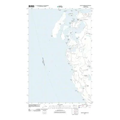 2011 Roche Harbor2011 Print · USGSCovers Yacht Haven, including Friday Harbor, Roche Harbor, and other nearby areas
 - 2014 Map of Roche Harbor, 2014 Print
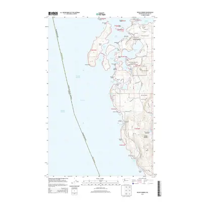 2014 Roche Harbor2014 Print · USGSCovers Yacht Haven, including Friday Harbor, Roche Harbor, and other nearby areas
 - 2017 Map of Roche Harbor, 2017 Print
 2017 Roche Harbor2017 Print · USGSCovers Yacht Haven, including Friday Harbor, Roche Harbor, and other nearby areas
 - 2020 Map of Roche Harbor, 2020 Print
 2020 Roche Harbor2020 Print · USGSCovers Yacht Haven, including Friday Harbor, Roche Harbor, and other nearby areas
 - 2023 Map of Roche Harbor, 2023 Print
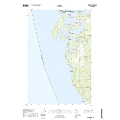
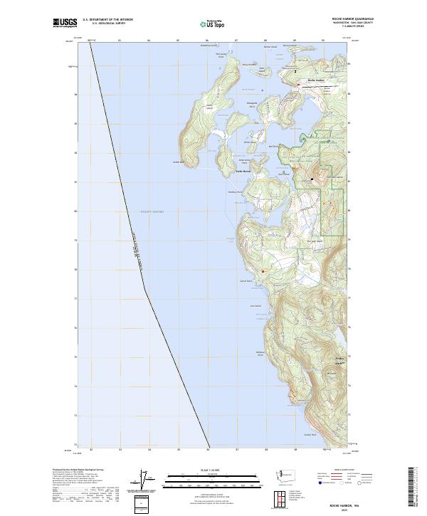 2023 Roche Harbor2023 Print · USGSSan Juan Island's northern coast is shown in high detail at the dawn of the 2020s, highlighting the intersection of maritime heritage and preserved wilderness. Trace historic sites like the Afterglow Vista Mausoleum or navigate the shoreline from Mosquito Pass to Yacht Haven.
End of results
Showing maps 1-8 of 8
Top cities near Yacht Haven
Frequently asked questions
- What are the different types of historical maps available for Yacht Haven?
- What is the oldest map of Yacht Haven?
- Where can I purchase historical maps of Yacht Haven for my home or office?
- Where can I download high-res historical maps of Yacht Haven?
- Are there historical topographic maps available for Yacht Haven?
- Is there historical aerial imagery available for Yacht Haven?
- Where are historical maps of Yacht Haven sourced from?