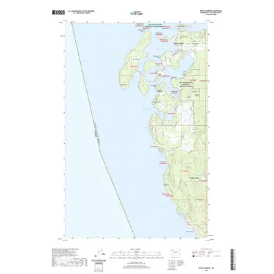
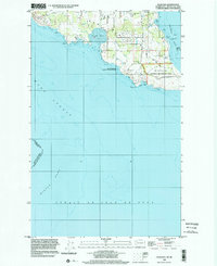
2020 Map of Roche Harbor
USGS Topo · Published 2020About this map
San Juan Island defines this coastal landscape, marked by its deep maritime history and the international boundary through the Haro Strait between the United States of America and Canada. The northern reach is anchored by Roche Harbor, where the Roche Harbor Airport and Afterglow Vista Mausoleum and Cem reflect the area's development. Cultural landmarks are preserved within the San Juan Island National Historical Park, including the English Camp Cem near Garrison Bay. The map shows a complex shoreline of inlets and points, from Kellett Bluff on Henry Island to the southern elevations of Mt Dallas. The presence of several small lakes, such as Trout Lake and Lawson Lake, suggests the island's varied topography beyond its salt-water bays. This modern survey tracks the legacy of the archipelago's settlement from its fishing and lime-quarrying roots into its contemporary role as a protected natural and historical site.
Find a feature on this map
93 named features on this map. Tap any name to fly to it.
Don’t see what you’re looking for? This feature index may not catch every label — zoom into the map to look around manually.
Map Details
Editions of this 2020 Roche Harbor Map
This is the sole edition of this map. No revisions or reprints were ever made.
Other maps of this area

1953 · Stuart Island
USGS Topo · 1:24,000

1954 · Roche Harbor
USGS Topo · 1:24,000

1954 · Waldron Island
USGS Topo · 1:24,000

1954 · Friday Harbor
USGS Topo · 1:24,000

1954 · False Bay
USGS Topo · 1:24,000

1957 · Victoria
USGS Topo · 1:250,000
1979 · Port Angeles
USGS Topo · 1:100,000
1981 · Roche Harbor
USGS Topo · 1:100,000
1997 · Waldron Island
USGS Topo · 1:24,000
1998 · False Bay
USGS Topo · 1:24,000