Old Maps of La Conner, Washington for Genealogy
Trace your family roots with 22 historic maps of La Conner. These high-res maps reveal old neighborhoods, homesites, landmarks, and streets — helping you uncover where your ancestors lived and how the area evolved over time.
- Explore historic neighborhoods: Identify where your relatives may have lived in the 1800s or 1900s.
- Compare maps over time: Trace the changes in streets, buildings, and landmarks for multi-generational research.
- Perfect for genealogy & ancestry research: Used by family historians and researchers to map out lineage and migration.
These maps are an incredible resource for exploring your personal connection to La Conner's past.
La Conner, WA maps
(22)- 1911 Map of Mount Vernon
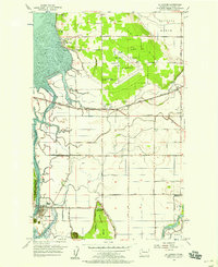
 1911 Mount Vernon1911 Print · USGSSkagit and Snohomish counties are shown here just after the turn of the century as the railroad and river networks fueled rapid growth. Researchers can trace historic transportation routes like the Anderson Ferry and the Monte Cristo RR through Mount Vernon and the Tulalip Indian Reservation.4 unique versions available
 - 1940 Map of Mt Vernon, 1957 Print
 1940 Mt Vernon1957 Print · USGSThe Skagit River delta and its thriving rail-and-river towns are captured here just before the mid-century. Genealogists can trace family roots through numerous country schools like Harmony Sch and landmarks like the Milltown Ch or the timber-hauling Logging Railroad.2 unique versions available
 - 1943 Map of Mt Vernon
 1943 Mt Vernon1943 Print · USGSSkagit County during the early years of the war reveals a complex network of river deltas and rail-dependent settlements. Researchers can trace the heritage of rural communities through labels for Skagit City, the Ridgeway Sch, and the Great Northern railroad.2 unique versions available
 - 1943 Map of Deception Pass
 1943 Deception Pass1943 Print · USGSFidalgo and Whidbey Islands are shown in the early 1940s, highlighting the maritime and rail connections of Puget Sound. Researchers can trace the boundaries of the Swinomish Indian Reservation or locate early schools like Fidalgo Sch and Dewey Sch.
 - 1951 Map of Deception Pass, 1953 Print
 1951 Deception Pass1953 Print · USGSWhidbey and Fidalgo Islands appear here in the early fifties as the region's naval and agricultural identities merged. Genealogists and local historians can trace early schools and coastal landmarks like Rosario School, Fort Whitman, and the village of La Conner.3 unique versions available
 - 1956 Map of La Conner, 1958 Print
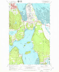
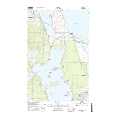
 1956 La Conner1958 Print · USGSSkagit County coastal life in the mid-fifties is defined by the labyrinthine waterways between La Conner and Bay View. Researchers can trace old schools like Harmony Sch (Aband) and landmarks such as the Pioneer Monument and Mount Vernon Airport.4 unique versions available
 - 1957 Map of Victoria, 1960 Print
 1957 Victoria1960 Print · USGSThe San Juan Islands and the North Cascades coastline are shown in detail during the late fifties, a period of significant military and industrial presence. Researchers can trace historic rail lines like the Great Northern or locate sites such as the Whidbey Island Naval Air Sta and Friday Harbor.4 unique versions available
 - 1975 Map of Port Townsend, 1977 Print
 1975 Port Townsend1977 Print · USGSThe northern Puget Sound in the mid-seventies shows a landscape of military readiness and maritime industry. Researchers can trace the extensive Whidbey Island Naval Air Station or locate historic coastal defenses at Fort Casey Military Res and Fort Ebey Military Res.
 - 1978 Map of Anacortes South, 1979 Print
 1978 Anacortes South1979 Print · USGSSkagit County's coastal landscape appears in transition during the late seventies, balancing heavy industry with island recreation. Researchers can trace the boundaries of the Swinomish Ind Res Bdy and locate local landmarks like Summit Hall, Fidalgo Sch, and the Drive-in Theater.3 unique versions available
 - 1993 Map of Port Townsend
 1993 Port Townsend1993 Print · USGSThe Puget Sound and Whidbey Island are captured in the early nineties, showing a landscape defined by naval aviation and maritime trade. Genealogists and local historians can trace the development of Oak Harbor and Coupeville or locate family sites near the Arlington Municipal Cemetery and Ault Field.
 - 1998 Map of Anacortes South, 2002 Print
 1998 Anacortes South2002 Print · USGSFidalgo Island's maritime and industrial landscape is captured in the late nineties, from the refineries of Anacortes to the waters of Skagit Bay. Trace local family roots at Fern Hill Cem or study the shoreline near Gibraltar and Kiket Island.
 - 1998 Map of La Conner, 2002 Print
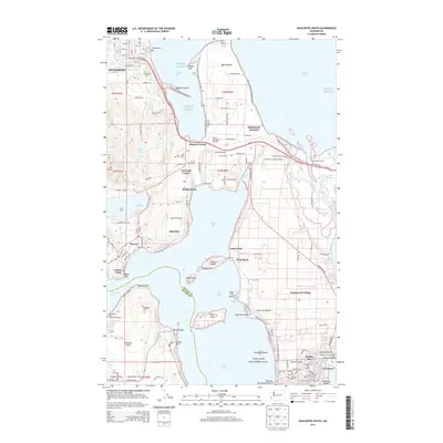
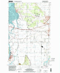 1998 La Conner2002 Print · USGSSkagit County’s delta lands and waterfront communities are captured here in the late twentieth century. Genealogists and historians can trace family-named landmarks and rural hubs from La Conner to Fredonia, including the Pioneer Monument and Grange Hall.
 - 2011 Map of La Conner, 2011 Print
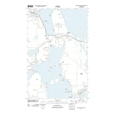
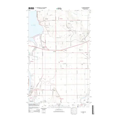
 2011 La Conner2011 Print · USGSCovers La Conner, including Fredonia, Whitney, and other nearby areas
 - 2011 Map of Anacortes South, 2011 Print
 2011 Anacortes South2011 Print · USGSCovers La Conner, including Anacortes, Howards Corner, and other nearby areas
 - 2014 Map of Anacortes South, 2014 Print
 2014 Anacortes South2014 Print · USGSCovers La Conner, including Anacortes, Howards Corner, and other nearby areas
 - 2014 Map of La Conner, 2014 Print
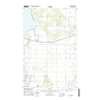
 2014 La Conner2014 Print · USGSCovers La Conner, including Fredonia, Whitney, and other nearby areas
 - 2017 Map of Anacortes South, 2017 Print
 2017 Anacortes South2017 Print · USGSCovers La Conner, including Anacortes, Howards Corner, and other nearby areas
 - 2017 Map of La Conner, 2017 Print
 2017 La Conner2017 Print · USGSCovers La Conner, including Fredonia, Whitney, and other nearby areas
 - 2020 Map of Anacortes South, 2020 Print
 2020 Anacortes South2020 Print · USGSCovers La Conner, including Anacortes, Howards Corner, and other nearby areas
 - 2020 Map of La Conner, 2020 Print
 2020 La Conner2020 Print · USGSCovers La Conner, including Fredonia, Whitney, and other nearby areas
 - 2023 Map of Anacortes South, 2023 Print
 2023 Anacortes South2023 Print · USGSCoastal Skagit County is mapped here in the early twenty-first century, showing the intricate waterways between Fidalgo and Whidbey Islands. Researchers can trace land boundaries near Swinomish Village, locate Swinomish Cem, or explore the road network near Anacortes.
 - 2023 Map of La Conner, 2023 Print
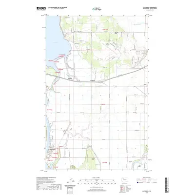
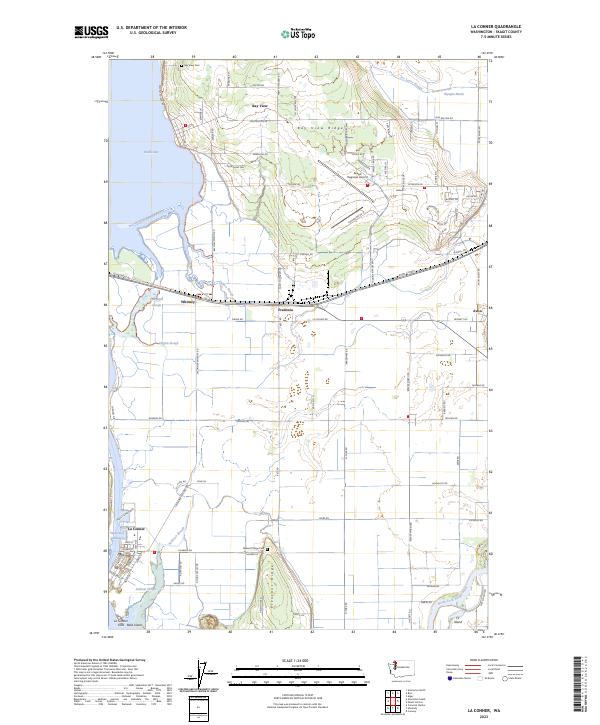 2023 La Conner2023 Print · USGSThe Skagit County coastline comes to life in this contemporary survey of the delta and its historic waterfront towns. Researchers can trace family sites at Bay View Cem, follow the Swinomish Channel through La Conner, or locate the rural crossroads of Whitney and Fredonia.
End of results
Showing maps 1-22 of 22
Top cities near La Conner
- Mount Vernon historical maps
- Oak Harbor historical maps
- Anacortes historical maps
- Sedro-Woolley historical maps
- Burlington historical maps
- Stanwood historical maps
See more
Frequently asked questions
- What are the different types of historical maps available for La Conner?
- What is the oldest map of La Conner?
- Where can I purchase historical maps of La Conner for my home or office?
- Where can I download high-res historical maps of La Conner?
- Are there historical topographic maps available for La Conner?
- Is there historical aerial imagery available for La Conner?
- Where are historical maps of La Conner sourced from?