1980s Maps of Sedro-Woolley, Washington
Explore 2 historic maps of Sedro-Woolley from the 1980s. These maps offer a rare glimpse into what life looked like during the 1980s — showing old roads, neighborhoods, homes, and landmarks that have changed or disappeared over time.
Whether you're researching your family's past, planning a metal detecting trip, or studying how Sedro-Woolley's landscape evolved across the 1980s, these high-resolution maps are a powerful tool for exploring the history of this region.
- Focus on a specific era: All maps on this page are from the 1980s, giving you a focused view of this time period.
- See what’s changed: Compare century-old streets, trails, and buildings to today's modern landscape using overlays and satellite layers.
- Research with precision: Use these maps for genealogy, historical research, land use analysis, or educational projects.
- View, download, or print: Maps are fully viewable online in high resolution, and can be downloaded or printed for your own records.
Start exploring Sedro-Woolley's history through authentic maps from the 1980s. This is your window into the past.
Sedro-Woolley, WA maps
(2)- 1981 Map of Sedro-Woolley North
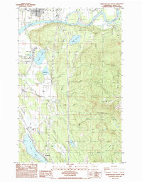
 1981 Sedro-Woolley North1981 Print · USGSThe Skagit Valley and the foothills of the Cascades come alive in this early 1980s look at the region's development. Researchers can trace the sprawling grounds of the Northern State Hospital, locate the historic Cokedale Mine, and explore the rail-linked streets of Sedro-Woolley.2 unique versions available
 - 1985 Map of Sedro-Woolley South
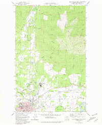
 1985 Sedro-Woolley South1985 Print · USGSSkagit County's valley floor and mountain foothills are captured here in the mid-eighties, showing the transition from the river to the high timber. Genealogists and historians can trace the lakeside communities of Big Lake and Montborne or locate old industrial sites like the Quarry.2 unique versions available
End of results
Showing maps 1-2 of 2
Top cities near Sedro-Woolley
Frequently asked questions
- What are the different types of historical maps available for Sedro-Woolley?
- What is the oldest map of Sedro-Woolley?
- Where can I purchase historical maps of Sedro-Woolley for my home or office?
- Where can I download high-res historical maps of Sedro-Woolley?
- Are there historical topographic maps available for Sedro-Woolley?
- Is there historical aerial imagery available for Sedro-Woolley?
- Where are historical maps of Sedro-Woolley sourced from?