1970s Maps of Opportunity, Spokane Valley
Explore 2 historic maps of Opportunity from the 1970s. These maps offer a rare glimpse into what life looked like during the 1970s — showing old roads, neighborhoods, homes, and landmarks that have changed or disappeared over time.
Whether you're researching your family's past, planning a metal detecting trip, or studying how Opportunity's landscape evolved across the 1970s, these high-resolution maps are a powerful tool for exploring the history of this region.
- Focus on a specific era: All maps on this page are from the 1970s, giving you a focused view of this time period.
- See what’s changed: Compare century-old streets, trails, and buildings to today's modern landscape using overlays and satellite layers.
- Research with precision: Use these maps for genealogy, historical research, land use analysis, or educational projects.
- View, download, or print: Maps are fully viewable online in high resolution, and can be downloaded or printed for your own records.
Start exploring Opportunity's history through authentic maps from the 1970s. This is your window into the past.
Opportunity, Spokane Valley maps
(2)- 1973 Map of Greenacres, 1977 Print
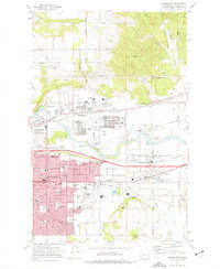 1973 Greenacres1977 Print · USGSSpokane Valley’s suburban expansion is in full swing during the early seventies, centered on the growing communities of Veradale and Opportunity. Genealogists can trace family landmarks at St Josephs Cem and the The Pines Cem, or locate long-standing institutions like Central Valley High Sch.2 unique versions available
 - 1978 Map of Greenacres, 1981 Print
 1978 Greenacres1981 Print · USGSSpokane Valley’s late-seventies landscape is revealed in this detailed aerial survey of the eastern Washington suburbs. Researchers can trace the industrial footprint of Trentwood or the residential growth of Greenacres and Veradale along the Spokane River.
End of results
Showing maps 1-2 of 2
Frequently asked questions
- What are the different types of historical maps available for Opportunity?
- What is the oldest map of Opportunity?
- Where can I purchase historical maps of Opportunity for my home or office?
- Where can I download high-res historical maps of Opportunity?
- Are there historical topographic maps available for Opportunity?
- Is there historical aerial imagery available for Opportunity?
- Where are historical maps of Opportunity sourced from?