Old Maps of North Hill, Spokane for Metal Detecting
Plan your next treasure hunt with 14 historic maps of North Hill. Find old homesites, ghost towns, trails, and gathering spots that may be lost to time — perfect for identifying promising metal detecting locations.
- Locate forgotten sites: Uncover places like long-lost settlements, abandoned rail lines, or gathering spots.
- Plan better hunts: Use map overlays combined with LiDAR or satellite views to narrow in on historically rich areas.
- Made for detectorists: Thousands of hobbyists use these maps to discover relics, coins, and hidden history.
Use these historic maps to boost your research and find new opportunities beneath the surface of North Hill.
North Hill, Spokane maps
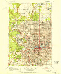
(14)- 1901 Map of Spokane
 1901 Spokane1901 Print · USGSThe Inland Empire was entering a period of massive rail-driven growth at the turn of the century, with Spokane as its industrial heart. Genealogists and historians can trace the early foundations of Ft. Wright, the railroad works at Hillyard, and rural outposts like Chattaroy and Spokane Bridge.6 unique versions available
 - 1950 Map of Spokane NW, 1952 Print
 1950 Spokane NW1952 Print · USGSSpokane enters the early fifties as a major military and rail hub, with neighborhoods expanding across the Spokane River. Genealogists and historians can locate legacy institutions like Gonzaga University, George Wright Air Force Base, and Holy Cross Cemetery.2 unique versions available
 - 1950 Map of Spokane, 1955 Print
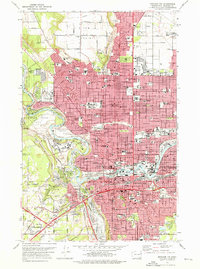
 1950 Spokane1955 Print · USGSSpokane was a bustling rail and aviation hub during the early fifties, caught in a moment of rapid post-war expansion. Genealogists and local historians can trace family roots through numerous parish schools, cemeteries like Holy Cross Cem, and outlying settlements such as Marshall and Pleasant Prairie.2 unique versions available
 - 1955 Map of Spokane, 1965 Print
 1955 Spokane1965 Print · USGSInland Empire life in the fifties and sixties centers on the growth of Spokane and the heavy mining industry of northern Idaho. Trace mid-century landmarks like Fairchild Air Force Base, the Bunker Hill Mine, and early campuses such as Gonzaga University.2 unique versions available
 - 1958 Map of Spokane
 1958 Spokane1958 Print · USGSThe Inland Empire is shown at a mid-century peak of industrial and military activity, from the rail hubs of Spokane to the deep silver mines of northern Idaho. Researchers can trace the sprawling rail lines of the Union Pacific RR or locate landmarks like Fairchild Air Force Base and the Bunker Hill Smelter & Mine.
 - 1963 Map of Spokane NW, 1964 Print
 1963 Spokane NW1964 Print · USGSSpokane emerges as a major Inland Empire rail and educational hub in the early sixties. Genealogists and researchers can trace the city's growth from Five Mile Prairie down to the historic Browne Addition, locating Fort Wright and dozens of neighborhood schools.
 - 1974 Map of Spokane NW, 1976 Print
 1974 Spokane NW1976 Print · USGSSpokane was a bustling hub of education, industry, and transit in the mid-seventies, centered on the Spokane River falls. Researchers can trace the legacy of local institutions like Gonzaga University or locate family plots in Holy Cross Cemetery and Greenwood Memorial Terrace.2 unique versions available
 - 1978 Map of Spokane NW, 1981 Print
 1978 Spokane NW1981 Print · USGSSpokane expanded toward the northern plateaus in the late 1970s, revealing a city defined by its relationship with the water. Trace the residential grid as it meets the bends of the Spokane River and the edges of Fivemile Prairie.
 - 1987 Map of Spokane
 1987 Spokane1987 Print · USGSGreater Spokane and its surrounding prairies are captured in the late 1980s as the region solidified its role as a regional hub. Researchers can trace family sites near Medical Lake, military life at Fairchild Air Force Base, and rural settlements like Peone and Chattaroy.
 - 2011 Map of Spokane NW, 2011 Print
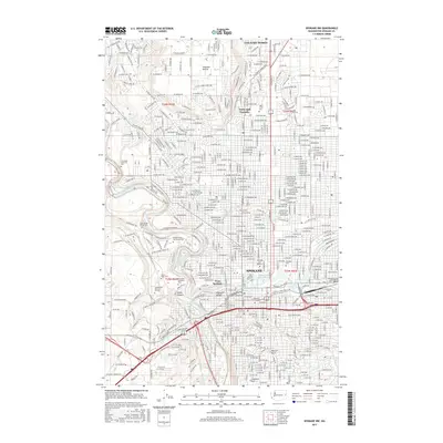
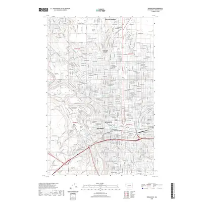
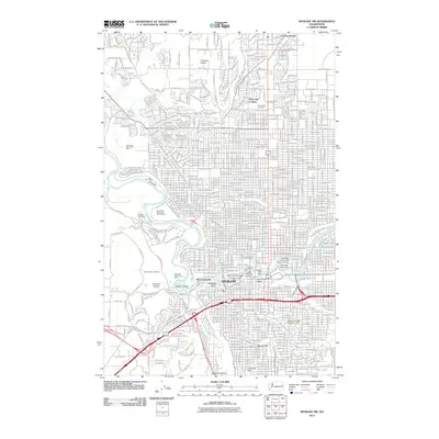 2011 Spokane NW2011 Print · USGSCovers North Hill, including Spokane, Country Homes, and other nearby areas
 - 2014 Map of Spokane NW, 2014 Print
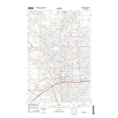 2014 Spokane NW2014 Print · USGSCovers North Hill, including Spokane, Country Homes, and other nearby areas
 - 2017 Map of Spokane NW, 2017 Print
 2017 Spokane NW2017 Print · USGSCovers North Hill, including Spokane, Country Homes, and other nearby areas
 - 2020 Map of Spokane NW, 2020 Print
 2020 Spokane NW2020 Print · USGSCovers North Hill, including Spokane, Country Homes, and other nearby areas
 - 2023 Map of Spokane NW, 2023 Print
 2023 Spokane NW2023 Print · USGSSpokane and its northern environs are shown here during their modern development, centered on the Spokane River and its urban cascades. Genealogists can trace family records across Fairmount Memorial Park, Holy Cross Cem, and the grounds of Fort George Wright.
End of results
Showing maps 1-14 of 14
Frequently asked questions
- What are the different types of historical maps available for North Hill?
- What is the oldest map of North Hill?
- Where can I purchase historical maps of North Hill for my home or office?
- Where can I download high-res historical maps of North Hill?
- Are there historical topographic maps available for North Hill?
- Is there historical aerial imagery available for North Hill?
- Where are historical maps of North Hill sourced from?