Old Maps of Wellpinit, Washington
Explore 11 old maps of Wellpinit, spanning from 1944 to today. These high-resolution historic maps reveal how streets, neighborhoods, landmarks, and natural features evolved over time — perfect for genealogy, metal detecting, research, and local history exploration.
What you can do with these maps:
- See how Wellpinit changed over time: Compare historical maps to modern-day views to trace roads, homesites, rail lines & more.
- View detailed metadata: Each map includes creators, publishers, year, scale, and archive source.
- Overlay maps with satellite & LiDAR: Visualize the past alongside modern tools to explore terrain & human change.
- Trusted historical sources: Maps sourced from the USGS, Library of Congress, and other archives.
- Access maps your way: View online, download high-res files, or order prints for personal or research use.
Start exploring old maps of Wellpinit to uncover forgotten places, hidden landmarks, and the deep history beneath your feet.
Wellpinit, WA maps
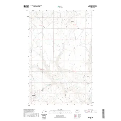
(11)- 1944 Map of Wellpinit
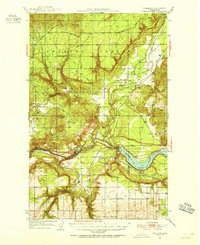
 1944 Wellpinit1944 Print · USGSThe Spokane Indian Reservation and the winding Spokane River define this 1940s landscape during an era of logging and early hydroelectric power. Genealogists and historians can trace the foundations of local life at Wellpinit, the Deer Park Logging Camp, and the State Fish Hatchery.2 unique versions available
 - 1953 Map of Wellpinit, 1955 Print
 1953 Wellpinit1955 Print · USGSThe Spokane Indian Reservation and the rugged Stevens County hills come to life in the early fifties. Genealogists and historians can locate St Joseph Ch, the Wellpinit settlement, and local landmarks like Little Chamokane Falls.3 unique versions available
 - 1955 Map of Spokane, 1965 Print
 1955 Spokane1965 Print · USGSInland Empire life in the fifties and sixties centers on the growth of Spokane and the heavy mining industry of northern Idaho. Trace mid-century landmarks like Fairchild Air Force Base, the Bunker Hill Mine, and early campuses such as Gonzaga University.2 unique versions available
 - 1958 Map of Spokane
 1958 Spokane1958 Print · USGSThe Inland Empire is shown at a mid-century peak of industrial and military activity, from the rail hubs of Spokane to the deep silver mines of northern Idaho. Researchers can trace the sprawling rail lines of the Union Pacific RR or locate landmarks like Fairchild Air Force Base and the Bunker Hill Smelter & Mine.
 - 1973 Map of Wellpinit, 1976 Print
 1973 Wellpinit1976 Print · USGSIn the early 1970s, the Spokane Indian Reservation landscape centered around the settlement of Wellpinit. Researchers can trace local lineage at the Chief Lot Cem and explore family-named landmarks like Joe Sherwood Road near Little Chamokane Falls.
 - 1987 Map of Spokane
 1987 Spokane1987 Print · USGSGreater Spokane and its surrounding prairies are captured in the late 1980s as the region solidified its role as a regional hub. Researchers can trace family sites near Medical Lake, military life at Fairchild Air Force Base, and rural settlements like Peone and Chattaroy.
 - 2011 Map of Wellpinit, 2011 Print
 2011 Wellpinit2011 Print · USGSCovers Wellpinit, including Stevens County, United States, and other nearby areas
 - 2014 Map of Wellpinit, 2014 Print
 2014 Wellpinit2014 Print · USGSCovers Wellpinit, including Stevens County, United States, and other nearby areas
 - 2017 Map of Wellpinit, 2017 Print
 2017 Wellpinit2017 Print · USGSCovers Wellpinit, including Stevens County, United States, and other nearby areas
 - 2020 Map of Wellpinit, 2020 Print
 2020 Wellpinit2020 Print · USGSCovers Wellpinit, including Stevens County, United States, and other nearby areas
 - 2023 Map of Wellpinit, 2023 Print
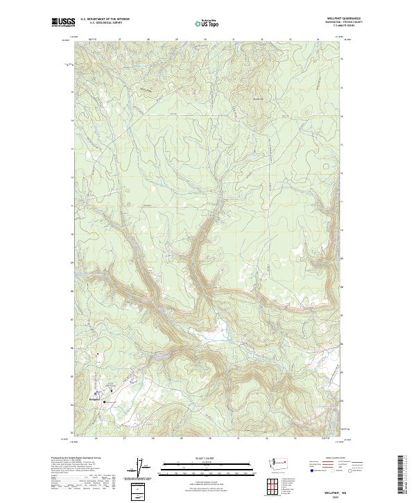 2023 Wellpinit2023 Print · USGSThe community of Wellpinit is shown in detail during the early 2020s, highlighting its role as a key settlement in Stevens County. Genealogists and historians can trace local sites like the Sacred Heart Catholic Cem, Chief Lot Cem, and the waters of Little Chamokane Falls.
End of results
Showing maps 1-11 of 11
Top cities near Wellpinit
Frequently asked questions
- What are the different types of historical maps available for Wellpinit?
- What is the oldest map of Wellpinit?
- Where can I purchase historical maps of Wellpinit for my home or office?
- Where can I download high-res historical maps of Wellpinit?
- Are there historical topographic maps available for Wellpinit?
- Is there historical aerial imagery available for Wellpinit?
- Where are historical maps of Wellpinit sourced from?