Old Maps of Walla Walla, Washington for Academic Research
Study the evolution of Walla Walla with 12 high-resolution historic maps. Whether you're teaching, researching, or modeling changes in land use, these maps provide essential visual documentation of urban, environmental, and geographic change.
- Analyze long-term change: Track patterns in development, transportation, and natural features.
- Ideal for environmental or urban studies: Support academic projects with primary historical map data.
- Use in the classroom or lab: Educators and researchers rely on these maps to bring historical context to life.
These maps are a powerful tool for teaching, research, and visualizing how Walla Walla has changed over the decades.
Walla Walla, WA maps
(12)- 1919 Map of Walla Walla, 1964 Print
 1919 Walla Walla1964 Print · USGSSoutheast Washington at the close of the First World War shows a thriving agricultural hub connected by the Oregon-Washington Railroad. Genealogists can trace family names across dozens of rural sites, from College Place and Dixie to the Kellogg School and Kibler Mill.
 - 1921 Map of Walla Walla
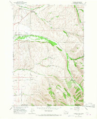
 1921 Walla Walla1921 Print · USGSSoutheastern Washington at the height of its rail-era agricultural expansion reveals a landscape of thriving wheat towns and mountain foothills. Genealogists can trace family footprints across dozens of rural landmarks, from the Whitman Monument to the Kellogg School and the early streets of Walla Walla.2 unique versions available
 - 1953 Map of Walla Walla, 1964 Print
 1953 Walla Walla1964 Print · USGSSoutheast Washington enters the atomic and hydroelectric age in the mid-twentieth century as new dams reshape the desert landscape. You can trace the development of the Hanford Works, identify remote rail stops like Novara Siding, and locate the historic Dry Creek Cem.3 unique versions available
 - 1958 Map of Walla Walla
 1958 Walla Walla1958 Print · USGSThe Tri-Cities and Walla Walla region are captured here during the mid-century expansion of atomic energy and river infrastructure. Genealogists and historians can trace the early layout of Richland (AEC), the rural Hatton and Washtucna settlements, and landmarks like Palouse Falls State Park.
 - 1966 Map of Buroker, 1967 Print
 1966 Buroker1967 Print · USGSThe rural agricultural landscape of Walla Walla County and Umatilla County is frozen in time during the mid-sixties. Genealogists and local historians can trace family land via the Donation Land Claim Boundary and locate early rail stops like Sapolil, Harbert, and Kibler.2 unique versions available
 - 1966 Map of Walla Walla, 1968 Print
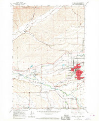
 1966 Walla Walla1968 Print · USGSMid-century Walla Walla is captured here during a period of steady growth and institutional expansion across the valley. Researchers can trace the layout of Whitman College, the State Penitentiary, and several local landmarks like Mtn View Cemetery and the County Fairgrounds.2 unique versions available
 - 1966 Map of College Place, 1968 Print
 1966 College Place1968 Print · USGSCollege Place and the Walla Walla River valley are shown in the mid-sixties at the height of their rail-and-river agricultural economy. Researchers can locate the Whitman Mission National Historic Site, trace old rail sidings at Sudbury, and find local landmarks like Valley Chapel and Mt Hope Cem.2 unique versions available
 - 1980 Map of Walla Walla
 1980 Walla Walla1980 Print · USGSThe Walla Walla Valley in the early eighties shows a landscape of deep-rooted agriculture and massive hydroelectric development. Researchers can trace the rail junctions at Wallula Junction, visit the historic Fort Walla Walla, or locate old landmarks like the Mountain View Cem.2 unique versions available
 - 1998 Map of Walla Walla, 2003 Print
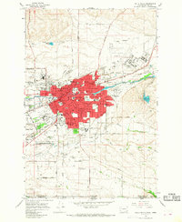
 1998 Walla Walla2003 Print · USGSWalla Walla and its surrounding agricultural valleys are captured in the late nineties, documenting a landscape of institutional history and civic growth. Researchers can trace the grounds of the State Penitentiary, find gravesites in Mountain View Cemetery, and locate old schools like De Sales High Sch.
 - 2023 Map of Buroker, 2023 Print
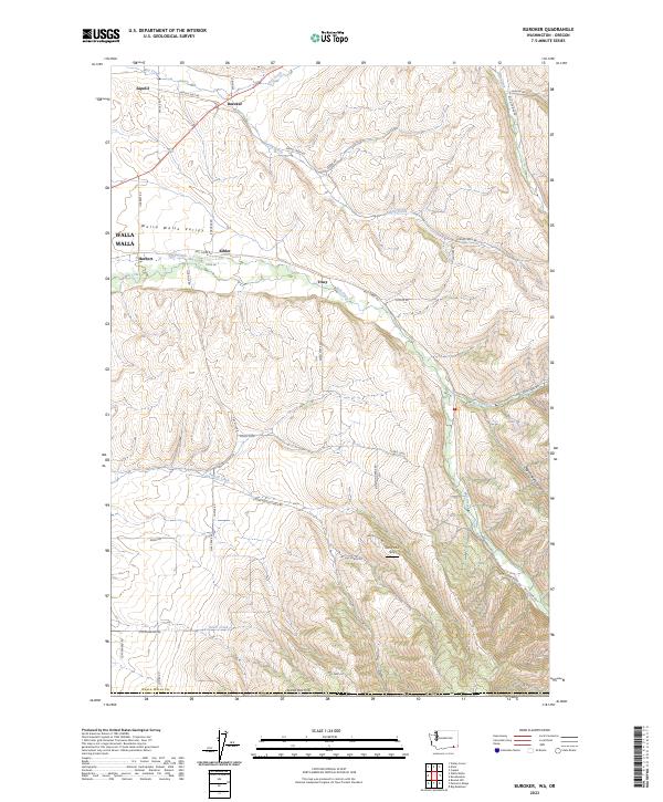 2023 Buroker2023 Print · USGSThe Walla Walla Valley is captured here in its modern agricultural context, showing the enduring layout of rural settlements. Genealogists can trace family-named routes like Smith Rd and Foster Rd while locating landmarks like Darcy's Air Strip.
 - 2023 Map of Walla Walla, 2023 Print
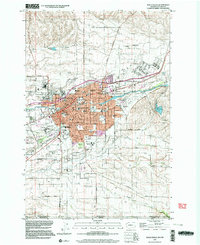
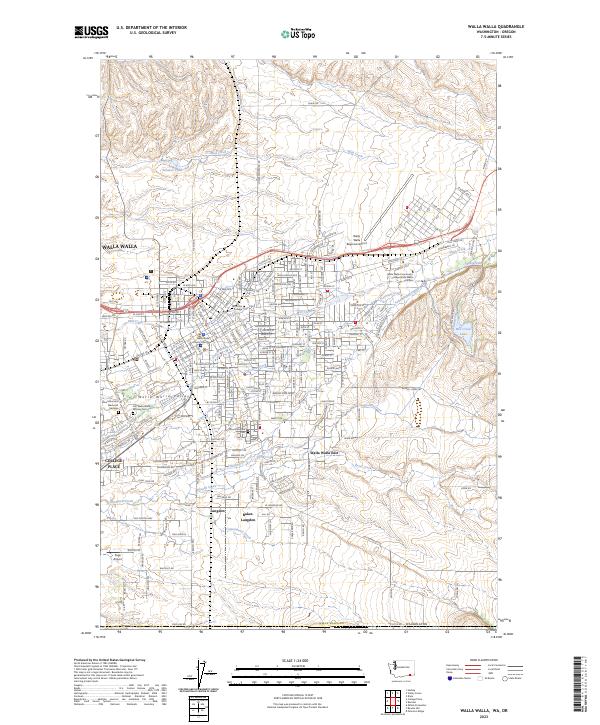 2023 Walla Walla2023 Print · USGSThe Walla Walla Valley at the start of the 2020s shows a sophisticated mix of college-town life, aviation history, and deep-rooted agricultural lands. Researchers can trace local heritage from the Walla Walla County Courthouse to the grounds of Whitman College and the Fort Walla Walla Military Cem.
 - 2023 Map of College Place, 2023 Print
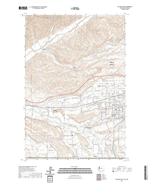 2023 College Place2023 Print · USGSThe Walla Walla Valley at the start of the 2020s shows a landscape deeply shaped by its early missions and extensive irrigation networks. Researchers can trace local heritage at the Whitman Mission National Historic Site or locate family history at Valley Chapel Cem and Mount Hope Cem.
End of results
Showing maps 1-12 of 12
Top cities near Walla Walla
Top neighborhoods of Walla Walla
Frequently asked questions
- What are the different types of historical maps available for Walla Walla?
- What is the oldest map of Walla Walla?
- Where can I purchase historical maps of Walla Walla for my home or office?
- Where can I download high-res historical maps of Walla Walla?
- Are there historical topographic maps available for Walla Walla?
- Is there historical aerial imagery available for Walla Walla?
- Where are historical maps of Walla Walla sourced from?