Old Maps of Edgemoor, Bellingham for Hiking & Exploration
Hike through history with 11 historic maps of Edgemoor. Explore old trails, ghost towns, and forgotten backroads — perfect for outdoor adventurers and local explorers.
- Rediscover forgotten places: Map out old mining camps, roads, and footpaths that no longer exist on modern maps.
- Layer with modern tools: Combine with LiDAR or satellite views to plan hikes through historical terrain.
- Made for exploration: Popular among hikers, overlanders, and local history lovers.
Use these maps to find adventure and explore the hidden past of Edgemoor.
Edgemoor, Bellingham maps
(11)- 1943 Map of Anacortes
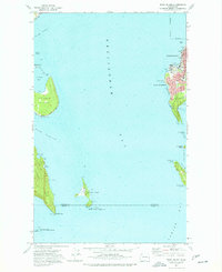
 1943 Anacortes1943 Print · USGSThe San Juan Islands and Skagit coastline appear here in the early 1940s, during an era of remote island schoolhouses and ferry reliance. Genealogists can locate family landmarks like Eden Cem and Guemes Sch, or trace the waterfront of Anacortes and South Bellingham.
 - 1951 Map of Anacortes, 1953 Print
 1951 Anacortes1953 Print · USGSThe northern Puget Sound islands and the city of Anacortes are captured here in the early fifties during a period of steady coastal growth. Researchers can locate vanished landmarks and family roots at Eden Cem, Sinclair Sch, and the Lummi Indian Reservation.2 unique versions available
 - 1957 Map of Victoria, 1960 Print
 1957 Victoria1960 Print · USGSThe San Juan Islands and the North Cascades coastline are shown in detail during the late fifties, a period of significant military and industrial presence. Researchers can trace historic rail lines like the Great Northern or locate sites such as the Whidbey Island Naval Air Sta and Friday Harbor.4 unique versions available
 - 1975 Map of Bellingham, 1977 Print
 1975 Bellingham1977 Print · USGSNorthwest Washington in the mid-seventies is captured here, from the Canadian border at Blaine to the San Juan Islands. Researchers can trace tribal lands on the Lummi Indian Reservation, find rural settlements like Cokedale, or follow the Burlington Northern rail lines.
 - 1977 Map of Eliza Island
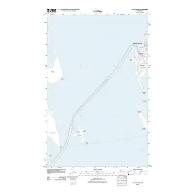
 1977 Eliza Island1977 Print · USGSThe Bellingham waterfront and neighboring islands are captured in the late seventies as the city expanded southward. Researchers can trace the Burlington Northern tracks along the coast and locate local landmarks like Fairhaven Middle Sch and the secluded shoreline of Eliza Island.2 unique versions available
 - 1998 Map of Eliza Island, 2003 Print
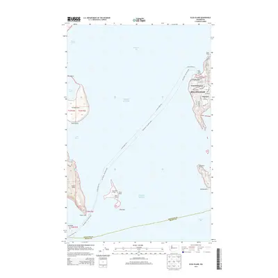
 1998 Eliza Island2003 Print · USGSBellingham's southern waterfront and the surrounding San Juan islands are captured here in the late 1990s as coastal development met environmental conservation. Trace the streets of Fairhaven and Edgemoor or locate landmarks like Fairhaven Middle Sch and Eliza Island.
 - 2011 Map of Eliza Island, 2011 Print
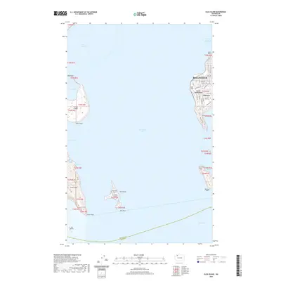
 2011 Eliza Island2011 Print · USGSCovers Edgemoor, including Bellingham, Whatcom County, and other nearby areas
 - 2014 Map of Eliza Island, 2014 Print
 2014 Eliza Island2014 Print · USGSCovers Edgemoor, including Bellingham, Whatcom County, and other nearby areas
 - 2017 Map of Eliza Island, 2017 Print
 2017 Eliza Island2017 Print · USGSCovers Edgemoor, including Bellingham, Whatcom County, and other nearby areas
 - 2020 Map of Eliza Island, 2020 Print
 2020 Eliza Island2020 Print · USGSCovers Edgemoor, including Bellingham, Whatcom County, and other nearby areas
 - 2023 Map of Eliza Island, 2023 Print
 2023 Eliza Island2023 Print · USGSThe islands and coastline of Whatcom County appear in detail in this modern survey of the Bellingham Bay area. Researchers can trace the residential streets of Edgemoor or locate offshore landmarks like Eliza Island and Chuckanut Island.
End of results
Showing maps 1-11 of 11
Frequently asked questions
- What are the different types of historical maps available for Edgemoor?
- What is the oldest map of Edgemoor?
- Where can I purchase historical maps of Edgemoor for my home or office?
- Where can I download high-res historical maps of Edgemoor?
- Are there historical topographic maps available for Edgemoor?
- Is there historical aerial imagery available for Edgemoor?
- Where are historical maps of Edgemoor sourced from?