2020s Maps of La Crosse, Washington
Explore 2 historic maps of La Crosse from the 2020s. These maps offer a rare glimpse into what life looked like during the 2020s — showing old roads, neighborhoods, homes, and landmarks that have changed or disappeared over time.
Whether you're researching your family's past, planning a metal detecting trip, or studying how La Crosse's landscape evolved across the 2020s, these high-resolution maps are a powerful tool for exploring the history of this region.
- Focus on a specific era: All maps on this page are from the 2020s, giving you a focused view of this time period.
- See what’s changed: Compare century-old streets, trails, and buildings to today's modern landscape using overlays and satellite layers.
- Research with precision: Use these maps for genealogy, historical research, land use analysis, or educational projects.
- View, download, or print: Maps are fully viewable online in high resolution, and can be downloaded or printed for your own records.
Start exploring La Crosse's history through authentic maps from the 2020s. This is your window into the past.
La Crosse, WA maps
(2)- 2023 Map of La Crosse East, 2023 Print
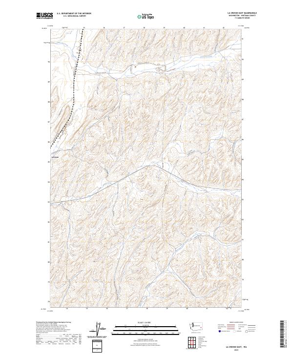 2023 La Crosse East2023 Print · USGSWhitman County's agricultural heartland is documented here in the early twenty-first century. Researchers can trace family-named rural routes like Long John Monasch Rd and Jim Knott Rd along the drainages of Union Flat Creek and Willow Creek.
 - 2023 Map of La Crosse West, 2023 Print
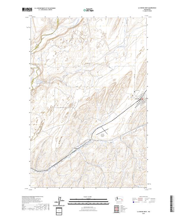 2023 La Crosse West2023 Print · USGSThe Palouse hills of Whitman County appear here in the early twenty-first century, showing the rural structure around the town of Lacrosse. Genealogists and researchers can trace local family landmarks like the Lacrosse Cem or follow the historic water routes of Union Flat Creek and the Palouse River.
End of results
Showing maps 1-2 of 2
Top cities near La Crosse
Top neighborhoods of La Crosse
Frequently asked questions
- What are the different types of historical maps available for La Crosse?
- What is the oldest map of La Crosse?
- Where can I purchase historical maps of La Crosse for my home or office?
- Where can I download high-res historical maps of La Crosse?
- Are there historical topographic maps available for La Crosse?
- Is there historical aerial imagery available for La Crosse?
- Where are historical maps of La Crosse sourced from?