Old Maps of Tomahawk, West Virginia for Genealogy
Trace your family roots with 16 historic maps of Tomahawk. These high-res maps reveal old neighborhoods, homesites, landmarks, and streets — helping you uncover where your ancestors lived and how the area evolved over time.
- Explore historic neighborhoods: Identify where your relatives may have lived in the 1800s or 1900s.
- Compare maps over time: Trace the changes in streets, buildings, and landmarks for multi-generational research.
- Perfect for genealogy & ancestry research: Used by family historians and researchers to map out lineage and migration.
These maps are an incredible resource for exploring your personal connection to Tomahawk's past.
Tomahawk, WV maps
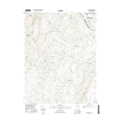
(16)- 1899 Map of Hancock, 1960 Print
 1899 Hancock1960 Print · USGSThe Potomac River valley at the turn of the century shows a bustling corridor of trade where Maryland, West Virginia, and Pennsylvania meet. Genealogy researchers can trace family landmarks like Stotlers Crossroads, Yeakle Mill, and the historic Fort Frederick.
 - 1901 Map of Hancock
 1901 Hancock1901 Print · USGSMaryland and West Virginia met at the turn of the century along a busy corridor of river transport and rail expansion. Genealogists can trace family roots through old landmarks like Yeakle Mill, Fairview Church, and early hamlets such as Stotlers Crossroads.8 unique versions available
 - 1948 Map of Cumberland
 1948 Cumberland1948 Print · USGSMid-century Appalachia and the Shenandoah Valley are shown in detail, documenting the industrial and transportation hubs of the tri-state area. Genealogists can trace family roots through settlements like Double Tollgate and Bunker Hill or along the Baltimore & Ohio RR.3 unique versions available
 - 1952 Map of Cumberland
 1952 Cumberland1952 Print · USGSThe Potomac Highlands and the Shenandoah Valley are revealed in this early 1950s survey of the Appalachian interior. Researchers can trace the river-and-rail corridors connecting Cumberland, Winchester, and the recreational waters of Deep Creek Lake.
 - 1956 Map of Cumberland, 1966 Print
 1956 Cumberland1966 Print · USGSThe tri-state Highlands in the mid-1950s show a landscape shaped by coal, timber, and the massive presence of the Baltimore & Ohio RR. Researchers can trace the industrial corridor from Cumberland through the Allegheny Mountains to mountain retreats like Deep Creek Lake.6 unique versions available
 - 1957 Map of Cumberland
 1957 Cumberland1957 Print · USGSThe Potomac River valley and the ridges of the Allegheny Front define this mid-century landscape at the intersection of Maryland, West Virginia, and Pennsylvania. Trace the steam-era rail lines of the Baltimore and Ohio RR or locate rural landmarks like St Stephens Church and Stony River Dam.
 - 1958 Map of Big Pool, 1959 Print
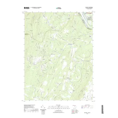
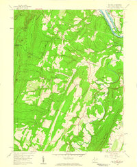 1958 Big Pool1959 Print · USGSMaryland's riverbank meets the West Virginia ridges in the late fifties, showcasing a landscape of vital rail and water corridors. Genealogists can trace rural communities around Hedgesville, Tomahawk, and Butlers Chapel near the Chesapeake and Ohio Canal.4 unique versions available
 - 1961 Map of Cumberland
 1961 Cumberland1961 Print · USGSThe tri-state highlands of Maryland, West Virginia, and Pennsylvania are shown in the mid-twentieth century as a complex landscape of ridges and river valleys. Researchers can trace the winding Potomac River and find old rail-and-river towns like Cumberland, Keyser, and Morgantown.
 - 1962 Map of Cumberland
 1962 Cumberland1962 Print · USGSThe central Appalachians meet at the height of the mid-century industrial era, showing the rugged topography between Morgantown and Winchester. Genealogists can trace family lands near Fort Necessity or along the vital Baltimore & Ohio RR corridors.
 - 1981 Map of Cumberland, 1982 Print
 1981 Cumberland1982 Print · USGSThe tri-state region of Maryland, Pennsylvania, and West Virginia is captured here in the early eighties as a landscape of industrial history and ridgeline geography. Researchers can trace the heritage of the C & O Canal and the B & O RR through mountain gaps and coal towns like Eckhart Mines and Frostburg.2 unique versions available
 - 1998 Map of Big Pool, 1999 Print
 1998 Big Pool1999 Print · USGSThe Potomac River valley and the historic C&O Canal corridor come alive in this late twentieth-century study of the Maryland-West Virginia border. Genealogists and local historians can trace rural communities and landmarks like Snyders Ch, Pleasant View Sch, and the grounds of Fort Frederick State Park.
 - 2011 Map of Big Pool, 2011 Print
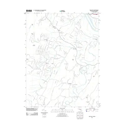 2011 Big Pool2011 Print · USGSCovers Tomahawk, including Johnsontown, Baxter, and other nearby areas
 - 2014 Map of Big Pool, 2014 Print
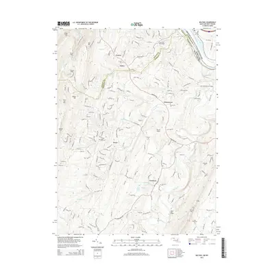 2014 Big Pool2014 Print · USGSCovers Tomahawk, including Johnsontown, Baxter, and other nearby areas
 - 2016 Map of Big Pool, 2016 Print
 2016 Big Pool2016 Print · USGSCovers Tomahawk, including Johnsontown, Baxter, and other nearby areas
 - 2019 Map of Big Pool, 2019 Print
 2019 Big Pool2019 Print · USGSCovers Tomahawk, including Johnsontown, Baxter, and other nearby areas
 - 2023 Map of Big Pool, 2023 Print
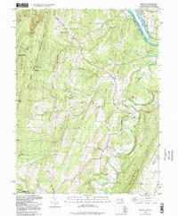
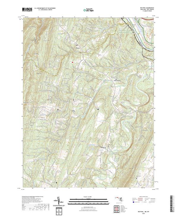 2023 Big Pool2023 Print · USGSThe Potomac River borderlands in the early 2020s remain defined by the winding Chesapeake and Ohio Canal and the steep ridges of Sleepy Creek Mtn. Genealogists can locate several rural burial sites, including Butler Chapel Cem and Hedges Chapel Methodist Cem.
End of results
Showing maps 1-16 of 16
Top cities near Tomahawk
- Martinsburg historical maps
- Ranson historical maps
- Inwood historical maps
- Williamsport historical maps
- Hancock historical maps
- Berkeley Springs historical maps
See more
Frequently asked questions
- What are the different types of historical maps available for Tomahawk?
- What is the oldest map of Tomahawk?
- Where can I purchase historical maps of Tomahawk for my home or office?
- Where can I download high-res historical maps of Tomahawk?
- Are there historical topographic maps available for Tomahawk?
- Is there historical aerial imagery available for Tomahawk?
- Where are historical maps of Tomahawk sourced from?