Old Maps of Huntington, West Virginia for Hiking & Exploration
Hike through history with 34 historic maps of Huntington. Explore old trails, ghost towns, and forgotten backroads — perfect for outdoor adventurers and local explorers.
- Rediscover forgotten places: Map out old mining camps, roads, and footpaths that no longer exist on modern maps.
- Layer with modern tools: Combine with LiDAR or satellite views to plan hikes through historical terrain.
- Made for exploration: Popular among hikers, overlanders, and local history lovers.
Use these maps to find adventure and explore the hidden past of Huntington.
Huntington, WV maps
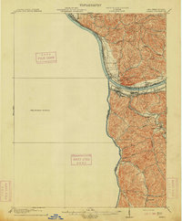
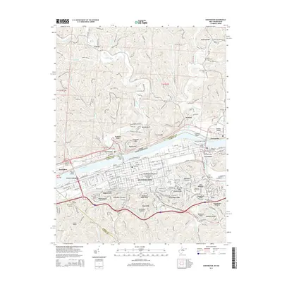
(34)- 1892 Map of Huntington, 1895 Print
 1892 Huntington1895 Print · USGSWest Virginia and Ohio meet along the river in the late nineteenth century, showing the rail-fueled growth of Huntington and Wayne. Local historians can trace the paths of the Chesapeake and Ohio Railroad past Barboursville and find early landmarks like Blue Sulphur Sp's and Davis Mill.
 - 1898 Map of Huntington
 1898 Huntington1898 Print · USGSNear the turn of the century, the Ohio River valley was transforming through the expansion of the Chesapeake and Ohio RR. Modern researchers can trace early nineteenth-century settlements from the bustling streets of Huntington to the inland hubs of Hamlin and Barboursville.3 unique versions available
 - 1901 Map of Guyandot, 1953 Print
 1901 Guyandot1953 Print · USGSThe Ohio River valley at the start of the twentieth century shows a bustling corridor of industry and river commerce. Genealogists and historians can trace the early footprints of Huntington and Ceredo alongside early rail routes like the Baltimore and Ohio RR.
 - 1901 Map of Ceredo, 1953 Print
 1901 Ceredo1953 Print · USGSThe tri-state convergence of West Virginia, Ohio, and Kentucky comes alive in this early 20th-century survey of the Ohio River valley. Genealogists and rail historians can trace the vital transport networks of Kenova and Ceredo, alongside family-named landmarks like Walker Br and Rice Run.2 unique versions available
 - 1902 Map of Guyandot
 1902 Guyandot1902 Print · USGSThe industrial hub of Huntington and the river town of Guyandot sit at the center of this early century border survey. Genealogists can trace family names and small settlements along Twelvepole Creek and Russell Creek, including Lavalette, Shoals, and Dickson.4 unique versions available
 - 1903 Map of Kenova
 1903 Kenova1903 Print · USGSThe tri-state river junction at Ashland and Kenova was a bustling industrial hub after the turn of the century. Trace early rail lines and mining settlements like Coalton and Boghead, or locate family landmarks along the Little Sandy River and Means Tunnel.5 unique versions available
 - 1904 Map of Kenova
 1904 Kenova1904 Print · USGSThe tri-state confluence of the Ohio River and Big Sandy River hums with early industrial activity at the start of the century. Genealogists can trace rail-side settlements and remote homesteads along Blaine Creek and near Mt Savage or Webbville.
 - 1913 Map of Ceredo
 1913 Ceredo1913 Print · USGSThe confluence of the Ohio and Big Sandy rivers comes alive in this pre-war survey of the West Virginia-Ohio borderlands. Genealogists and rail historians can trace the early footprints of Kenova, Ceredo, and the winding path of Twelvepole Creek.4 unique versions available
 - 1953 Map of Catlettsburg, 1955 Print
 1953 Catlettsburg1955 Print · USGSThe industrial riverfront of northeastern Kentucky is captured here just after the war, where the Ohio and Big Sandy rivers converge. Researchers can trace the mid-century footprint of Catlettsburg and Ashland alongside landmarks like England Hill Sch and Lock No 29.
 - 1957 Map of Catlettsburg, 1958 Print
 1957 Catlettsburg1958 Print · USGSThe tri-state river junction comes alive in the late fifties, showing the industrial heart of the OHIO RIVER valley. Genealogists and historians can trace family roots through the England Hill Sch, Williams Cem, and the historic streets of Kenova.2 unique versions available
 - 1957 Map of Huntington, 1959 Print
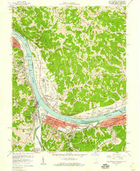
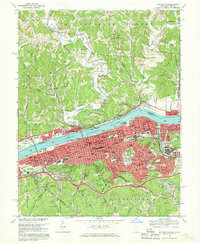
 1957 Huntington1959 Print · USGSThe industrial and academic heart of the Tri-State area comes alive in this late 1950s survey of the Ohio River valley. Researchers can trace the sprawling grounds of Marshall College, locate family plots in Spring Hill Cemetery, or follow the busy tracks of the Baltimore and Ohio railroad.
 - 1957 Map of Barboursville, 1959 Print
 1957 Barboursville1959 Print · USGSThe Barboursville and Guyandotte river valleys in the late fifties reveal a landscape of growing suburbs and river industry. Genealogists can locate family names at White Chapel Memorial Gardens or trace landmarks like the Fairland High Sch and Lock No 27.2 unique versions available
 - 1957 Map of Huntington, 1966 Print
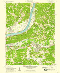
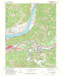
 1957 Huntington1966 Print · USGSThe industrial heart of the Ohio River valley is captured here in the mid-sixties, showing the growth of Huntington and Ashland. Researchers can trace the extensive rail networks of the Chesapeake and Ohio RR and locate sites like the Chief Cornstalk Hunting Ground.3 unique versions available
 - 1960 Map of Huntington
 1960 Huntington1960 Print · USGSThe tri-state river valley thrived in the late fifties as a hub of heavy industry and Appalachian rail transit. Genealogists and historians can trace the connection between river towns like Ashland and Portsmouth or locate family homesteads near Coleman Ridge.
 - 1968 Map of Huntington, 1970 Print
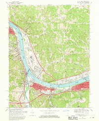
 1968 Huntington1970 Print · USGSHuntington and the Ohio River valley reached a peak of industrial and rail connectivity during the late sixties. Genealogists and historians can trace family locations through Spring Hill Cemetery, numerous city schools like Buffington Sch, and the riverside rail networks of the B & O.4 unique versions available
 - 1968 Map of Barboursville, 1970 Print
 1968 Barboursville1970 Print · USGSThe riverfront communities of West Virginia and Ohio thrived during the late sixties along the winding Ohio River. Genealogists and historians can locate family landmarks such as White Chapel Cem, Fairland High Sch, and the old County Fairgrounds.3 unique versions available
 - 1968 Map of Catlettsburg, 1970 Print
 1968 Catlettsburg1970 Print · USGSThe tri-state junction of Kentucky, Ohio, and West Virginia is captured here in the late sixties at the busy confluence of the Big Sandy and Ohio Rivers. Researchers can trace the industrial footprint of Kenova and Catlettsburg or locate family sites like Sandhill Cem and Mt Pleasant Ch.3 unique versions available
 - 1976 Map of Huntington, 1979 Print
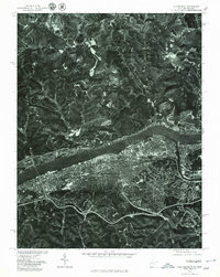 1976 Huntington1979 Print · USGSThe Huntington riverfront and neighboring Ohio shorelines appear in sharp aerial detail during the mid-seventies. Trace the urban footprint of Huntington across from Proctorville or follow the path of Symmes Creek through the northern hills.
 - 1982 Map of Huntington, 1983 Print
 1982 Huntington1983 Print · USGSThe tri-state region around Huntington and Ashland is shown in the early 1980s, documenting a landscape shaped by river commerce and coal-country railroads. Trace family roots and old routes through Barboursville, the Gas Field, and the Tug Fork valley.
 - 2011 Map of Catlettsburg, 2011 Print
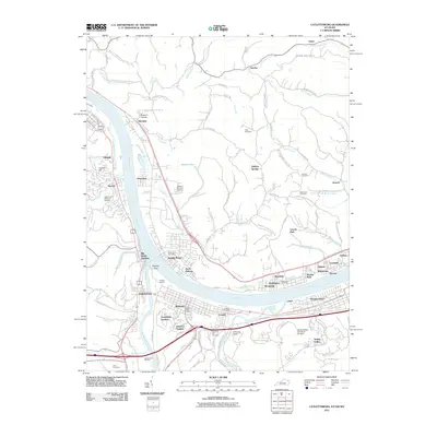 2011 Catlettsburg2011 Print · USGSCovers Huntington, including Ashland, South Point, and other nearby areas
 - 2011 Map of Barboursville, 2011 Print
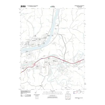 2011 Barboursville2011 Print · USGSCovers Huntington, including Rome, Barboursville, and other nearby areas
 - 2011 Map of Huntington, 2011 Print
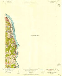
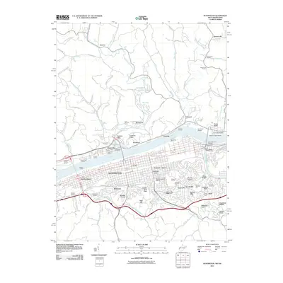 2011 Huntington2011 Print · USGSCovers Huntington, including Chesapeake, Proctorville, and other nearby areas
 - 2013 Map of Catlettsburg, 2013 Print
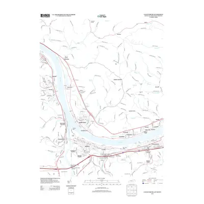 2013 Catlettsburg2013 Print · USGSCovers Huntington, including Ashland, South Point, and other nearby areas
 - 2014 Map of Barboursville, 2014 Print
 2014 Barboursville2014 Print · USGSCovers Huntington, including Rome, Barboursville, and other nearby areas
 - 2014 Map of Huntington, 2014 Print
 2014 Huntington2014 Print · USGSCovers Huntington, including Chesapeake, Proctorville, and other nearby areas
Showing maps 1-25 of 34
Top cities near Huntington
- Ashland historical maps
- Ironton historical maps
- Rome historical maps
- South Point historical maps
- Kenova historical maps
- Barboursville historical maps
See more
Top neighborhoods of Huntington
- Honorary Reggie Oliver Square historical maps
- Altizer historical maps
- Enslow Park Place historical maps
- Guyandotte historical maps
- Harveytown historical maps
- Marcum Terrace historical maps
See more
Frequently asked questions
- What are the different types of historical maps available for Huntington?
- What is the oldest map of Huntington?
- Where can I purchase historical maps of Huntington for my home or office?
- Where can I download high-res historical maps of Huntington?
- Are there historical topographic maps available for Huntington?
- Is there historical aerial imagery available for Huntington?
- Where are historical maps of Huntington sourced from?